افریقہ کے عالمی ثقافتی ورثہ مقامات کی فہرست
یونیسکو نے افریقا میں 135 عالمی ثقافتی ورثہ مقامات کو نامزد کیا ہے۔

نقشہ افریقہ کے عالمی ثقافتی ورثہ مقامات
کوئی مقام نہیں
1-2 مقامات
3-4 مقامات
5-6 مقامات
7+ مقامات
کوئی مقام نہیں
1-2 مقامات
3-4 مقامات
5-6 مقامات
7+ مقامات
مقامات
خطرے میں
* ماورائے سرحد مقام
| مقام | تصویر | جگہ | یونیسکو عالمی ثقافتی ورثہ | رقبہ ہیکٹر (ایکڑ) |
سال | تفصیل |
|---|---|---|---|---|---|---|
| Aapravasi Ghat | 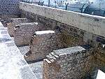 | پورٹ لوئس ضلع, 20°09′31″S 57°30′11″E | ثقافتی: (vi) | 0.16 (0.40) | 2006 | Aapravasi Ghat was the first site chosen by the British government to take part in the "Great Experiment", where indentured laborers were used instead of slaves. Between 1834 and 1920, almost half a million contracted workers passed through پورٹ لوئس from India, either to work in Mauritius or to transfer to other British colonies.[1] |
| ابو مینا |
Abusir, 30°50′28″N 29°39′47″E | ثقافتی: (iv) | 182 (450) | 1979 | The ruins of the former Christian holy city contain a church, a baptistery, basilicas, public buildings, streets, monasteries, houses, and workshops, and were built over the tomb of Menas of Alexandria.[2] The World Heritage Committee designated Abu Mena as an endangered site in 2001, due to cave-ins in the area caused by the clay at the surface, which becomes semi-liquid when met with "excess water".[3] | |
| Air and Ténéré Natural Reserves |
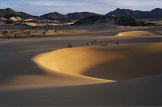 | ارلیت محکمہ, 18°N 9°E | قدرتی: (vii), (ix), (x) | 7,736,000 (19,120,000) | 1991 | Africa's largest protected area, located in the Saharan desert of Ténéré, consists of the volcanic rock mass of Aïr and a small isolated ساحلian pocket with unique flora and fauna.[4] The natural reserve was placed on UNESCO's List of World Heritage in Danger in 1992, due to the increase in military conflicts and the hostage-taking of six reserve staff in February. Removal from this list was considered in 1999, but as of 2011, its position remains unchanged.[5][6] |
| Aksum |  | تیگراے علاقہ, 14°07′49″N 38°43′07″E | ثقافتی: (i), (iv) | — | 1980 | The ruins of the city of Aksum, dating from the 1st to the 13th century, mark the heart of ancient Ethiopia and what was the "most powerful state between the Eastern Roman Empire and Persia". It includes monolithic obelisks, giant stelae، royal tombs, and ruins of former castles.[7] |
| Al Qal'a of Beni Hammad | 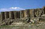 | ماڈیڈ, 35°49′06″N 4°47′13″E | ثقافتی: (iii) | 150 (370) | 1980 | The fortified first capital of the Hammadid emirs was originally built in 1007 and demolished in 1152. It features an 8-bay, 13-aisle mosque, which is one of the largest in Algeria.[8] |
| Aldabra Atoll | 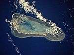 | الدابرا گروپ, 9°25′00″S 46°25′00″E | قدرتی: (vii), (ix), (x) | 35,000 (86,000) | 1982 | The Aldabra Atoll consists of four large coral islands and a lagoon, surrounded by a coral reef. The islands are home to the world's largest population of giant tortoises.[9] |
| الجم | 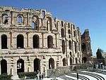 | الجم، 35°17′47″N 10°42′25″E | ثقافتی: (iv), (vi) | — | 1979 | The Amphitheatre of El Jem, built during the 3rd century, is North Africa's largest amphitheatre, and the largest one built outside of Italy, with a capacity of 35,000 spectators, and "illustrates the grandeur and extent of Imperial Rome."[10] |
| Ancient Ksour of وادان, شنقیط, تیشیت and ولاتہ | 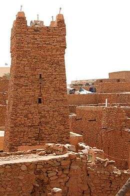 | شنقیط, وادان, ولاتہ, and تیشیت، 20°55′44″N 11°37′25″W | ثقافتی: (iii), (iv), (v) | — | 1996 | "Founded in the 11th and 12th centuries to serve the caravans crossing the Sahara, these trading and religious centres became focal points of Islamic culture. [...] Typically, houses with patios crowd along narrow streets around a mosque with a square minaret. They illustrate a traditional way of life centred on the nomadic culture of the people of the western Sahara."[11] |
| طيبہ with its Necropolis | 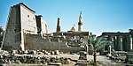 | قنا, 25°44′00″N 32°36′00″E | ثقافتی: (i), (iii), (vi) | 7,390 (18,300) | 1979 | The former capital of Egypt and city of the Egyptian god آمون contains relics from the height of قدیم مصر. The temples, palaces and the necropolises of the Valley of the Kings and the Valley of the Queens bear "a striking testimony to Egyptian civilization." [12] |
| قرطاج | 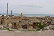 | تونس شہر, 36°51′10″N 10°19′24″E | ثقافتی: (ii), (iii), (vi) | — | 1979 | Founded in the 9th century BCE, Carthage was developed into a trading empire spanning the بحیرہ روم, and was, according to UNESCO, "home to a brilliant civilization." The city was destroyed in 146 BCE in the Punic Wars at the hands of the Romans, but was later rebuilt by these.[13] |
| Archaeological Site of Cyrene | 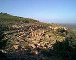 | Jebel Akhdar, 32°49′30″N 21°51′30″E | ثقافتی: (ii), (iii), (vi) | — | 1982 | The formerly Greek colony was قدیم روم and transformed into a capital, until it was destroyed by an earthquake in 365. The thousand-year-old ruins have remained renowned since the 18th century.[14] |
| لبدہ کبری | 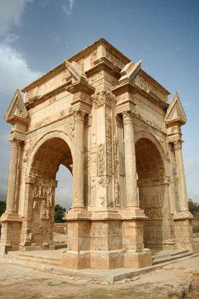 | خمس، لیبیا, 32°38′18″N 14°17′35″E | ثقافتی: (i), (ii), (iii) | — | 1982 | The Roman city of Leptis Magna was enlarged by Emperor Septimius Severus، who was born there. Public monuments, a harbour, a marketplace, storehouses, shops, and homes were among the reasons for its induction into the list.[15] |
| صبراتہ | 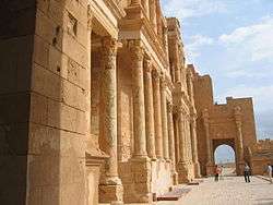 | صبراتہ، 32°48′19″N 12°29′06″E | ثقافتی: (iii) | — | 1982 | "A Phoenician trading-post that served as an outlet for the products of the African hinterland, Sabratha was part of the short-lived Numidian Kingdom of Massinissa before being Romanized and rebuilt in the 2nd and 3rd centuries."[16] |
| ولیلی | 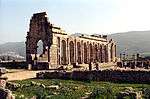 | مکناس, 34°04′26″N 5°33′25″W | ثقافتی: (ii), (iii), (iv), (vi) | 42 (100) | 1997 | The important Roman outpost of Volubilis was founded in the 3rd century BCE to become the capital of موریتانیہ. It contained many buildings, the remains of which have survived extensively to this day.[17] |
| Archaeological Sites of the Island of Meroe |  | مرواہ, 16°56′00″N 33°43′00″E | ثقافتی: (ii), (iii), (iv), (v) | 2,357 (5,820) | 2011 | The site was the centre of the مملکت کوش، a major force active from the 8th century BCE to the 4th century CE. It is home to pyramids, temples, and domestic buildings, among other vestiges.[18] |
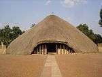
| Asante Traditional Buildings |  | کوماسی, 6°24′04″N 1°37′33″W | ثقافتی: (v) | — | 1980 | The site, north-east of کوماسی, hosts the final intact remains of the سلطنت اشانتی، which peaked in the 18th century. The dwellings, which are made of earth, wood, and straw, are susceptible to the damages caused by the "onslaught of time and weather."[19] |
| Banc d'Arguin National Park |  | Azefal and نواذیبو, 20°14′05″N 16°06′32″W | قدرتی: (ix), (x) | 1,200,000 (3,000,000) | 1989 | The park consists of sand dunes, coastal swamps, small islands, and shallow bodies of water; all bordering the coast of the Atlantic Ocean. Birds are often found to migrate in the area, accompanied by various species of sea turtles and dolphins, whose presence fishermen often use to attract fish.[20] |
| Bassari Country: Bassari, Fula and Bedik Cultural Landscapes |  | 12°35′36″N 12°50′45″W | ثقافتی: (iii), (v), (vi) | 50,309 (124,320) | 2012 | [21] |
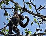
| Bwindi Impenetrable National Park |  | کابالے ضلع, کیسورو ضلع, and روکونگیری ضلع, 1°04′50″S 29°39′41″E | قدرتی: (vii), (x) | 32,092 (79,300) | 1994 | Located on the border of plain and mountain forests, the park in south-western Uganda is home to over 160 species of trees, over a hundred species of ferns, and various species of birds and butterflies. Many endangered species are within its boundaries as well, including the mountain gorilla.[22] |
| Cape Floral Region Protected Areas | 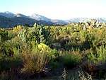 | مشرقی کیپ and مغربی کیپ، 34°21′40″S 18°28′30″E | قدرتی: (ix), (x) | 553,000 (1,370,000) | 2004 | The site consists of eight protected areas that are among the richest in plant life worldwide, containing nearly 20% of Africa's total flora. Its scientific value is demonstrated by the presence of fire and radiation adaptivity in plants and seed dispersal by insects.[23] |
| Chongoni Rock-Art Area | 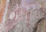 | Dedza District, 14°17′36″S 34°16′45″E | ثقافتی: (iii), (vi) | 12,640 (31,200) | 2006 | The 127-site area contains the richest concentration of rock art in Central Africa, ranging from پتھر کا دور paintings to contemporary work from farmers. The symbols depicted in the rock art are strongly centred around women, and retain a cultural significance for the Chewa.[24] |
| Cidade Velha, Historic Centre of Ribeira Grande | 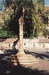 | Ribeira Grande، 14°54′55″N 23°36′19″W | ثقافتی: (ii), (iii), (vi) | 209 (520) | 2009 | The town, south of the island of Santiago, was the first European colonial outpost in the tropics, with remains dating back to the 16th century. Two churches, a royal fortress, and Pillary Square help comprise the tropical town's original street layout.[25] |
| Cliff of Bandiagara (Land of the Dogons) | 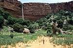 | باندیاگارا سرکل، 14°20′00″N 3°25′00″W | Mixed: (v), (vii) | 327,390 (809,000) | 1989 | The sandy plateau and cliffs of Bandiagara outline the site, featuring houses, granaries, altars, sanctuaries, and Togu-Na meeting-places. Age-old social traditions such as masks, feasts, rituals, and ancestral worship also add to its cultural significance.[26] |
| Comoé National Park |
 | Zanzan, 9°N 4°E | قدرتی: (ix), (x) | 1,150,000 (2,800,000) | 1983 | Among the largest protected sites of West Africa, the park features the Comoé River and the unique flora which accompanies it.[27] The site was placed on UNESCO's List of World Heritage in Danger in 2003, due to unrest in Côte d'Ivoire, and various other factors such as poaching, wildfires, lack of proper management of the site, and overgrazing.[28] |
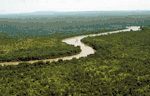
| Dja Faunal Reserve | 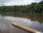 | جا اے کوبو and اوت نیونگ, 3°N 13°E | قدرتی: (ix), (x) | 526,000 (1,300,000) | 1987 | Among Africa's largest and best protected rain forests, the Cameroonian reserve is almost completely surrounded by the Dja River and contains 107 mammal species, of which five are threatened.[29] |
| Djémila | 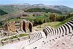 | سطیف, 36°19′14″N 5°44′12″E | ثقافتی: (iii), (iv) | 30 (74) | 1982 | The ruins of a Roman town in a mountainous location, including a forum, temples, basilicas, triumphal arches and houses, each adapted to a location 900 میٹر (3,000 فٹ) above sea level.[30] |
| Djoudj National Bird Sanctuary | 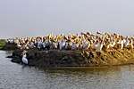 | سینٹ-لوئیس علاقہ, 16°30′00″N 16°10′00″W | قدرتی: (vii), (x) | 16,000 (40,000) | 1981 | The دریائے سینیگال delta wetland area consists of streams, lakes, ponds and backwaters. It is the home to 1.5 million birds, including the great white pelican, the purple heron, the African spoonbill, the great egret, and کارمورنٹs. The sanctuary also features crocodiles, African manatees, and other typical ساحلian species.[31] |
| Dougga / Thugga |  | باجا, 36°25′25″N 9°13′13″E | ثقافتی: (ii), (iii) | 70 (170) | 1997 | The site features the ruins of Dougga, a former capital of a لیبیاn–Punic state, which flourished under قدیم روم and the بازنطینی سلطنت, but declined in the اسلامی عہدِ زریں.[32] |
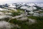
| Ecosystem and Relict Cultural Landscape of Lopé-Okanda |  | اوگوئی اویندو صوبہ and اوگوئی لولو صوبہ، 0°30′N 11°30′E | Mixed: (iii), (iv), (ix), (x) | 491,291 (1,214,010) | 2007 | The park features well-preserved tropical rain forests and savanna, resulting in a diverse ecosystem consisting of endangered, large mammals.[33] |
| Fasil Ghebbi, Gondar Region | 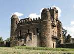 | امہارا علاقہ, 12°36′25″N 37°27′58″E | ثقافتی: (ii), (iii) | — | 1979 | The fortress was the residence of the Ethiopian emperors during the 16th and 17th century. The city remains, which feature buildings with Hindu and مسلم فن تعمیر influences, were later remodelled with Baroque-style architecture by یسوعی missionaries.[34] |
| Fort Jesus, Mombasa | 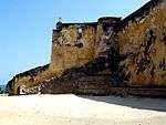 | ممباسا, 4°03′46″S 39°40′46″E | ثقافتی: (i), (iv) | 161,485 (399,040) | 2011 | Fort Jesus is a پرتگال fort built from 1593 to 1596 on Mombasa Island to guard the old port of Mombasa, Kenya. The site's layout follows the نشاۃ ثانیہ ideal that the human body is perfectly proportionate.[35] |
| Forts and Castles, Volta, Greater Accra, Central and Western Regions | 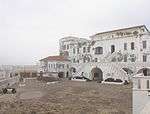 | وسطی علاقہ (گھانا), عظیم اکرا علاقہ, وولٹا علاقہ, and مغربی علاقہ (گھانا)، 5°14′51″N 0°47′07″W | ثقافتی: (vi) | — | 1979 | The site features the remains of fortified trading posts, built along the Ghanaian coast between 1482 and 1786.[36] |
| Fossil Hominid Sites of South Africa[lower-alpha 1] |  | گاؤتنگ, لیمپوپو, and شمال مغربی (جنوبی افریقی صوبہ)، 24°09′31″S 29°10′37″E | ثقافتی: (iii), (vi) | — | 1999 | The various fossil sites contain traces of human occupation and evolution dating 3.3 million years.[37] |
| Garajonay National Park | 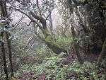 | لا گومیرا, 28°07′34″N 17°14′14″W | قدرتی: (vii), (ix) | 3,984 (9,840) | 1986 | Most of the park, in the middle of the island of La Gomera of the جزائر کناری, is covered with a lush laurel forest.[38] |
| Garamba National Park |
 | اورینتال صوبہ, 4°00′N 29°15′E | قدرتی: (vii), (x) | 500,000 (1,200,000) | 1980 | The park has vast savannas, grasslands and woodland, featuring elephants, giraffes, hippopotamuses and the سفید گینڈا.[39] Garamba was deemed to be endangered following the diminution of the white rhinoceros population in the area,[40] but it was removed from the list in 1991.[41] However, it later regained the status in 1996, when three rangers were killed and the population of white rhinoceros fell once again.[42][43] |
| Gebel Barkal and the Sites of the Napatan Region | 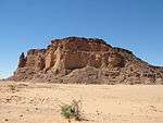 | مرواہ, 18°32′00″N 31°49′00″E | ثقافتی: (i), (ii), (iii), (iv), (vi) | 183 (450) | 2003 | The five sites in the دریائے نیل feature temples that are testimonial to the Napatan and Meroitic cultures.[44] |
| Gough and Inaccessible Islands | 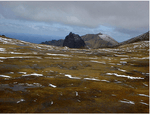 | سینٹ ہلینا، اسینشن و ترسٹان دا کونیا, 40°19′29″S 9°55′43″W | قدرتی: (vii), (x) | 7,900 (20,000) | 1995 | The site represent one of the least-disrupted islands and marine ecosystems in the North Temperate Zone. The cliffs are free of introduced mammals and feature one of the world's largest colonies of seabirds.[45] |
| Great Zimbabwe National Monument | 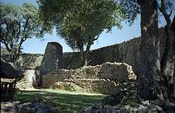 | ماسونگو صوبہ, 20°17′00″S 30°56′00″E | ثقافتی: (i), (iii), (vi) | 722 (1,780) | 1986 | The city, now in ruins, was an important trading center between the 11th and 15th centuries, and was capital of the Bantu civilization.[46] |
| ہرار | 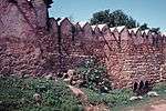 | ہراری علاقہ، 9°18′32″N 42°08′16″E | ثقافتی: (ii), (iii), (iv), (v) | 48 (120) | 2006 | The city is on a plateau and surrounded by gorges and savanna. It contains 82 mosques, 102 shrines, and unique interior design in the townhouses. It is said to be the fourth-holiest city of Islam.[47] |
| قاہرہ المعز | 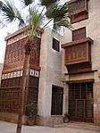 | قاہرہ, 30°03′00″N 31°15′40″E | ثقافتی: (i), (v), (vi) | 524 (1,290) | 1979 | One of the world's oldest Islamic cities and in the middle of urban Cairo, the site dates from the 10th century and reached its golden age in the 14th century. It contains mosques, مدرسہ, ترکی حمام and fountains.[48] |
| Historic Centre of Agadez | 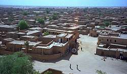 | تچیروزیرینے محکمہ، 16°58′25″N 7°59′29″E | ثقافتی: (ii), (iii) | 78 (190) | 2013 | [49] |
| مکناس | 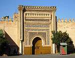 | مکناس، 33°53′00″N 5°33′30″W | ثقافتی: (iv) | — | 1996 | The former capital was founded in the 11th century and turned into a city with Spanish-Moorish influence during the 17th and 18th centuries.[50] |
| Historic Town of Grand-Bassam | 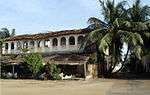 | جنوبی کوموے، 5°11′45″N 3°44′11″W | ثقافتی: (iii), (iv) | 110 (270) | 2012 | A colonial town built during the 19th and 20th centuries, Grand-Bassam was the first Ivorian capital following French rule in the region. Its quarters, which specialised in commerce, administration and general housing, helped the city become the economic and judicial hub of the country, in addition to being its most important port.[51] |
| Ichkeul National Park | 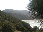 | بنزرت, 37°09′49″N 9°40′29″E | قدرتی: (x) | 12,600 (31,000) | 1980 | Ichkeul Lake and the surrounding wetlands is a destination for hundreds of thousands of migrating birds, including ducks, geese, storks and pink flamingos. It was once part of a chain that extended across North Africa.[52] |
| iSimangaliso Wetland Park |  | کوازولو نیٹل, 27°50′20″S 32°33′00″E | قدرتی: (vii), (ix), (x) | 239,566 (591,980) | 1999 | The park features a variety of landforms, including مرجانی جل پتھرs, long sandy beaches, coastal dunes, lake systems, and papyrus wetland, caused by fluvial, marine and aeolian processes.[53] |
| Island of Gorée |  | ڈاکار علاقہ، 14°40′02″N 17°24′03″W | ثقافتی: (vi) | — | 1978 | The island was the largest slave-trading center on the African coast from the 15th to the 19th century.[54] |
| Island of Mozambique | 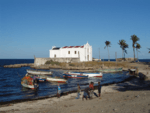 | Nampula، 15°02′03″S 40°44′09″E | ثقافتی: (iv), (vi) | — | 1991 | The fortified former Portuguese trading post has used the same architectural techniques, style, and materials since the 16th century.[55] |
| Island of Saint-Louis | 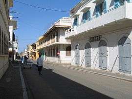 | سینٹ-لوئیس علاقہ, 16°01′40″N 16°30′16″W | ثقافتی: (ii), (iv) | — | 2000 | The French colonial settlement from the 17th century is on an island in the mouth of the دریائے سینیگال. It played an important role in the culture and economy of West Africa.[56] |
| Kahuzi-Biega National Park |
 | مانیما and جنوبی کیوو, 2°30′N 28°45′E | قدرتی: (x) | 600,000 (1,500,000) | 1980 | The park is dominated by two extinct volcanoes, Kahuzi and Biega. It also has abundant fauna, including the graueria gorillas.[57] The park was deemed to be endangered in 1997 when deforestation and hunting became a major problem. Militia groups and illegal settlers were also settling in the park, while fire and poaching helped justify the World Heritage Committee's decision.[58] |
| قیروان | 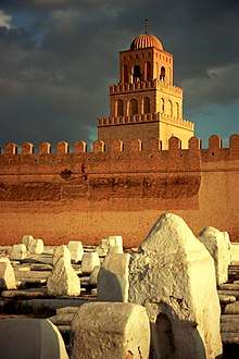 | قیروان, 35°40′54″N 10°06′14″E | ثقافتی: (i), (ii), (iii), (v), (vi) | — | 1988 | The former capital was founded in 670 and flourished in the 9th century. Its heritage includes the جامع القیروان الاکبر and the Mosque of the Three Gates.[59] |
| قصبہ، الجزائر | 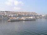 | الجزائر شہر, 36°47′00″N 3°03′37″E | ثقافتی: (ii), (v) | 60 (150) | 1992 | A unique Islamic city on the بحیرہ روم coast, the former site overlooks the قرطاج trading posts of the 4th century BCE. It contains remains of a citadel, old mosques, and Ottoman-style palaces.[60] |
| Kenya Lake System in the Great Rift Valley |  | رفٹ ویلی صوبہ, 0°26′33″N 36°14′24″E | قدرتی: (viii), (x) | 161,485 (399,040) | 2011 | Located in the Great Rift Valley, Kenya, the site features three lakes: Lake Bogoria, Lake Nakuru and Lake Elementaita. A highly diverse population of birds, including thirteen threatened species, frequent the area.[61][62] |
| Khami Ruins National Monument | 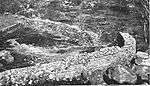 | Matabeleland، 20°09′30″S 28°22′36″E | ثقافتی: (iii), (iv) | — | 1986 | The city was built after the mid-16th century and was an important trading center.[63] |
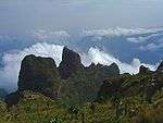
| Kilimanjaro National Park | 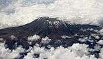 | کلیمنجارو علاقہ, 3°04′00″S 37°22′00″E | قدرتی: (vii) | 75,575 (186,750) | 1987 | The volcanic massif کلیمنجارو is Africa's highest point at 5,895 میٹر (19,341 فٹ)، and is surrounded by a park with savanna and forest featuring numerous mammals.[64] |
| Kondoa Rock-Art Sites | Kondoa district, 4°43′28″S 35°50′02″E | ثقافتی: (iii), (vi) | 233,600 (577,000) | 2006 | Two millennia of rock carving, many of high artistic value, have been found at 150 shelters in the site. They tell the tale of socio-economic development from hunter-gatherer to agro-pastoralism.[65] | |
| Konso Cultural Landscape |  | جنوبی اقوام، قومیتیں، اور عوامی علاقہ، 5°18′N 37°24′E | ثقافتی: (iii), (v) | 14,000 (35,000) | 2011 | The site features 55 کلومیٹر (180,000 فٹ) of stonewalled terraces and fortified settlements in the Konso highlands of Ethiopia.[66] |
| Koutammakou, the Land of the Batammariba | 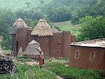 | کارا علاقہ, 10°04′00″N 1°08′00″E | ثقافتی: (v), (vi) | 50,000 (120,000) | 2004 | The Batammariba's mud tower houses have become a symbol of Togo. They range up to two stories and feature spherical granaries.[67] |
| آیت بن حدو | 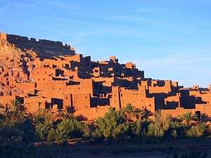 | آیت بن حدو, 31°02′50″N 7°07′44″W | ثقافتی: (iv), (v) | 3 (7.4) | 1987 | The ksar is an example of a traditional pre-Saharan habitat, surrounded by high walls and reinforced with corner towers.[68] |
| Kunta Kinteh Island and Related Sites[lower-alpha 2] | 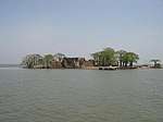 | بانجول, Lower Niumi, and Upper Niumi, 13°18′58″N 16°21′26″W | ثقافتی: (iii), (vi) | 8 (20) | 2003 | The site is a testimony to the encounters between Africa and Europe from pre-colonial times to independence along the دریائے گمبیا.[69] |
| Lake Malawi National Park |  | Central Region and Southern Region, 14°02′00″S 34°53′00″E | قدرتی: (vii), (ix), (x) | 9,400 (23,000) | 1984 | جھیل ملاوی contains hundreds of fish species, mostly endemic.[70] |
| Lakes of Ounianga | انیدی علاقہ، 19°03′18″N 20°30′20″E | قدرتی: (vii) | 62,808 (155,200) | 2012 | The Lakes of Ounianga are a series of 18 lakes located in the Sahara desert, in North-Eastern Chad. They exhibit a variety of sizes, depths, chemical compositions and colorations, and some of them are home to aquatic fauna.[71] | |
| Lake Turkana National Parks |  | جھیل ٹرکانا, 3°03′05″N 36°30′13″E | قدرتی: (viii), (x) | 161,485 (399,040) | 1997 | Turkana, as Africa's largest نمکین پانی lake, is an important area for the study of fauna and flora. It is a breeding ground for the Nile crocodile, دریائی گھوڑا and several venomous snakes.[72] |
| Lamu Old Town | 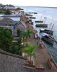 | Lamu, 2°16′05″S 40°54′07″E | ثقافتی: (ii), (iv), (vi) | 16 (40) | 2001 | The town is the oldest Swahili settlement, and is built in coral stone and mangrove timber. It features inner courtyards, verandas, and elaborate wooden doors.[73] |
| Laurisilva of Madeira | 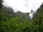 | مادیعیرا, 32°46′00″N 17°00′00″W | قدرتی: (ix), (x) | 15,000 (37,000) | 1999 | The site is the largest surviving area of laurel forest. It consists of approximately 90% old-growth forest and is home to endemic species such as the Madeiran long-toed pigeon.[74] |
| Le Morne Cultural Landscape | 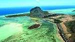 | ریویر نوار ضلع، 20°27′07″S 57°19′42″E | ثقافتی: (iii), (vi) | 349 (860) | 2008 | The rugged mountain that juts into the ocean was used as a shelter by runaway slaves through the 18th and early 19th centuries. They formed small settlements in the caves and on its summit.[75] |
| Lower Valley of the Awash |  | افار علاقہ, 11°06′00″N 40°34′46″E | ثقافتی: (ii), (iii), (iv) | — | 1980 | Palaentological findings from at least four million years ago, such as Lucy، give evidence of human evolution.[76] |
| Lower Valley of the Omo | 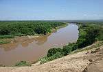 | جنوبی اقوام، قومیتیں، اور عوامی علاقہ, 4°48′00″N 35°58′00″E | ثقافتی: (iii), (iv) | — | 1980 | The prehistoric site near جھیل ٹرکانا is the location of many fossil findings, such as Homo gracilis.[77] |
| M'Zab Valley | 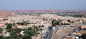 | غرادیہ, 32°29′00″N 3°41′00″E | ثقافتی: (ii), (iii), (v) | 4,000 (9,900) | 1982 | The intact, traditional human habitat was built around five ksour in the 10th century by the اباضیہes.[78] |
| Maloti-Drakensberg Park | 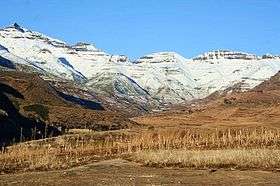 | Qacha's Nek District, کوازولو نیٹل، 29°45′55″S 29°07′23″E | Mixed: (i), (iii), (vii), (x) | 249,313 (616,070) | 2000 | The park features incisive dramatic cutbacks, golden sandstone ramparts, and the largest concentration of cave art in Sub-Saharan Africa.[79] |
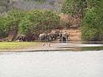
| Mana Pools National Park, Sapi and Chewore Safari Areas |  | ماتابیلےلینڈ شمالی صوبہ, 15°49′10″S 29°24′29″E | قدرتی: (vii), (ix), (x) | 676,600 (1,672,000) | 1984 | The park, located on the banks of the Zambezi River, features a variety of wild animals, such as buffalo, leopards, cheetahs and Nile crocodiles.[80] |
| Manovo-Gounda St. Floris National Park |
 | بامینگوئی-بانگوران, 9°00′N 21°30′E | قدرتی: (ix), (x) | 1,740,000 (4,300,000) | 1988 | The park features vast savannas with a wealth of flora and fauna, such as black rhinoceros, ہاتھیs, چیتاs, تیندواs, wild dogs, red-fronted gazelles and buffalo.[81] The site was placed on the List of World Heritage in Danger in 1997 due to grazing and poaching that is thought to have claimed 80% of the wildlife in the park. Also cited was the shooting of four park staff and "a general state of deteriorating security".[82] |
| Mapungubwe Cultural Landscape |  | لیمپوپو, 22°11′33″S 29°14′20″E | ثقافتی: (ii), (iii), (iv), (v) | 28,168 (69,600) | 2003 | The open savanna landscape lies at the confluence of the دریائے لیمپوپو and Shashe Rivers. It was the heart of the Mapungubwe Kingdom until the 14th century, when the area was abandoned, leaving untouched remains of palaces and settlements.[83] |
| Matobo Hills |  | ماتابیلےلینڈ جنوبی صوبہ, 20°30′S 28°30′E | ثقافتی: (iii), (v), (vi) | 205,000 (510,000) | 2003 | The large boulders have been used as natural shelters since the early پتھر کا دور and feature a collection of rock paintings.[84] |
| Medina of Essaouira (formerly Mogador) | 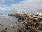 | صویرہ، 31°31′00″N 9°46′10″W | ثقافتی: (ii), (iv) | 30 (74) | 2001 | The fortified seaport built during the late 18th century has a mix of North African and European architecture, and was a major trading hub between the Sahara and Europe.[85] |
| Medina of Fez | 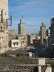 | فاس، 34°03′40″N 4°58′40″W | ثقافتی: (ii), (v) | 280 (690) | 1981 | The former capital was founded in the 9th century and features the world's oldest university. The urban fabric and main monuments date from the 13th and 14th centuries.[86] |
| مراکش (شہر) | 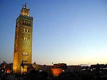 | مراکش (شہر), 31°37′53″N 7°59′12″W | ثقافتی: (i), (ii), (iv), (v) | 1,107 (2,740) | 1985 | The town was founded in the 1070s and remained a political, economic, and cultural centre for a long time. Monuments from that period include the مسجد کتبیہ, the قصبہ، الجزائر، and the battlements. The city also holds newer features, including palaces.[87] |
| سوسہ | 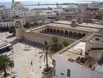 | سوسہ، 35°49′40″N 10°38′19″E | ثقافتی: (iii), (iv), (v) | 32 (79) | 1988 | A prime example of a town from the early Islamic period, the city was an important port during the 9th century.[88] |
| تطوان | 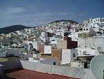 | تطوان, 35°34′15″N 5°22′00″W | ثقافتی: (ii), (iv), (v) | 7 (17) | 1997 | Morocco's most complete medina served as the main point of contact between Morocco and اندلوسیا during the 8th century. The town was rebuilt by Andalusian refugees following the استرداد.[89] |
| Medina of Tunis | 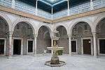 | تونس شہر, 36°49′00″N 10°10′00″E | ثقافتی: (ii), (iii), (v) | — | 1979 | The medina holds 700 monuments, including palaces, mosques, mausoleums, مدرسہ and fourtains, testifying to Tunis' golden age from the 12th to the 16th century.[90] |
| ممفس، مصر and its Necropolis – the Pyramid Fields from Giza to Dahshur | 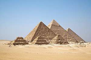 | گیزہ, 29°58′34″N 31°07′49″E | ثقافتی: (i), (iii), (vi) | 16,358 (40,420) | 1979 | The former capital features funerary monuments, like rock tombs, mastabas, temples, and pyramids. It is one of the قدیم دنیا کے سات عجائبات عالم.[91] |
| وکٹوریا آبشار | 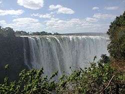 | Livingstone District and ماتابیلےلینڈ شمالی صوبہ, 17°55′28″S 25°51′19″E | قدرتی: (vii), (viii) | 8,780 (21,700) | 1989 | The falls of the Zambezi River، which is more than 2 کلومیٹر (6,561 فٹ 8 انچ) wide, plunge down various basalt gorges resulting in a colorful mist.[92] |
| Mount Kenya National Park/Natural Forest | 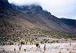 | وسطی صوبہ (کینیا) and مشرقی صوبہ (کینیا), 0°09′18″N 37°18′56″E | قدرتی: (vii), (ix) | 142,020 (350,900) | 1997 | The park surrounds the 5,199 میٹر (17,057 فٹ) کوہ کینیا and features twelve glaciers.[93] |
| Mount Nimba Strict Nature Reserve |
 | لولا پریفیکچور, 7°36′11″N 8°23′27″W | قدرتی: (ix), (x) | 18,000 (44,000) | 1981 | The reserve features Mount Nimba، its slopes covered in dense forest and grassy mountain pastures.[94] In 1992, the park was inscribed on the World Heritage Committee's danger list, citing a proposed iron and ore mining concession inside the park's boundaries and the apparition of refugees. The state party later stated that there was an error with the proposed mining site's boundaries, and that it was not in the reserve.[95] However, as of 2011, the site remains on the list due to poor security on the Ivorian side.[96] |
| صحرائے نمیب |  | 24°53′07″S 15°24′28″E | قدرتی: (vii), (viii), (ix), (x) | 3,077,700 (7,605,000) | 2013 | [97] |
| Ngorongoro Conservation Area | 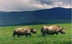 | Arusha Region, 3°11′14″S 35°32′27″E | Mixed: (iv), (vii), (viii), (ix), (x) | 809,440 (2,000,200) | 1979 | The site features a concentration of wild animals in a crater beside the active volcano Oldonyo Lengai.[98] |
| Niokolo-Koba National Park |
 | کیدؤگؤ علاقہ and تامباکؤندا علاقہ, 13°04′00″N 12°43′00″W | قدرتی: (x) | 913,000 (2,260,000) | 1981 | The forests and savannas bordering the دریائے گمبیا have a diverse fauna, including Derby eland، chimpanzees, lions, birds, reptiles, and amphibians.[99] The park was listed as being endangered for low mammal populations, the construction of a dam, and management problems.[100] |
| ابوسمبل | 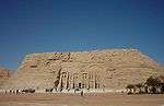 | اسوان, 22°20′11″N 31°37′34″E | ثقافتی: (i), (iii), (vi) | 374 (920) | 1979 | Located along the دریائے نیل, the site contains monuments such as the Temple of رمسيس ثانی and the Sanctuary of ایزیس.[101] |
| Okapi Wildlife Reserve |
 | اورینتال صوبہ, 2°00′N 28°30′E | قدرتی: (x) | 1,372,625 (3,391,830) | 1996 | Covering a fifth of the Ituri Rainforest in the دریائے کانگو basin, the reserve contains many threatened species of primates and birds. It is inhabited by the nomadic pygmy Mbuti and Efé tribes.[102] In 1997, looting, the killing of elephants, and the departure of reserve staff led the World Heritage Committee to place the reserve on its List of World Heritage in Danger, only a year following its inscription as a natural heritage site.[103] |
| Okavango Delta | 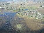 | اورینتال صوبہ، 19°17′00″S 22°54′00″E | قدرتی: (x) | 2,023,590 (5,000,400) | 2014 | [104] |
| Old Towns of Djenné |  | Djenné, 13°54′23″N 4°33′18″W | ثقافتی: (iii), (iv) | — | 1988 | Inhabited since 250 BCE, the city was an important link in the trans-Saharan gold trade. It contains 2,000 traditional houses.[105] |
| Old Town of Ghadamès | 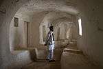 | Ghadames، 30°08′00″N 9°30′00″E | ثقافتی: (v) | — | 1986 | Located in an oasis, Ghadames is one of the oldest pre-Saharan cities and represents a traditional architecture with vertical division of functions.[106] |
| Osun-Osogbo Sacred Grove | 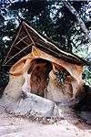 | اوسوگبو, 7°45′20″N 4°33′08″E | ثقافتی: (ii), (iii), (vi) | 75 (190) | 2005 | The dense forests are one of the final remnants of high forests in southern Nigeria. It is the last sacred grove of the Yoruba culture.[107] |
| Pitons, Cirques and Remparts of Reunion Island | 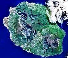 | رے یونیوں، 21°05′58″S 55°28′48″E | قدرتی: (vii), (x) | 105,838 (261,530) | 2010 | Outstanding terrain and biodiversity, as part of La Réunion National Park.[108] |
| الجدیدہ (مراکش) | 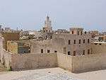 | الجدیدہ (مراکش), 33°15′24″N 8°30′07″W | ثقافتی: (ii), (iv) | 8 (20) | 2004 | The fortification, akin to نشاۃ ثانیہ military design from the early 16th century, was taken over by Morocco in 1769. Surviving buildings include the cistern and a Gothic church.[109] |
| Punic Town of Kerkuane and its Necropolis | 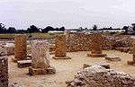 | نابل, 36°56′47″N 11°05′57″E | ثقافتی: (iii) | — | 1985 | The city was abandoned in 250 BCE during the First Punic War, and is the only surviving example of a فونیقی–Punic settlement.[110] |
| رباط (شہر), Modern Capital and Historic City: a Shared Heritage | 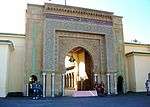 | رباط سلا زمور زعیر, 34°01′27″N 6°49′22″W | ثقافتی: (ii), (iv) | 349 (860) | 2012 | Rebuilt under the direction of the French from 1912 to the 1930s, the city blends historic and modern features, such as botanical gardens, the Hassan Mosque، and the remnants of Moorish and Andalusian settlements from the 17th century.[111] |
| Rainforests of the Atsinanana |
 | Eastern Madagascar, 14°27′35″S 49°42′09″E | قدرتی: (ix), (x) | 479,660 (1,185,300) | 2007 | The site consists of six national parks, and protects the island's unique biodiversity, which has evolved in isolation for 60 million years.[112] The park was deemed to be in danger in 2010, when logging and hunting activities continued to escalate, despite a ban by Madagascar on exporting illegal timber.[113] |
| Richtersveld Cultural and Botanical Landscape |  | شمالی کیپ, 28°36′00″S 17°12′14″E | ثقافتی: (iv), (v) | 160,000 (400,000) | 2007 | The mountainous desert sustains the semi-nomadic livelihood of the Nama، which includes seasonal migrations that have gone unchanged for two millennia.[114] |
| Robben Island |  | مغربی کیپ، 33°48′00″S 18°22′00″E | ثقافتی: (iii), (vi) | 475 (1,170) | 1999 | Between the 17th and 20th century, the island was used as a prison, including for political prisoners, a hospital for socially unacceptable groups, and a military base.[115] |
| Rock-Art Sites of Tadrart Acacus | 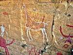 | فزان، 24°50′00″N 10°20′00″E | ثقافتی: (iii) | — | 1985 | Thousands of cave paintings are visible in different styles, dating from 12,000 BCE to 100 CE.[116] |
| لالیبیلا | 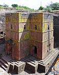 | امہارا علاقہ، 12°01′46″N 39°02′26″E | ثقافتی: (i), (ii), (iii) | — | 1978 | The site contains eleven medieval cave churches from the 13th century.[117] |
| Royal Hill of Ambohimanga |  | اینٹانانیریو، 18°45′33″S 47°33′46″E | ثقافتی: (iii), (iv), (vi) | 59 (150) | 2001 | The royal city and burial site is a spiritual and sacred site which has created strong feelings of national identity for several centuries.[118] |
| Royal Palaces of Abomey |  | زوؤ محکمہ, 7°11′00″N 1°59′00″E | ثقافتی: (iii), (iv) | 48 (120) | 1985 | The city held the seat of twelve kings who ruled the داهومی between 1625 and 1900. All but one king built their palace within the area.[119] |
| Ruins of Kilwa Kisiwani and Ruins of Songo Mnara | 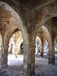 | Kilwa District، 8°57′28″S 39°31′22″E | ثقافتی: (iii) | — | 1981 | The site features the remains of two ports used extensively for trade across the Indian Ocean from the 13th and 16th century.[120] It was placed onto the list of List of World Heritage in Danger by the World Heritage Committee in 2004, citing "the continuing deterioration and the serious threats affecting the property of the Ruins of Kilwa Kisiwani and Songo Mnara".[121] Conditions subsequently improved and the site was removed from the World Heritage in Danger list in 2014.[122] |
| Ruins of Loropéni | 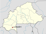 | لوروپئنی, 10°15′00″N 3°35′00″W | ثقافتی: (iii) | 1.1 (2.7) | 2009 | More than a thousand years old, Loropéni is the best-preserved of ten fortresses in Lobi, which were part of about a hundred stone enclosures built during the trans-Saharan gold trade.[123] |
| Rwenzori Mountains National Park | 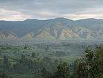 | بوندیبوگیو ضلع, کابارولے ضلع, and کاسیسے ضلع, 0°13′25″N 29°55′27″E | قدرتی: (vii), (x) | 99,600 (246,000) | 1994 | Covering most of the Rwenzori Mountains, including Mount Margherita، Africa's third-highest peak, the park features glaciers, waterfalls and lakes in an Alpine landscape. It also features various endangered species and unusual flora.[124] |
| Sacred Mijikenda Kaya Forests |  | صوبہ ساحل, 3°55′55″S 39°35′46″E | ثقافتی: (iii), (v), (vi) | 1,538 (3,800) | 2008 | The site comprises eleven forests spread 200 کلومیٹر (660,000 فٹ) along the coast of Kenya. They hold the remains of villages built during the 16th century by the Mijikenda، and are now considered sacred sites.[125] |
| Saint Catherine Area | 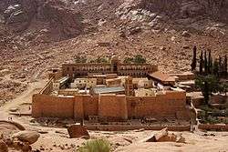 | محافظہ جنوبی سینا, 28°33′22″N 33°58′32″E | ثقافتی: (i), (iii), (iv), (vi) | 60,100 (149,000) | 2002 | The orthodox monastery from the 6th century is positioned near حورب where, according to the عہد نامہ قدیم, موسیٰ علیہ السلام received the الواح. The region is sacred for Christians, Muslims and Jews.[126] |
| Salonga National Park |
 | مانیما and جنوبی کیوو, 2°S 21°E | قدرتی: (vii), (ix) | 3,600,000 (8,900,000) | 1984 | Africa's largest tropical rain forest reserve is situated at the heart of the دریائے کانگو basin and only accessible by water. It is the habitat of endangered species such as the bonobo, the Congo peafowl, the forest elephant, and the slender-snouted crocodile.[127] The site was deemed to be in danger in 1999, due to increased poaching activities and encroachments.[128] |
| Saloum Delta | 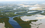 | 13°50′07″N 16°29′55″W | ثقافتی: (iii), (iv), (v) | 145,811 (360,310) | 2011 | The area has sustained human life thanks to fishing and shellfish gathering, for which there are 218 shellfish mounds across the site.[129] |
| سان کریستوبال دے لگونا |  | صوبہ سانتا کروز دے فینیریفے، 28°28′40″N 16°18′42″W | ثقافتی: (ii), (iv) | 60 (150) | 1999 | The city contains two centres: the unplanned Upper Town, and the planned Lower Town, laid out according to philosophical principals. Many of the buildings date from the 16th to the 18th centuries.[130] |
| Sangha Trinational | 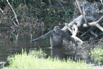 | 2°36′34″N 16°33′15″E | قدرتی: (ix), (x) | 746,309 (1,844,170) | 2012 | [131] |
| Selous Game Reserve |
 | لیندی علاقہ, موروگورو علاقہ, متوارا علاقہ, پوانی علاقہ, and Ruvuma Region, 9°00′S 37°24′E | قدرتی: (ix), (x) | 5,000,000 (12,000,000) | 1982 | The park's vegetation varies from dense thickets to open wooded grasslands, and features large numbers of elephants, black rhinoceros, cheetahs, giraffes, hippos and crocodiles.[132] It was placed onto the list of List of World Heritage in Danger by the World Heritage Committee in 2014 due to widespread poaching، especially of elephants and rhinoceros.[133] |
| سرنگیٹی نیشنل پارک | 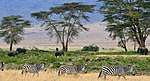 | Arusha Region, مارا علاقہ, and شینیانگا علاقہ, 2°20′00″S 34°34′00″E | قدرتی: (vii), (x) | 1,476,300 (3,648,000) | 1981 | The vast savanna is known for the annual migration for herds of wildebeest, غزال، zebras, and their predators.[134] |
| Simien National Park |
 | امہارا علاقہ, 13°11′00″N 38°04′00″E | قدرتی: (vii), (x) | 22,000 (54,000) | 1978 | The eroded ایتھوپیائی کوہستانی خطہ comprises jagged mountain peaks, deep valleys, and sharp precipices dropping about 1,500 میٹر (4,900 فٹ).[135] The decrease of the walia ibex, bushbuck, and bushpig populations, as well as an increase of the human population in the park prompted the World Heritage Committee to place it on their List of World Heritage in Danger in 1996.[136] |
| Stone Circles of Senegambia | 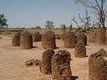 | سینٹرل ریور ڈویژن and کاولاک علاقہ, 13°41′28″N 15°31′21″W | ثقافتی: (i), (iii) | 10 (25) | 2006 | The groups of stone circles are among over 1,000 different monuments along the دریائے گمبیا. Used as burial grounds, they were erected between the 3rd century BCE and the 16th century CE.[137] |
| سٹون ٹاؤن | 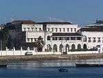 | زنجبار، 6°09′47″S 39°11′21″E | ثقافتی: (ii), (iii), (vi) | 96 (240) | 2000 | A prime example of an East African coastal trading town, its urban fabric and townscape remains intact.[138] |
| Sukur Cultural Landscape |  | میڈاگالی، 10°44′26″N 13°34′19″E | ثقافتی: (iii), (v), (vi) | — | 1999 | The site features the Palace of the Hidi, terraced fields, and the remains of a former iron industry.[139] |
| Taï National Park |  | گویگلو and ساساندرا, 5°45′00″N 7°07′00″W | قدرتی: (vii), (x) | 330,000 (820,000) | 1982 | One of few remaining sections of the West African tropical forest، the park features a rich flora, including eleven species of monkeys.[140] |
| Tassili n'Ajjer | 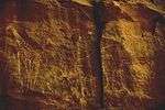 | الیزی and تمنراست، 25°30′N 9°00′E | Mixed: (i), (iii), (vii), (viii) | 7,200,000 (18,000,000) | 1982 | The site is in a landscape with 15,000 cave engravings that record climatic changes, animal migrations, and the evolution of human life, dating from 6,000 BCE to the first centuries CE.[141] |
| Teide National Park |  | صوبہ سانتا کروز دے فینیریفے, 28°16′17″N 16°38′37″W | قدرتی: (vii), (viii) | 18,990 (46,900) | 2007 | The national park features the ٹیڈ stratovolcano، which at 3,718 میٹر (12,198 فٹ) is Spain's tallest mountain and the world's third-tallest volcano.[142] |
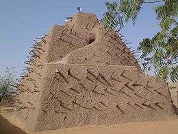
| ٹمبکٹو |
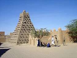 | Timbuktu Cercle, 16°46′24″N 2°59′58″W | ثقافتی: (ii), (iv), (v) | — | 1988 | The city was a centre for the propagation of Islam in the 15th and 16th centuries, and features three mosques and many مدرسہs.[143] The sites were deemed endangered after the Battle of Gao in June 2012, which followed several weeks of constant threats to the area. Days later, some sites within Timbuktu were destroyed by Ansar Dine, an Islamist group, citing religious reasons.[144] |
| Timgad | 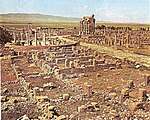 | صوبہ باتنہ, 35°29′03″N 6°28′07″E | ثقافتی: (ii), (iii), (iv) | 0.04 (0.099) | 1982 | A military colony built by تراجان in 100 CE, the site features cardo and decumanus streets, typical of a Roman town.[145] |
| تیبازہ | 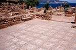 | تیبازہ, 36°35′31″N 2°26′58″E | ثقافتی: (iii), (iv) | 52 (130) | 1982 | First a قرطاج trading center, Tipasa was converted into a military base by the Romans. Heavy Christian influences can be seen from the 3rd and 4th centuries, though Tipasa went into steady decline in the بازنطینی سلطنت period.[146] |
| Tiya |  | جنوبی اقوام، قومیتیں، اور عوامی علاقہ, 8°26′06″N 38°36′44″E | ثقافتی: (i), (iv) | — | 1980 | The archaeological site contains 36 monuments, which includes 32 carved stelae covered with symbols hard to decrypt.[147] |
| Tomb of Askia |
 | علاقہ گاو, 16°17′23″N 0°02′40″E | ثقافتی: (ii), (iii), (iv) | 4 (9.9) | 2004 | Built in 1495, the pyramid was built as a tomb for Emperor Askia Mohamed. It represents the power of an empire that controlled the trans-Saharan gold trade.[148] The site was deemed endangered after the Battle of Gao in June 2012, which followed several weeks of constant threats to the area.[149] |
| Tombs of Buganda Kings at Kasubi |
 | کمپالا ضلع, 0°20′55″N 32°33′05″E | ثقافتی: (i), (iii), (iv), (vi) | 27 (67) | 2001 | The tombs, built after 1884, are a major example of prime architecture using organic materials, principally wood, thatch, reed, and wattle and daub.[150] The tombs were almost completely destroyed by a fire in March 2010, prompting the World Heritage Committee to reluctantly mark the site as being in danger. The Ugandan government has since called for the reconstruction of the tombs, and UNESCO has agreed to mobilise funds for the project.[151][152] |
| Tsingy de Bemaraha Strict Nature Reserve |  | میلاکا, 18°40′00″S 44°45′00″E | قدرتی: (vii), (x) | 152,000 (380,000) | 1990 | The canyon of the Manambolo River comprises karstic and limestone landscapes cut into peaks and a forest of limestone needles. It also holds undisturbed forests, lakes and چمرنگs, which are the habitat for lemurs and birds.[153] |
| Tsodilo | 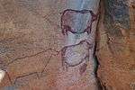 | North-West, 18°45′00″S 21°44′00″E | ثقافتی: (i), (iii), (vi) | 4,800 (12,000) | 2001 | The site features more than 4,500 rock art paintings in the صحرائے کالاہاری. Archaeological records provide evidence of human and environmental activities ranging over 100,000 years.[154] |
| Twyfelfontein or /Ui-//aes | 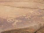 | Kunene، 20°35′44″S 14°22′21″E | ثقافتی: (iii), (v) | 57 (140) | 2007 | The site has one of the largest concentrations of rock engravings in Africa, which range from a period of over 2,000 years.[155] |
| Vallée de Mai Nature Reserve | 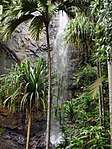 | Praslin, 4°19′45″S 55°44′15″E | قدرتی: (vii), (viii), (ix), (x) | 20 (49) | 1983 | The natural palm forest is preserved in almost its original state.[156] |
| Virunga National Park |
 | شمالی کیوو and اورینتال صوبہ, 0°55′00″N 29°10′00″E | قدرتی: (vii), (viii), (x) | 800,000 (2,000,000) | 1979 | The park comprises swamps, savannas, and snowfields.[157] Virunga was inscribed on the World Heritage Committee's List of World Heritage in Danger in 1994, due to the war in Rwanda and the subsequent increase of the refugee population in the park, deforestation, poaching, departure of park staff, and depletion of forests.[158] |
| Vredefort Dome |  | فری سٹیٹ (صوبہ) and شمال مغربی (جنوبی افریقی صوبہ), 26°52′S 27°16′E | قدرتی: (viii) | 30,000 (74,000) | 2005 | The crater, with a diameter of 190 کلومیٹر (620,000 فٹ), is the largest, oldest, and most deeply eroded astrobleme found on Earth, dating back more than two billion years.[159] |
| W National Park of Niger |  | ساے محکمہ، 12°21′N 2°21′E | قدرتی: (ix), (x) | 220,000 (540,000) | 1996 | The park is in the zone between savanna and forest lands, and is an important ecosystem for the biogeographical area.[160] |
| Wadi Al-Hitan (Whale Valley) |  | محافظہ فیوم, 29°20′00″N 30°11′00″E | قدرتی: (viii) | 20,015 (49,460) | 2005 | Located in western Egypt, the site contains fossil remains of the now extinct Archaeoceti, mapping the evolution of the whales from a land-based to an aquatic mammal.[161] |
بیرونی روابط
- UNESCO World Heritage Centre official website
- List of UNESCO World Heritage Sites official website
- VRheritage.org - documentation of World Heritage Sites
- Worldheritage-Forum - Information and Weblog on World Heritage Issues
حوالہ جات
- "Aapravasi Ghat"۔ UNESCO۔ مورخہ 24 دسمبر 2018 کو اصل سے آرکائیو شدہ۔ اخذ شدہ بتاریخ 28 مئی 2010۔
- "Abu Mena"۔ UNESCO۔ مورخہ 24 دسمبر 2018 کو اصل سے آرکائیو شدہ۔ اخذ شدہ بتاریخ 28 مئی 2010۔
- "Abu Mena – Threats to the Site (2001)"۔ UNESCO۔ مورخہ 24 دسمبر 2018 کو اصل سے آرکائیو شدہ۔ اخذ شدہ بتاریخ 27 اگست 2010۔
- "Air and Ténéré Natural Reserves"۔ UNESCO۔ مورخہ 24 دسمبر 2018 کو اصل سے آرکائیو شدہ۔ اخذ شدہ بتاریخ 28 مئی 2010۔
- "Air and Ténéré Natural Reserves – Threats to the Site (1992)"۔ UNESCO۔ مورخہ 24 دسمبر 2018 کو اصل سے آرکائیو شدہ۔ اخذ شدہ بتاریخ 28 اگست 2010۔
- "Decision 33COM 7A.10 – Air and Ténéré Natural Reserves (Niger) (N 573)"۔ UNESCO۔ مورخہ 24 دسمبر 2018 کو اصل سے آرکائیو شدہ۔ اخذ شدہ بتاریخ 28 اگست 2010۔
- "Aksum"۔ UNESCO۔ مورخہ 24 دسمبر 2018 کو اصل سے آرکائیو شدہ۔ اخذ شدہ بتاریخ 28 مئی 2010۔
- "Al Qal'a of Beni Hammad"۔ UNESCO۔ مورخہ 24 دسمبر 2018 کو اصل سے آرکائیو شدہ۔ اخذ شدہ بتاریخ 28 مئی 2010۔
- "Aldabra Atoll"۔ UNESCO۔ مورخہ 24 دسمبر 2018 کو اصل سے آرکائیو شدہ۔ اخذ شدہ بتاریخ 28 مئی 2010۔
- "Amphitheatre of El Jem"۔ UNESCO۔ مورخہ 24 دسمبر 2018 کو اصل سے آرکائیو شدہ۔ اخذ شدہ بتاریخ 28 مئی 2010۔
- "Ancient Ksour of Ouadane, Chinguetti, Tichitt and Oualata"۔ UNESCO۔ مورخہ 24 دسمبر 2018 کو اصل سے آرکائیو شدہ۔ اخذ شدہ بتاریخ 28 مئی 2010۔
- "Ancient Thebes with its Necropolis"۔ UNESCO۔ مورخہ 24 دسمبر 2018 کو اصل سے آرکائیو شدہ۔ اخذ شدہ بتاریخ 28 مئی 2010۔
- "Archaeological Site of Carthage"۔ UNESCO۔ مورخہ 24 دسمبر 2018 کو اصل سے آرکائیو شدہ۔ اخذ شدہ بتاریخ 28 مئی 2010۔
- "Archaeological Site of Cyrene"۔ UNESCO۔ مورخہ 24 دسمبر 2018 کو اصل سے آرکائیو شدہ۔ اخذ شدہ بتاریخ 28 مئی 2010۔
- "Archaeological Site of Leptis Magna"۔ UNESCO۔ مورخہ 24 دسمبر 2018 کو اصل سے آرکائیو شدہ۔ اخذ شدہ بتاریخ 28 مئی 2010۔
- "Archaeological Site of Sabratha"۔ UNESCO۔ مورخہ 24 دسمبر 2018 کو اصل سے آرکائیو شدہ۔ اخذ شدہ بتاریخ 28 مئی 2010۔
- "Archaeological Site of Volubilis"۔ UNESCO۔ مورخہ 24 دسمبر 2018 کو اصل سے آرکائیو شدہ۔ اخذ شدہ بتاریخ 28 مئی 2010۔
- "Archaeological Sites of the Island of Meroe"۔ UNESCO۔ مورخہ 24 دسمبر 2018 کو اصل سے آرکائیو شدہ۔ اخذ شدہ بتاریخ 17 اگست 2011۔
- "Asante Traditional Buildings"۔ UNESCO۔ مورخہ 24 دسمبر 2018 کو اصل سے آرکائیو شدہ۔ اخذ شدہ بتاریخ 28 مئی 2010۔
- "Banc d'Arguin National Park"۔ UNESCO۔ مورخہ 24 دسمبر 2018 کو اصل سے آرکائیو شدہ۔ اخذ شدہ بتاریخ 28 مئی 2010۔
- "Bassari Country: Bassari, Fula and Bedik Cultural Landscapes"۔ UNESCO۔ مورخہ 24 دسمبر 2018 کو اصل سے آرکائیو شدہ۔ اخذ شدہ بتاریخ 4 اگست 2013۔
- "Bwindi Impenetrable National Park"۔ UNESCO۔ مورخہ 24 دسمبر 2018 کو اصل سے آرکائیو شدہ۔ اخذ شدہ بتاریخ 28 مئی 2010۔
- "Cape Floral Region Protected Areas"۔ UNESCO۔ مورخہ 24 دسمبر 2018 کو اصل سے آرکائیو شدہ۔ اخذ شدہ بتاریخ 28 مئی 2010۔
- "Chongoni Rock-Art Area"۔ UNESCO۔ مورخہ 24 دسمبر 2018 کو اصل سے آرکائیو شدہ۔ اخذ شدہ بتاریخ 28 مئی 2010۔
- "Cidade Velha, Historic Centre of Ribeira Grande"۔ UNESCO۔ مورخہ 24 دسمبر 2018 کو اصل سے آرکائیو شدہ۔ اخذ شدہ بتاریخ 28 مئی 2010۔
- "Cliff of Bandiagara (Land of the Dogons)"۔ UNESCO۔ مورخہ 24 دسمبر 2018 کو اصل سے آرکائیو شدہ۔ اخذ شدہ بتاریخ 28 مئی 2010۔
- "Comoé National Park"۔ UNESCO۔ مورخہ 24 دسمبر 2018 کو اصل سے آرکائیو شدہ۔ اخذ شدہ بتاریخ 28 مئی 2010۔
- "Comoé National Park – Threats to the Site (2003)"۔ UNESCO۔ مورخہ 24 دسمبر 2018 کو اصل سے آرکائیو شدہ۔ اخذ شدہ بتاریخ 30 اگست 2010۔
- "Dja Faunal Reserve"۔ UNESCO۔ مورخہ 24 دسمبر 2018 کو اصل سے آرکائیو شدہ۔ اخذ شدہ بتاریخ 28 مئی 2010۔
- "Djémila"۔ UNESCO۔ مورخہ 24 دسمبر 2018 کو اصل سے آرکائیو شدہ۔ اخذ شدہ بتاریخ 28 مئی 2010۔
- "Djoudj National Bird Sanctuary"۔ UNESCO۔ مورخہ 24 دسمبر 2018 کو اصل سے آرکائیو شدہ۔ اخذ شدہ بتاریخ 28 مئی 2010۔
- "Dougga / Thugga"۔ UNESCO۔ مورخہ 24 دسمبر 2018 کو اصل سے آرکائیو شدہ۔ اخذ شدہ بتاریخ 28 مئی 2010۔
- "Ecosystem and Relict Cultural Landscape of Lopé-Okanda"۔ UNESCO۔ مورخہ 24 دسمبر 2018 کو اصل سے آرکائیو شدہ۔ اخذ شدہ بتاریخ 28 مئی 2010۔
- "Fasil Ghebbi, Gondar Region"۔ UNESCO۔ مورخہ 24 دسمبر 2018 کو اصل سے آرکائیو شدہ۔ اخذ شدہ بتاریخ 28 مئی 2010۔
- "Fort Jesus, Mombasa"۔ UNESCO۔ مورخہ 24 دسمبر 2018 کو اصل سے آرکائیو شدہ۔ اخذ شدہ بتاریخ 11 جولائی 2011۔
- "Forts and Castles, Volta, Greater Accra, Central and Western Regions"۔ UNESCO۔ مورخہ 24 دسمبر 2018 کو اصل سے آرکائیو شدہ۔ اخذ شدہ بتاریخ 28 مئی 2010۔
- "Fossil Hominid Sites of Sterkfontein, Swartkrans, Kromdraai, and Environs"۔ UNESCO۔ مورخہ 24 دسمبر 2018 کو اصل سے آرکائیو شدہ۔ اخذ شدہ بتاریخ 28 مئی 2010۔
- "Garajonay National Park"۔ UNESCO۔ مورخہ 24 دسمبر 2018 کو اصل سے آرکائیو شدہ۔ اخذ شدہ بتاریخ 28 مئی 2010۔
- "Garamba National Park"۔ یونیسکو۔ مورخہ 24 دسمبر 2018 کو اصل سے آرکائیو شدہ۔ اخذ شدہ بتاریخ 28 مئی 2010۔
- "Decision – 08COM X.26-27 – Inscriptions on the List of World Heritage in Danger"۔ یونیسکو۔ مورخہ 24 دسمبر 2018 کو اصل سے آرکائیو شدہ۔ اخذ شدہ بتاریخ 10 ستمبر 2011۔
- "Decision – 16COM X.E – Removed from the World Heritage List in Danger: Garamba National Park (Zaire)"۔ UNESCO۔ مورخہ 24 دسمبر 2018 کو اصل سے آرکائیو شدہ۔ اخذ شدہ بتاریخ 10 ستمبر 2011۔
- (PDF) Convention Concerning the Protection of the World Cultural and Natural Heritage, Eighth Ordinary Session. Buenos Aires: UNESCO. 29 October – 2 November 1994. http://whc.unesco.org/archive/1984/sc-84-conf004-9e.pdf۔ اخذ کردہ بتاریخ 10 September 2011.
- Convention Concerning the Protection of the World Cultural and Natural Heritage, Twentieth Session. Mérida, Yucatán: UNESCO. 2–7 December 1996. Archived from the original on 24 دسمبر 2018. http://web.archive.org/web/20181224214927/http://whc.unesco.org/archive/repcom96.htm۔ اخذ کردہ بتاریخ 10 September 2011.
- "Gebel Barkal and the Sites of the Napatan Region"۔ UNESCO۔ مورخہ 24 دسمبر 2018 کو اصل سے آرکائیو شدہ۔ اخذ شدہ بتاریخ 28 مئی 2010۔
- "Gough and Inaccessible Islands"۔ UNESCO۔ مورخہ 24 دسمبر 2018 کو اصل سے آرکائیو شدہ۔ اخذ شدہ بتاریخ 28 مئی 2010۔
- "Great Zimbabwe National Monument"۔ UNESCO۔ مورخہ 24 دسمبر 2018 کو اصل سے آرکائیو شدہ۔ اخذ شدہ بتاریخ 28 مئی 2010۔
- "Harar Jugol, the Fortified Historic Town"۔ UNESCO۔ مورخہ 24 دسمبر 2018 کو اصل سے آرکائیو شدہ۔ اخذ شدہ بتاریخ 28 مئی 2010۔
- "Historic Cairo"۔ UNESCO۔ مورخہ 24 دسمبر 2018 کو اصل سے آرکائیو شدہ۔ اخذ شدہ بتاریخ 28 مئی 2010۔
- "Historic Centre of Agadez"۔ UNESCO۔ مورخہ 24 دسمبر 2018 کو اصل سے آرکائیو شدہ۔ اخذ شدہ بتاریخ 4 اگست 2013۔
- "Historic City of Meknes"۔ UNESCO۔ مورخہ 24 دسمبر 2018 کو اصل سے آرکائیو شدہ۔ اخذ شدہ بتاریخ 28 مئی 2010۔
- "Historic Town of Grand-Bassam"۔ UNESCO۔ مورخہ 24 دسمبر 2018 کو اصل سے آرکائیو شدہ۔ اخذ شدہ بتاریخ 19 ستمبر 2012۔
- "Ichkeul National Park"۔ UNESCO۔ مورخہ 24 دسمبر 2018 کو اصل سے آرکائیو شدہ۔ اخذ شدہ بتاریخ 28 مئی 2010۔
- "iSimangaliso Wetland Park"۔ UNESCO۔ مورخہ 24 دسمبر 2018 کو اصل سے آرکائیو شدہ۔ اخذ شدہ بتاریخ 28 مئی 2010۔
- "Island of Gorée"۔ UNESCO۔ مورخہ 24 دسمبر 2018 کو اصل سے آرکائیو شدہ۔ اخذ شدہ بتاریخ 28 مئی 2010۔
- "Island of Mozambique"۔ UNESCO۔ مورخہ 24 دسمبر 2018 کو اصل سے آرکائیو شدہ۔ اخذ شدہ بتاریخ 28 مئی 2010۔
- "Island of Saint-Louis"۔ UNESCO۔ مورخہ 24 دسمبر 2018 کو اصل سے آرکائیو شدہ۔ اخذ شدہ بتاریخ 28 مئی 2010۔
- "Kahuzi-Biega National Park"۔ UNESCO۔ مورخہ 24 دسمبر 2018 کو اصل سے آرکائیو شدہ۔ اخذ شدہ بتاریخ 28 مئی 2010۔
- "Kahuzi-Biega National Park – Threats to the Site (1997)"۔ UNESCO۔ مورخہ 24 دسمبر 2018 کو اصل سے آرکائیو شدہ۔ اخذ شدہ بتاریخ 10 ستمبر 2011۔
- "Kairouan"۔ UNESCO۔ مورخہ 24 دسمبر 2018 کو اصل سے آرکائیو شدہ۔ اخذ شدہ بتاریخ 28 مئی 2010۔
- "Kasbah of Algiers"۔ UNESCO۔ مورخہ 24 دسمبر 2018 کو اصل سے آرکائیو شدہ۔ اخذ شدہ بتاریخ 28 مئی 2010۔
- "Kenya Lake System in the Great Rift Valley and Australia's Ningaloo Coast inscribed on UNESCO's World Heritage List"۔ UNESCO۔ مورخہ 24 دسمبر 2018 کو اصل سے آرکائیو شدہ۔ اخذ شدہ بتاریخ 28 جون 2011۔
- "Kenya Lake System in the Great Rift Valley"۔ UNESCO۔ مورخہ 24 دسمبر 2018 کو اصل سے آرکائیو شدہ۔ اخذ شدہ بتاریخ 28 جون 2011۔
- "Khami Ruins National Monument"۔ UNESCO۔ مورخہ 24 دسمبر 2018 کو اصل سے آرکائیو شدہ۔ اخذ شدہ بتاریخ 28 مئی 2010۔
- "Kilimanjaro National Park"۔ UNESCO۔ مورخہ 24 دسمبر 2018 کو اصل سے آرکائیو شدہ۔ اخذ شدہ بتاریخ 28 مئی 2010۔
- "Kondoa Rock-Art Sites"۔ UNESCO۔ مورخہ 24 دسمبر 2018 کو اصل سے آرکائیو شدہ۔ اخذ شدہ بتاریخ 28 مئی 2010۔
- "Konso Cultural Landscape"۔ UNESCO۔ مورخہ 24 دسمبر 2018 کو اصل سے آرکائیو شدہ۔ اخذ شدہ بتاریخ 17 اگست 2011۔
- "Koutammakou, the Land of the Batammariba"۔ UNESCO۔ مورخہ 24 دسمبر 2018 کو اصل سے آرکائیو شدہ۔ اخذ شدہ بتاریخ 28 مئی 2010۔
- "Ksar of Ait-Ben-Haddou"۔ UNESCO۔ مورخہ 24 دسمبر 2018 کو اصل سے آرکائیو شدہ۔ اخذ شدہ بتاریخ 28 مئی 2010۔
- "Kunta Kinteh Island and Related Sites"۔ UNESCO۔ مورخہ 24 دسمبر 2018 کو اصل سے آرکائیو شدہ۔ اخذ شدہ بتاریخ 6 نومبر 2015۔
- "Lake Malawi National Park"۔ UNESCO۔ مورخہ 24 دسمبر 2018 کو اصل سے آرکائیو شدہ۔ اخذ شدہ بتاریخ 28 مئی 2010۔
- "Lakes of Ounianga"۔ UNESCO۔ مورخہ 24 دسمبر 2018 کو اصل سے آرکائیو شدہ۔ اخذ شدہ بتاریخ 11 جولائی 2013۔
- "Lake Turkana National Parks"۔ UNESCO۔ مورخہ 24 دسمبر 2018 کو اصل سے آرکائیو شدہ۔ اخذ شدہ بتاریخ 28 مئی 2010۔
- "Lamu Old Town"۔ UNESCO۔ مورخہ 24 دسمبر 2018 کو اصل سے آرکائیو شدہ۔ اخذ شدہ بتاریخ 28 مئی 2010۔
- "Laurisilva of Madeira"۔ UNESCO۔ مورخہ 24 دسمبر 2018 کو اصل سے آرکائیو شدہ۔ اخذ شدہ بتاریخ 28 مئی 2010۔
- "Le Morne Cultural Landscape"۔ UNESCO۔ مورخہ 24 دسمبر 2018 کو اصل سے آرکائیو شدہ۔ اخذ شدہ بتاریخ 28 مئی 2010۔
- "Lower Valley of the Awash"۔ UNESCO۔ مورخہ 24 دسمبر 2018 کو اصل سے آرکائیو شدہ۔ اخذ شدہ بتاریخ 28 مئی 2010۔
- "Lower Valley of the Omo"۔ UNESCO۔ مورخہ 24 دسمبر 2018 کو اصل سے آرکائیو شدہ۔ اخذ شدہ بتاریخ 28 مئی 2010۔
- "M'Zab Valley"۔ UNESCO۔ مورخہ 24 دسمبر 2018 کو اصل سے آرکائیو شدہ۔ اخذ شدہ بتاریخ 28 مئی 2010۔
- "Maloti-Drakensberg Park"۔ UNESCO۔ مورخہ 24 دسمبر 2018 کو اصل سے آرکائیو شدہ۔ اخذ شدہ بتاریخ 4 اگست 2013۔
- "Mana Pools National Park, Sapi and Chewore Safari Areas"۔ UNESCO۔ مورخہ 24 دسمبر 2018 کو اصل سے آرکائیو شدہ۔ اخذ شدہ بتاریخ 28 مئی 2010۔
- "Manovo-Gounda St Floris National Park"۔ یونیسکو۔ مورخہ 24 دسمبر 2018 کو اصل سے آرکائیو شدہ۔ اخذ شدہ بتاریخ 28 مئی 2010۔
- "Mapungubwe Cultural Landscape"۔ UNESCO۔ مورخہ 24 دسمبر 2018 کو اصل سے آرکائیو شدہ۔ اخذ شدہ بتاریخ 28 مئی 2010۔
- "Matobo Hills"۔ UNESCO۔ مورخہ 24 دسمبر 2018 کو اصل سے آرکائیو شدہ۔ اخذ شدہ بتاریخ 28 مئی 2010۔
- "Medina of Essaouira (formerly Mogador)"۔ UNESCO۔ مورخہ 24 دسمبر 2018 کو اصل سے آرکائیو شدہ۔ اخذ شدہ بتاریخ 28 مئی 2010۔
- "Medina of Fez"۔ UNESCO۔ مورخہ 24 دسمبر 2018 کو اصل سے آرکائیو شدہ۔ اخذ شدہ بتاریخ 28 مئی 2010۔
- "Medina of Marrakesh"۔ UNESCO۔ مورخہ 24 دسمبر 2018 کو اصل سے آرکائیو شدہ۔ اخذ شدہ بتاریخ 28 مئی 2010۔
- "Medina of Sousse"۔ UNESCO۔ مورخہ 24 دسمبر 2018 کو اصل سے آرکائیو شدہ۔ اخذ شدہ بتاریخ 28 مئی 2010۔
- "Medina of Tétouan (formerly known as Titawin)"۔ UNESCO۔ مورخہ 24 دسمبر 2018 کو اصل سے آرکائیو شدہ۔ اخذ شدہ بتاریخ 28 مئی 2010۔
- "Medina of Tunis"۔ UNESCO۔ مورخہ 24 دسمبر 2018 کو اصل سے آرکائیو شدہ۔ اخذ شدہ بتاریخ 28 مئی 2010۔
- "Memphis and its Necropolis – the Pyramid Fields from Giza to Dahshur"۔ UNESCO۔ مورخہ 24 دسمبر 2018 کو اصل سے آرکائیو شدہ۔ اخذ شدہ بتاریخ 28 مئی 2010۔
- "Mosi-oa-Tunya / Victoria Falls"۔ UNESCO۔ مورخہ 24 دسمبر 2018 کو اصل سے آرکائیو شدہ۔ اخذ شدہ بتاریخ 28 مئی 2010۔
- "Mount Kenya National Park/Natural Forest"۔ UNESCO۔ مورخہ 24 دسمبر 2018 کو اصل سے آرکائیو شدہ۔ اخذ شدہ بتاریخ 28 مئی 2010۔
- "Mount Nimba Strict Nature Reserve"۔ UNESCO۔ مورخہ 24 دسمبر 2018 کو اصل سے آرکائیو شدہ۔ اخذ شدہ بتاریخ 28 مئی 2010۔
- "Mount Nimba Strict Nature Reserve – Threats to the Site (1992)"۔ UNESCO۔ مورخہ 24 دسمبر 2018 کو اصل سے آرکائیو شدہ۔ اخذ شدہ بتاریخ 11 ستمبر 2011۔
- "Decision – 35COM 7A.3 – Mount Nimba Strict Nature Reserve (Côte d'Ivoire/Guinea) (N 155 bis)"۔ UNESCO۔ مورخہ 24 دسمبر 2018 کو اصل سے آرکائیو شدہ۔ اخذ شدہ بتاریخ 11 ستمبر 2011۔
- "Namib Sand Sea"۔ UNESCO۔ مورخہ 24 دسمبر 2018 کو اصل سے آرکائیو شدہ۔ اخذ شدہ بتاریخ 4 اگست 2013۔
- "Ngorongoro Conservation Area"۔ UNESCO۔ مورخہ 24 دسمبر 2018 کو اصل سے آرکائیو شدہ۔ اخذ شدہ بتاریخ 28 مئی 2010۔
- "Niokolo-Koba National Park"۔ UNESCO۔ مورخہ 24 دسمبر 2018 کو اصل سے آرکائیو شدہ۔ اخذ شدہ بتاریخ 28 مئی 2010۔
- "Decision – 31COM 7B.1 – State of conservation of World Heritage Properties – Niokolo-Koba National Park"۔ UNESCO۔ مورخہ 24 دسمبر 2018 کو اصل سے آرکائیو شدہ۔ اخذ شدہ بتاریخ 11 ستمبر 2011۔
- "Nubian Monuments from Abu Simbel to Philae"۔ UNESCO۔ مورخہ 24 دسمبر 2018 کو اصل سے آرکائیو شدہ۔ اخذ شدہ بتاریخ 28 مئی 2010۔
- "Okapi Wildlife Reserve"۔ UNESCO۔ مورخہ 24 دسمبر 2018 کو اصل سے آرکائیو شدہ۔ اخذ شدہ بتاریخ 28 مئی 2010۔
- "Okapi Wildlife Reserve – Threats to the Site (1997)"۔ UNESCO۔ مورخہ 24 دسمبر 2018 کو اصل سے آرکائیو شدہ۔ اخذ شدہ بتاریخ 11 ستمبر 2011۔
- "Okavango Delta"۔ یونیسکو۔ مورخہ 24 دسمبر 2018 کو اصل سے آرکائیو شدہ۔ اخذ شدہ بتاریخ 6 دسمبر 2014۔
- "Old Towns of Djenné"۔ یونیسکو۔ مورخہ 24 دسمبر 2018 کو اصل سے آرکائیو شدہ۔ اخذ شدہ بتاریخ 28 مئی 2010۔
- "Old Town of Ghadamès"۔ UNESCO۔ مورخہ 24 دسمبر 2018 کو اصل سے آرکائیو شدہ۔ اخذ شدہ بتاریخ 28 مئی 2010۔
- "Osun-Osogbo Sacred Grove"۔ UNESCO۔ مورخہ 24 دسمبر 2018 کو اصل سے آرکائیو شدہ۔ اخذ شدہ بتاریخ 28 مئی 2010۔
- "Pitons, cirques and remparts of Reunion Island"۔ UNESCO۔ مورخہ 24 دسمبر 2018 کو اصل سے آرکائیو شدہ۔ اخذ شدہ بتاریخ 10 جولائی 2011۔
- "Portuguese City of Mazagan (El Jadida)"۔ UNESCO۔ مورخہ 24 دسمبر 2018 کو اصل سے آرکائیو شدہ۔ اخذ شدہ بتاریخ 28 مئی 2010۔
- "Punic Town of Kerkuane and its Necropolis"۔ UNESCO۔ مورخہ 24 دسمبر 2018 کو اصل سے آرکائیو شدہ۔ اخذ شدہ بتاریخ 28 مئی 2010۔
- "Rabat, modern capital and historic city: a shared heritage"۔ UNESCO۔ مورخہ 24 دسمبر 2018 کو اصل سے آرکائیو شدہ۔ اخذ شدہ بتاریخ 30 جون 2012۔
- "Rainforests of the Atsinanana"۔ UNESCO۔ مورخہ 24 دسمبر 2018 کو اصل سے آرکائیو شدہ۔ اخذ شدہ بتاریخ 28 مئی 2010۔
- "Decision – 34COM 7B.2 – Rainforests of Atsinanana (Madagascar) (N 1257)"۔ UNESCO۔ مورخہ 24 دسمبر 2018 کو اصل سے آرکائیو شدہ۔ اخذ شدہ بتاریخ 11 ستمبر 2011۔
- "Richtersveld Cultural and Botanical Landscape"۔ UNESCO۔ مورخہ 24 دسمبر 2018 کو اصل سے آرکائیو شدہ۔ اخذ شدہ بتاریخ 28 مئی 2010۔
- "Robben Island"۔ UNESCO۔ مورخہ 24 دسمبر 2018 کو اصل سے آرکائیو شدہ۔ اخذ شدہ بتاریخ 28 مئی 2010۔
- "Rock-Art Sites of Tadrart Acacus"۔ UNESCO۔ مورخہ 24 دسمبر 2018 کو اصل سے آرکائیو شدہ۔ اخذ شدہ بتاریخ 28 مئی 2010۔
- "Rock-Hewn Churches, Lalibela"۔ UNESCO۔ مورخہ 24 دسمبر 2018 کو اصل سے آرکائیو شدہ۔ اخذ شدہ بتاریخ 28 مئی 2010۔
- "Royal Hill of Ambohimanga"۔ UNESCO۔ مورخہ 24 دسمبر 2018 کو اصل سے آرکائیو شدہ۔ اخذ شدہ بتاریخ 28 مئی 2010۔
- "Royal Palaces of Abomey"۔ UNESCO۔ مورخہ 24 دسمبر 2018 کو اصل سے آرکائیو شدہ۔ اخذ شدہ بتاریخ 28 مئی 2010۔
- "Ruins of Kilwa Kisiwani and Ruins of Songo Mnara"۔ UNESCO۔ مورخہ 24 دسمبر 2018 کو اصل سے آرکائیو شدہ۔ اخذ شدہ بتاریخ 28 مئی 2010۔
- "Decision – 28COM 15B.41 – Ruins of Kilwa Kisiwani and Ruins of Songo Mnara (United Republic of Tanzania)"۔ UNESCO۔ مورخہ 24 دسمبر 2018 کو اصل سے آرکائیو شدہ۔ اخذ شدہ بتاریخ 11 ستمبر 2011۔
- United Nations Educational, Scientific and Cultural Organization (17 جون 2014)، Tanzania’s Ruins of Kilwa Kisiwani and Ruins of Songo Mnara removed from UNESCO List of World Heritage in Danger، مورخہ 5 ستمبر 2015 کو اصل سے آرکائیو شدہ، اخذ شدہ بتاریخ 5 نومبر 2015.
- "Ruins of Loropéni"۔ UNESCO۔ مورخہ 24 دسمبر 2018 کو اصل سے آرکائیو شدہ۔ اخذ شدہ بتاریخ 11 نومبر 2015۔
- "Ruwenzori Mountains National Park"۔ UNESCO۔ مورخہ 24 دسمبر 2018 کو اصل سے آرکائیو شدہ۔ اخذ شدہ بتاریخ 28 مئی 2010۔
- "Sacred Mijikenda Kaya Forests"۔ UNESCO۔ مورخہ 24 دسمبر 2018 کو اصل سے آرکائیو شدہ۔ اخذ شدہ بتاریخ 28 مئی 2010۔
- "Saint Catherine Area"۔ UNESCO۔ مورخہ 24 دسمبر 2018 کو اصل سے آرکائیو شدہ۔ اخذ شدہ بتاریخ 28 مئی 2010۔
- "Salonga National Park"۔ UNESCO۔ مورخہ 24 دسمبر 2018 کو اصل سے آرکائیو شدہ۔ اخذ شدہ بتاریخ 28 مئی 2010۔
- "Decision – 23COM X.B.21 – SOC: Salonga National Park (Democratic Republic of the Congo (DRC))"۔ UNESCO۔ مورخہ 24 دسمبر 2018 کو اصل سے آرکائیو شدہ۔ اخذ شدہ بتاریخ 11 ستمبر 2011۔
- "Saloum Delta"۔ UNESCO۔ مورخہ 24 دسمبر 2018 کو اصل سے آرکائیو شدہ۔ اخذ شدہ بتاریخ 17 اگست 2011۔
- "San Cristóbal de la Laguna"۔ UNESCO۔ مورخہ 24 دسمبر 2018 کو اصل سے آرکائیو شدہ۔ اخذ شدہ بتاریخ 28 مئی 2010۔
- "Sangha Trinational"۔ UNESCO۔ مورخہ 24 دسمبر 2018 کو اصل سے آرکائیو شدہ۔ اخذ شدہ بتاریخ 11 نومبر 2015۔
- "Selous Game Reserve"۔ UNESCO۔ مورخہ 24 دسمبر 2018 کو اصل سے آرکائیو شدہ۔ اخذ شدہ بتاریخ 28 مئی 2010۔
- United Nations Educational, Scientific and Cultural Organization (18 جون 2014)، Poaching puts Tanzania’s Selous Game Reserve on List of World Heritage in Danger، مورخہ 22 اکتوبر 2015 کو اصل سے آرکائیو شدہ، اخذ شدہ بتاریخ 5 نومبر 2015.
- "Serengeti National Park"۔ UNESCO۔ مورخہ 24 دسمبر 2018 کو اصل سے آرکائیو شدہ۔ اخذ شدہ بتاریخ 28 مئی 2010۔
- "Simien National Park"۔ UNESCO۔ مورخہ 24 دسمبر 2018 کو اصل سے آرکائیو شدہ۔ اخذ شدہ بتاریخ 1 اگست 2010۔
- "Simien National Park – Threats to the Site (1996)"۔ UNESCO۔ مورخہ 24 دسمبر 2018 کو اصل سے آرکائیو شدہ۔ اخذ شدہ بتاریخ 11 ستمبر 2011۔
- "Stone Circles of Senegambia"۔ UNESCO۔ مورخہ 24 دسمبر 2018 کو اصل سے آرکائیو شدہ۔ اخذ شدہ بتاریخ 28 مئی 2010۔
- "Stone Town of Zanzibar"۔ UNESCO۔ مورخہ 24 دسمبر 2018 کو اصل سے آرکائیو شدہ۔ اخذ شدہ بتاریخ 28 مئی 2010۔
- "Sukur Cultural Landscape"۔ UNESCO۔ مورخہ 24 دسمبر 2018 کو اصل سے آرکائیو شدہ۔ اخذ شدہ بتاریخ 28 مئی 2010۔
- "Taï National Park"۔ UNESCO۔ مورخہ 24 دسمبر 2018 کو اصل سے آرکائیو شدہ۔ اخذ شدہ بتاریخ 28 مئی 2010۔
- "Tassili n'Ajjer"۔ UNESCO۔ مورخہ 24 دسمبر 2018 کو اصل سے آرکائیو شدہ۔ اخذ شدہ بتاریخ 28 مئی 2010۔
- "Teide National Park"۔ UNESCO۔ مورخہ 24 دسمبر 2018 کو اصل سے آرکائیو شدہ۔ اخذ شدہ بتاریخ 28 مئی 2010۔
- "Timbuktu"۔ یونیسکو۔ مورخہ 24 دسمبر 2018 کو اصل سے آرکائیو شدہ۔ اخذ شدہ بتاریخ 28 مئی 2010۔
- "Ansar Dine fighters destroy Timbuktu shrines"۔ الجزیرہ۔ 30 جون 2012۔ مورخہ 24 دسمبر 2018 کو اصل سے آرکائیو شدہ۔ اخذ شدہ بتاریخ 30 جون 2012۔
- "Timgad"۔ UNESCO۔ مورخہ 24 دسمبر 2018 کو اصل سے آرکائیو شدہ۔ اخذ شدہ بتاریخ 28 مئی 2010۔
- "Tipasa"۔ UNESCO۔ مورخہ 24 دسمبر 2018 کو اصل سے آرکائیو شدہ۔ اخذ شدہ بتاریخ 11 جنوری 2011۔
- "Tiya"۔ UNESCO۔ مورخہ 24 دسمبر 2018 کو اصل سے آرکائیو شدہ۔ اخذ شدہ بتاریخ 28 مئی 2010۔
- "Tomb of Askia"۔ UNESCO۔ مورخہ 24 دسمبر 2018 کو اصل سے آرکائیو شدہ۔ اخذ شدہ بتاریخ 28 مئی 2010۔
- "Heritage sites in northern Mali placed on List of World Heritage in Danger"۔ UNESCO۔ 28 جون 2012۔ مورخہ 24 دسمبر 2018 کو اصل سے آرکائیو شدہ۔ اخذ شدہ بتاریخ 30 جون 2012۔
- "Tombs of Buganda Kings at Kasubi"۔ UNESCO۔ مورخہ 24 دسمبر 2018 کو اصل سے آرکائیو شدہ۔ اخذ شدہ بتاریخ 28 مئی 2010۔
- "Uganda tombs to be reconstructed"۔ Afrol News۔ 13 اپریل 2010۔ مورخہ 24 دسمبر 2018 کو اصل سے آرکائیو شدہ۔ اخذ شدہ بتاریخ 11 ستمبر 2011۔
- "Decision – 34COM 7B.53 – Tombs of Buganda Kings at Kasubi (Uganda) (C 1022)"۔ UNESCO۔ مورخہ 24 دسمبر 2018 کو اصل سے آرکائیو شدہ۔ اخذ شدہ بتاریخ 11 ستمبر 2011۔
- "Tsingy de Bemaraha Strict Nature Reserve"۔ UNESCO۔ مورخہ 24 دسمبر 2018 کو اصل سے آرکائیو شدہ۔ اخذ شدہ بتاریخ 28 مئی 2010۔
- "Tsodilo"۔ UNESCO۔ مورخہ 24 دسمبر 2018 کو اصل سے آرکائیو شدہ۔ اخذ شدہ بتاریخ 28 مئی 2010۔
- "Twyfelfontein or /Ui-//aes"۔ UNESCO۔ مورخہ 24 دسمبر 2018 کو اصل سے آرکائیو شدہ۔ اخذ شدہ بتاریخ 28 مئی 2010۔
- "Vallée de Mai Nature Reserve"۔ UNESCO۔ مورخہ 24 دسمبر 2018 کو اصل سے آرکائیو شدہ۔ اخذ شدہ بتاریخ 28 مئی 2010۔
- "Virunga National Park"۔ UNESCO۔ مورخہ 24 دسمبر 2018 کو اصل سے آرکائیو شدہ۔ اخذ شدہ بتاریخ 28 مئی 2010۔
- "Virunga National Park – Threats to the Site (1994)"۔ UNESCO۔ مورخہ 24 دسمبر 2018 کو اصل سے آرکائیو شدہ۔ اخذ شدہ بتاریخ 11 ستمبر 2011۔
- "Vredefort Dome"۔ UNESCO۔ مورخہ 24 دسمبر 2018 کو اصل سے آرکائیو شدہ۔ اخذ شدہ بتاریخ 28 مئی 2010۔
- "W National Park of Niger"۔ UNESCO۔ مورخہ 24 دسمبر 2018 کو اصل سے آرکائیو شدہ۔ اخذ شدہ بتاریخ 28 مئی 2010۔
- "Wadi Al-Hitan (Whale Valley)"۔ UNESCO۔ مورخہ 24 دسمبر 2018 کو اصل سے آرکائیو شدہ۔ اخذ شدہ بتاریخ 28 مئی 2010۔
ملاحظات
- Fossil Hominid Sites of South Africa was originally inscribed as Fossil Hominid Sites of Sterkfontein, Swartkrans, Kromdraai, and Environs. The World Heritage Committee adopted the changed name in 2013.
- Kunta Kinteh Island and Related Sites was originally inscribed as James Island and Related Sites. The World Heritage Committee adopted the changed name in 2011.
سانچہ:فہرستیں عالمی ثقافتی ورثہ مقامات
This article is issued from
Wikipedia.
The text is licensed under Creative
Commons - Attribution - Sharealike.
Additional terms may apply for the media files.