سابا
سابا (Saba) نیدرلینڈ کے زیر انتظام ایک کیریبین جزیرہ ہے۔
| سابا Saba |
||||||
|---|---|---|---|---|---|---|
| — Public body of the Netherlands — | ||||||
|
||||||
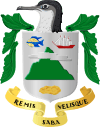
| Motto: "Remis Velisque" (لاطینی زبان) "With oars and sails" (English) |
||||||
| Anthem: "Saba you rise from the ocean" |
||||||
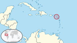 محل وقوع سابا (circled in red) the کیریبین (light yellow) محل وقوع سابا (circled in red) the کیریبین (light yellow) |
||||||
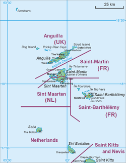 Map showing location of Saba relative to St. Eustatius and St. Martin. Map showing location of Saba relative to St. Eustatius and St. Martin.
|
||||||
| ملک | نیدرلینڈز | |||||
| دارالحکومت (and سب سے بڑا شہر) | دی باٹم 17°38′N 63°15′W | |||||
| دفتری زبان (زبانیں) | ولندیزی, انگریزی[1] | |||||
| حکومت | See Politics of the Netherlands | |||||
| - | Lt. Governor | Jonathan Johnson | ||||
| رقبہ | ||||||
| - | کل | 13 کلومیٹر2 5 مربع میل |
||||
| آبادی | ||||||
| - | 2012[2] مردم شماری | 1,971 | ||||
| - | کثافت | 140/کلومیٹر2 362.6/مربع میل |
||||
| سکہ | امریکی ڈالر (USD) |
|||||
| منطقہ وقت | AST (UTC−4) | |||||
| بلند ترین اسمِ ساحہ | An.,[3] Nl. | |||||
| رمز بعید تکلم | +599-4 | |||||
مزید دیکھیے
حوالہ جات
- English can be used in relations with the government
"Invoeringswet openbare lichamen Bonaire, Sint Eustatius en Saba" (Dutch زبان میں)۔ wetten.nl۔ اخذ شدہ بتاریخ 2011-01-01۔ - "Bevolkingsontwikkeling Caribisch Nederland; geboorte, sterfte, migratie" (Dutch زبان میں)۔ Central Bureau of Statistics۔ مورخہ 25 دسمبر 2018 کو اصل سے آرکائیو شدہ۔ اخذ شدہ بتاریخ 2012-12-13۔
- The domain for the نیدرلینڈز انٹیلیز has remained active after its dissolution. The آیزو 3166-1 الفا-2 code BQ was established for the entity "Bonaire, Sint Eustatius, Saba". ("ISO 3166-1 decoding table"۔ International Organization for Standardization۔ مورخہ 25 دسمبر 2018 کو اصل سے آرکائیو شدہ۔ اخذ شدہ بتاریخ 2010-12-17۔) An Internet بلند ترین ڈومین نیم برائے ممالک has however not been established by the IANA, and it is unknown if it will be opened for registration.
| ویکی کومنز پر سابا سے متعلق سمعی و بصری مواد ملاحظہ کریں۔ |
شمالی امریکا کے ممالک اور تابع علاقہ جات | |||||||||||||||||||
|---|---|---|---|---|---|---|---|---|---|---|---|---|---|---|---|---|---|---|---|
| خود مختار ریاستیں | 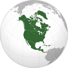 | ||||||||||||||||||
| خود مختار ریاستوں کے حصے | |||||||||||||||||||
| تابع |
| ||||||||||||||||||
.svg.png)
This article is issued from
Wikipedia.
The text is licensed under Creative
Commons - Attribution - Sharealike.
Additional terms may apply for the media files.