নেভাডা
নেভাডা (ইংরেজি: Nevada নেভ়্যাডা, মূলতঃ স্পেনীয় Nevada নেভ়াদ়া অর্থাৎ "তুষারাবৃত") মার্কিন যুক্তরাষ্ট্রের একটি অঙ্গরাজ্য। ১৮৬৪ সালে যুক্তরাষ্ট্রের ৩৬তম অঙ্গরাজ্য হিসেবে নেভাডা অন্তর্ভুক্ত হয়।
| স্টেট অব নেভাডা | |||||
|---|---|---|---|---|---|
| |||||
| ডাকনাম(সমূহ): Silver State (official); Sagebrush State; Battle Born State | |||||
| নীতিবাক্য: All for Our Country | |||||
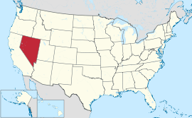 Map of the United States with নেভাডা highlighted | |||||
| অফিসিয়াল ভাষাসমূহ | De jure: None De facto: English | ||||
| Demonym | Nevadan | ||||
| রাজধানী | Carson City | ||||
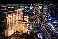
| বৃহত্তম শহর | Las Vegas | ||||
| বৃহত্তম মেট্রো | Las Vegas metropolitan area | ||||
| অঞ্চল | 7th স্থান | ||||
| • মোট | 110,622 বর্গ মাইল (286,367 কিমি২) | ||||
| • প্রস্থ | 322 মাইল (519 কিমি) | ||||
| • দৈর্ঘ্য | 492 মাইল (787 কিমি) | ||||
| • % পানি | 0.69 | ||||
| • Latitude | 35° N to 42° N | ||||
| • দ্রাঘিমা | 114° 2′ W to 120° W | ||||
| জনসংখ্যা | 35th স্থান | ||||
| • মোট | 2,758,931 (2012 est)[1] | ||||
| • ঘনত্ব | 24.8/বর্গ মাইল (9.57/কিমি২) 42nd স্থান | ||||
| • গড় পরিবারের আয় | $56,361 (15th) | ||||
| উচ্চতা | |||||
| • সর্বোচ্চ বিন্দু | Boundary Peak[2][3][4][lower-alpha 1] 13,147 ফুট (4007.1 মিটার) | ||||
| • এর অর্থ | 5,500 ফুট (1680 মিটার) | ||||
| • সর্বনিম্ন বিন্দু | Colorado River at California border[3][4] 481 ফুট (147 মিটার) | ||||
| রাষ্ট্রসত্তার আগে | Nevada Territory | ||||
| ইউনিয়নে ভর্তি | October 31, 1864 (36th) | ||||
| গভর্নর | Brian Sandoval (R) | ||||
| লেফটেন্যান্ট গভর্নর | Brian Krolicki (R) | ||||
| আইন-সভা | Nevada Legislature | ||||
| • উচ্চকক্ষ | Senate | ||||
| • নিম্ন কক্ষ | Assembly | ||||
| মার্কিন সিনেটার | Harry Reid (D) Dean Heller (R) | ||||
| মার্কিন হাউস প্রতিনিধিদল | 1: Dina Titus (D) 2: Mark Amodei (R) 3: Joe Heck (R) 4: Steven Horsford (D) (তালিকা) | ||||
| সময় অঞ্চলসমূহ | |||||
| • most of state | Pacific: UTC −8/−7 | ||||
| • West Wendover | Mountain: UTC −7/−6 | ||||
| আইএসও ৩১৬৬ | US-NV | ||||
| সংক্ষেপে | NV, Nev. | ||||
| ওয়েবসাইট | www | ||||
তথ্যসূত্র
- "Table 1. Annual Estimates of the Population for the United States, Regions, States, and Puerto Rico: April 1, 2010 to July 1, 2013"। 2013 Population Estimates। United States Census Bureau, Population Division। ডিসেম্বর ৩০, ২০১৩। আগস্ট ২৪, ২০১৪ তারিখে মূল (CSV) থেকে আর্কাইভ করা। সংগ্রহের তারিখ ডিসেম্বর ৩০, ২০১৩।
|কর্ম=এ বহিঃসংযোগ দেয়া (সাহায্য) - টেমপ্লেট:Cite ngs
- "Elevations and Distances in the United States"। United States Geological Survey। ২০০১। ১৫ অক্টোবর ২০১১ তারিখে মূল থেকে আর্কাইভ করা। সংগ্রহের তারিখ অক্টোবর ২৪, ২০১১।
- Elevation adjusted to North American Vertical Datum of 1988.
আরও দেখুন
- The distinction of highest point in Nevada goes to the summit of Boundary Peak, so named because it is very near the Nevada-California border, at the northern terminus of the White Mountains. However, Boundary Peak can be considered a subsidiary summit of Montgomery Peak, whose summit is in California, since the topographic prominence of Boundary Peak is only ২৫৩ ফুট (৭৭ মি), which falls under the often used ৩০০-ফুট (৯১ মি) cutoff for an independent peak. Also, Boundary Peak is less than ১ মাইল (১.৬ কিমি) away from its higher neighbor. Hence Boundary Peak can be described as not being wholly within Nevada. By contrast, the prominence of Wheeler Peak, ১৩,০৬৩ ফুট (৩,৯৮২ মি), is quite large and in fact it is the twelfth largest in the contiguous United States. Wheeler Peak is the highest point in a radius of more than ২০০ বর্গমাইল (৫২০ কিমি২) and is entirely within the state of Nevada.
বহিঃসংযোগ
This article is issued from
Wikipedia.
The text is licensed under Creative
Commons - Attribution - Sharealike.
Additional terms may apply for the media files.