ডেলাওয়্যার
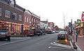
ডেলাওয্যার (ইংরেজিতে: Delaware ডেলাওয়ের; আ-ধ্ব-ব: [ˈdɛləweɹ]) মার্কিন যুক্তরাষ্ট্রের একটি অঙ্গরাজ্য। প্রথম যে তেরোটি অঙ্গরাজ্যের সমন্বয়ে যুক্তরাষ্ট্র গঠিত হয়, ডেলাওয়্যার তার অন্যতম।
| স্টেট অব ডেলাওয়্যার | |||||
|---|---|---|---|---|---|
| |||||
| ডাকনাম(সমূহ): The First State; The Small Wonder; Blue Hen State; The Diamond State | |||||
| নীতিবাক্য: Liberty and Independence | |||||
_(US48).svg.png) Map of the United States with ডেলাওয়্যার highlighted | |||||
| Demonym | Delawarean | ||||
| রাজধানী | Dover | ||||
| বৃহত্তম শহর | Wilmington | ||||
| অঞ্চল | 49th স্থান | ||||
| • মোট | 2,490 বর্গ মাইল (6,452 কিমি২) | ||||
| • প্রস্থ | 30 মাইল (48 কিমি) | ||||
| • দৈর্ঘ্য | 96 মাইল (154 কিমি) | ||||
| • % পানি | 21.5 | ||||
| • Latitude | 38° 27′ N to 39° 50′ N | ||||
| • দ্রাঘিমা | 75° 3′ W to 75° 47′ W | ||||
| জনসংখ্যা | 45th স্থান | ||||
| • মোট | 917,092 (2012 est)[1] | ||||
| • ঘনত্ব | 464/বর্গ মাইল (179/কিমি২) 6th স্থান | ||||
| • গড় পরিবারের আয় | $50,152 (12th) | ||||
| উচ্চতা | |||||
| • সর্বোচ্চ বিন্দু | Near the Ebright Azimuth[2][3][4] 447 ফুট (136.2 মিটার) | ||||
| • এর অর্থ | 60 ফুট (20 মিটার) | ||||
| • সর্বনিম্ন বিন্দু | Atlantic Ocean[2] সমুদ্রপৃষ্ঠ | ||||
| রাষ্ট্রসত্তার আগে | Delaware Colony | ||||
| ইউনিয়নে ভর্তি | December 7, 1787 (1st) | ||||
| গভর্নর | Jack A. Markell (D) | ||||
| লেফটেন্যান্ট গভর্নর | Matthew P. Denn (D) | ||||
| আইন-সভা | General Assembly | ||||
| • উচ্চকক্ষ | Senate | ||||
| • নিম্ন কক্ষ | House of Representatives | ||||
| মার্কিন সিনেটার | Thomas R. Carper (D) Chris Coons (D) | ||||
| মার্কিন হাউস প্রতিনিধিদল | John C. Carney, Jr. (D) (তালিকা) | ||||
| সময় অঞ্চল | Eastern: UTC −5/−4 | ||||
| আইএসও ৩১৬৬ | US-DE | ||||
| সংক্ষেপে | DE, Del. | ||||
| ওয়েবসাইট | delaware | ||||
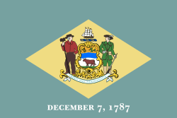 | |
| The Flag of Delaware. | |
| Animate insignia | |
| Bird(s) | Blue Hen Chicken |
| Butterfly | Eastern Tiger Swallowtail |
| Fish | Weakfish |
| Flower(s) | Peach blossom |
| Insect | Ladybug |
| Tree | American Holly |
| Inanimate insignia | |
| Beverage | Milk |
| Colors | Colonial Blue, Buff |
| Fossil | Belemnite |
| Mineral | Sillimanite |
| Slogan(s) | It's Good Being First |
| Soil | Greenwich |
| Song(s) | Our Delaware |
| Route marker(s) | |
 | |
| State Quarter | |
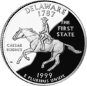 | |
| Released in 1999 | |
| Lists of United States state insignia | |
তথ্যসূত্র
- "Table 1. Annual Estimates of the Population for the United States, Regions, States, and Puerto Rico: April 1, 2010 to July 1, 2013"। 2013 Population Estimates। United States Census Bureau, Population Division। ডিসেম্বর ৩০, ২০১৩। আগস্ট ২৪, ২০১৪ তারিখে মূল (CSV) থেকে আর্কাইভ করা। সংগ্রহের তারিখ ডিসেম্বর ৩০, ২০১৩।
|কর্ম=এ বহিঃসংযোগ দেয়া (সাহায্য) - "Elevations and Distances in the United States"। United States Geological Survey। ২০০১। ১৫ অক্টোবর ২০১১ তারিখে মূল থেকে আর্কাইভ করা। সংগ্রহের তারিখ অক্টোবর ২১, ২০১১।
- Elevation adjusted to North American Vertical Datum of 1988.
- Schenck, William S। "Highest Point in Delaware"। Delaware Geological Survey। সংগ্রহের তারিখ জুলাই ২৩, ২০০৮।
আরও দেখুন
বহিঃসংযোগ
This article is issued from
Wikipedia.
The text is licensed under Creative
Commons - Attribution - Sharealike.
Additional terms may apply for the media files.