আর্কানসাস
আর্কান্স অথবা আর্কান্সো (ইংরেজিতে: Arkansas আর্কান্স; আ-ধ্ব-ব: [ˈaɹkənsɔ]) মার্কিন যুক্তরাষ্ট্রের একটি অঙ্গরাজ্য। ১৮৩৬ সালে যুক্তরাষ্ট্রের ২৫তম অঙ্গরাজ্য হিসেবে আর্কান্স অন্তর্ভুক্ত হয়।
| স্টেট অব আর্কানসাস | |||||
|---|---|---|---|---|---|
| |||||
| ডাকনাম(সমূহ): {{{Nickname}}} | |||||
| নীতিবাক্য: Regnat populus (Latin) | |||||
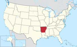 Map of the United States with আর্কানসাস highlighted | |||||
| Demonym | Arkansan Arkansawyer[1] | ||||
| রাজধানী | {{{Capital}}} | ||||
| বৃহত্তম শহর | {{{LargestCity}}} | ||||
| অঞ্চল | ২৯তম স্থান | ||||
| • মোট | ৫৩,১৭৯ বর্গ মাইল (১৩৭,৭৩৩ কিমি২) | ||||
| • প্রস্থ | ২৩৯ মাইল (৩৮৫ কিমি) | ||||
| • দৈর্ঘ্য | ২৬১ মাইল (৪২০ কিমি) | ||||
| • % পানি | 2.09 | ||||
| • Latitude | 33° 00′ N to 36° 30′ N | ||||
| • দ্রাঘিমা | 89° 39′ W to 94° 37′ W | ||||
| জনসংখ্যা | ৩২তম স্থান | ||||
| • মোট | ২৯৪৯১৩১ (2012 est)[2] | ||||
| • ঘনত্ব | 56.4/বর্গ মাইল (21.8/কিমি২) ৩৪তম স্থান | ||||
| উচ্চতা | |||||
| • সর্বোচ্চ বিন্দু | Magazine Mountain[3][4][lower-alpha 1][lower-alpha 2] 2,753 ফুট (839 মিটার) | ||||
| • এর অর্থ | 650 ফুট (200 মিটার) | ||||
| • সর্বনিম্ন বিন্দু | Ouachita River at Louisiana border[4] 55 ফুট (17 মিটার) | ||||
| রাষ্ট্রসত্তার আগে | আর্কানসাস টেরিটোরি | ||||
| ইউনিয়নে ভর্তি | June 15, 1836 (25th) | ||||
| গভর্নর | Mike Beebe (D) | ||||
| লেফটেন্যান্ট গভর্নর | Mark Darr (R) | ||||
| আইন-সভা | General Assembly | ||||
| • উচ্চকক্ষ | Senate | ||||
| • নিম্ন কক্ষ | House of Representatives | ||||
| মার্কিন সিনেটার | Mark Pryor (D) John Boozman (R) | ||||
| মার্কিন হাউস প্রতিনিধিদল | 4 Republicans (তালিকা) | ||||
| সময় অঞ্চল | Central: UTC −6/−5 | ||||
| আইএসও ৩১৬৬ | US-AR | ||||
| সংক্ষেপে | AR, Ark | ||||
| ওয়েবসাইট | www | ||||


আরও দেখুন
তথ্যসূত্র
- Blevins 2009, p. 2.
- "Annual Estimates of the Population for the United States, Regions, States, and Puerto Rico: April 1, 2010 to July 1, 2012"। 2012 Population Estimates। United States Census Bureau, Population Division। ডিসেম্বর ২০১২। জুন ২২, ২০১৩ তারিখে মূল (CSV) থেকে আর্কাইভ করা। সংগ্রহের তারিখ ডিসেম্বর ২৪, ২০১২।
- টেমপ্লেট:Cite ngs
- "Elevations and Distances in the United States"। United States Geological Survey। ২০০১। ১৫ অক্টোবর ২০১১ তারিখে মূল থেকে আর্কাইভ করা। সংগ্রহের তারিখ অক্টোবর ২১, ২০১১।
- "Magazine Mountain"। Geographic Names Information System। United States Geological Survey। সংগ্রহের তারিখ জানুয়ারি ২, ২০১৩।
- "Signal Hill"। Geographic Names Information System। United States Geological Survey। সংগ্রহের তারিখ জানুয়ারি ২, ২০১৩।
বহিঃসংযোগ
- Elevation adjusted to North American Vertical Datum of 1988.
- The Geographic Names Index System (GNIS) of the United States Geologic Survey (USGS) indicates that the official name of this feature is Magazine Mountain, not "Mount Magazine". Although not a hard and fast rule, generally "Mount X" is used for a peak and "X Mountain" is more frequently used for ridges, which better describes this feature. Magazine Mountain appears in the GNIS as a ridge,[5] with Signal Hill identified as its summit.[6] "Mount Magazine" is the name used by the Arkansas Department of Parks and Tourism, which follows what the locals have used since the area was first settled.
This article is issued from
Wikipedia.
The text is licensed under Creative
Commons - Attribution - Sharealike.
Additional terms may apply for the media files.