ওয়াইয়োমিং
ওয়াইয়োমিং মার্কিন যুক্তরাষ্ট্রের একটি অঙ্গরাজ্য। ১৮৯০ সালে যুক্তরাষ্ট্রের ৪৪তম অঙ্গরাজ্য হিসেবে ওয়াইয়োমিং অন্তর্ভুক্ত হয়।
| ওয়াইয়োমিং State of Wyoming | |||||
|---|---|---|---|---|---|
| |||||
| ডাকনাম(সমূহ): Equality State (official); Cowboy State; Big Wyoming | |||||
| নীতিবাক্য: Equal Rights | |||||
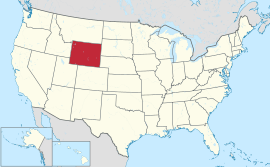 Map of the United States with Wyoming highlighted | |||||
| অফিসিয়াল ভাষাসমূহ | ইংরেজি | ||||
| Demonym | Wyomingite | ||||
| রাজধানী (এবং বৃহত্তম শহর) | Cheyenne | ||||
| বৃহত্তম মেট্রো | Cheyenne Metro Area | ||||
| অঞ্চল | 10th স্থান | ||||
| • মোট | 97,814 বর্গ মাইল (253,348 কিমি২) | ||||
| • প্রস্থ | 360 মাইল (581 কিমি) | ||||
| • দৈর্ঘ্য | 280 মাইল (450 কিমি) | ||||
| • % পানি | 0.7 | ||||
| • Latitude | 41°N to 45°N | ||||
| • দ্রাঘিমা | 104°3'W to 111°3'W | ||||
| জনসংখ্যা | 50th স্থান | ||||
| • মোট | 582,658 (2013 estimate)[1] | ||||
| • ঘনত্ব | 5.85/বর্গ মাইল (2.26/কিমি২) 49th স্থান | ||||
| উচ্চতা | |||||
| • সর্বোচ্চ বিন্দু | Gannett Peak[2][3][4] 13,809 ফুট (4209.1 মিটার) | ||||
| • এর অর্থ | 6,700 ফুট (2040 মিটার) | ||||
| • সর্বনিম্ন বিন্দু | Belle Fourche River at South Dakota border[3][4] 3,101 ফুট (945 মিটার) | ||||
| রাষ্ট্রসত্তার আগে | Wyoming Territory | ||||
| ইউনিয়নে ভর্তি | July 10, 1890 (44th) | ||||
| গভর্নর | Matt Mead (R) | ||||
| Secretary of State | Max Maxfield (R) | ||||
| আইন-সভা | Wyoming Legislature | ||||
| • উচ্চকক্ষ | Senate | ||||
| • নিম্ন কক্ষ | House of Representatives | ||||
| মার্কিন সিনেটার | Mike Enzi (R) John Barrasso (R) | ||||
| মার্কিন হাউস প্রতিনিধিদল | Cynthia Lummis (R) (তালিকা) | ||||
| সময় অঞ্চল | Mountain: UTC -7/-6 | ||||
| আইএসও ৩১৬৬ | US-WY | ||||
| সংক্ষেপে | WY, | ||||
| ওয়েবসাইট | wyoming | ||||
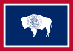 | |
| The Flag of Wyoming. | |
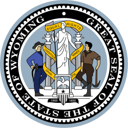 | |
| The Seal of Wyoming. | |
| Animate insignia | |
| Bird(s) | Western Meadowlark (Sturnella neglecta) |
| Fish | Cutthroat trout (Oncorhynchus clarki) |
| Flower(s) | Wyoming Indian paintbrush (Castilleja linariifolia) |
| Grass | Western Wheatgrass (Pascopyrum smithii) |
| Mammal(s) | American Bison (Bison bison) |
| Reptile | Horned lizard (Phrynosoma douglassi brevirostre) |
| Tree | Plains Cottonwood (Populus sargentii) |
| Inanimate insignia | |
| Fossil | Knightia |
| Mineral | Nephrite |
| Motto | Equal Rights (motto) |
| Soil | Forkwood (unofficial) |
| Song(s) | Wyoming (song) by Charles E. Winter & George E. Knapp |
| Route marker(s) | |
 | |
| State Quarter | |
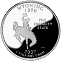 | |
| Released in 2007 | |
| Lists of United States state insignia | |
তথ্যসূত্র
- "Annual Estimates of the Population for the United States, Regions, States, and Puerto Rico: April 1, 2010 to July 1, 2012"। 2012 Population Estimates। United States Census Bureau, Population Division। ডিসেম্বর ২০১২। ডিসেম্বর ২৯, ২০১২ তারিখে মূল (CSV) থেকে আর্কাইভ করা। সংগ্রহের তারিখ ডিসেম্বর ২২, ২০১২।
- টেমপ্লেট:Cite ngs
- "Elevations and Distances in the United States"। United States Geological Survey। ২০০১। সংগ্রহের তারিখ জুলাই ১৩, ২০১৪।
- Elevation adjusted to North American Vertical Datum of 1988.
আরও দেখুন
বহিঃসংযোগ
This article is issued from
Wikipedia.
The text is licensed under Creative
Commons - Attribution - Sharealike.
Additional terms may apply for the media files.