কেন্টাকি
কেন্টাকি (ইংরেজি: Kentucky কেন্টাকী) মার্কিন যুক্তরাষ্ট্রের একটি অঙ্গরাজ্য। ১৭৯২ সালে যুক্তরাষ্ট্রের ১৫তম অঙ্গরাজ্য হিসেবে কেন্টাকি অন্তর্ভুক্ত হয়।
| কমনওয়েলথ অব কেন্টাকি | |||||
|---|---|---|---|---|---|
| |||||
| ডাকনাম(সমূহ): Bluegrass State | |||||
| নীতিবাক্য: United we stand, divided we fall and Deo gratiam habeamus (Let us be grateful to God) | |||||
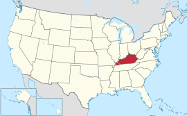 Map of the United States with কেন্টাকি highlighted | |||||
| অফিসিয়াল ভাষাসমূহ | ইংরেজি[1] | ||||
| Demonym | Kentuckian | ||||
| রাজধানী | Frankfort | ||||
| বৃহত্তম শহর | Louisville | ||||
| বৃহত্তম মেট্রো | Louisville metropolitan area | ||||
| অঞ্চল | 37th স্থান | ||||
| • মোট | 40,409 বর্গ মাইল (104,659 কিমি২) | ||||
| • প্রস্থ | 140 মাইল (225 কিমি) | ||||
| • দৈর্ঘ্য | 379 মাইল (610 কিমি) | ||||
| • % পানি | 1.7 | ||||
| • Latitude | 36° 30′ N to 39° 09′ N | ||||
| • দ্রাঘিমা | 81° 58′ W to 89° 34′ W | ||||
| জনসংখ্যা | 26th স্থান | ||||
| • মোট | 4,395,295 (2013 est)[2] | ||||
| • ঘনত্ব | 110/বর্গ মাইল (42.5/কিমি২) 22nd স্থান | ||||
| উচ্চতা | |||||
| • সর্বোচ্চ বিন্দু | Black Mountain[3][4] 4,145 ফুট (1263 মিটার) | ||||
| • এর অর্থ | 750 ফুট (230 মিটার) | ||||
| • সর্বনিম্ন বিন্দু | Mississippi River at Kentucky Bend[3][4] 257 ফুট (78 মিটার) | ||||
| ইউনিয়নে ভর্তি | June 1, 1792 (15th) | ||||
| গভর্নর | Steve Beshear (D) | ||||
| লেফটেন্যান্ট গভর্নর | Jerry Abramson (D) | ||||
| আইন-সভা | Kentucky General Assembly | ||||
| • উচ্চকক্ষ | Senate | ||||
| • নিম্ন কক্ষ | House of Representatives | ||||
| মার্কিন সিনেটার | Mitch McConnell (R) Rand Paul (R) | ||||
| মার্কিন হাউস প্রতিনিধিদল | 5 Republicans, 1 Democrat (তালিকা) | ||||
| সময় অঞ্চলসমূহ | |||||
| • eastern half | Eastern: UTC -5/-4 | ||||
| • western half | Central: UTC -6/-5 | ||||
| আইএসও ৩১৬৬ | US-KY | ||||
| সংক্ষেপে | KY, | ||||
| ওয়েবসাইট | kentucky | ||||


তথ্যসূত্র
- "Kentucky State Symbols"। Kentucky Department for Libraries and Archives। সংগ্রহের তারিখ নভেম্বর ২৯, ২০০৬।
- "Table 1. Annual Estimates of the Population for the United States, Regions, States, and Puerto Rico: April 1, 2010 to July 1, 2013"। 2013 Population Estimates। United States Census Bureau, Population Division। ডিসেম্বর ৩০, ২০১৩। আগস্ট ২৪, ২০১৪ তারিখে মূল (CSV) থেকে আর্কাইভ করা। সংগ্রহের তারিখ ডিসেম্বর ৩০, ২০১৩।
|কর্ম=এ বহিঃসংযোগ দেয়া (সাহায্য) - "Elevations and Distances in the United States"। United States Geological Survey। ২০০১। ১৫ অক্টোবর ২০১১ তারিখে মূল থেকে আর্কাইভ করা। সংগ্রহের তারিখ অক্টোবর ২১, ২০১১।
- Elevation adjusted to North American Vertical Datum of 1988.
আরও দেখুন
বহিঃসংযোগ
This article is issued from
Wikipedia.
The text is licensed under Creative
Commons - Attribution - Sharealike.
Additional terms may apply for the media files.