উত্তরাঞ্চলীয় আমেরিকা
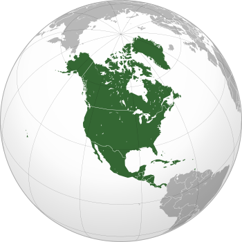
উত্তরাঞ্চলীয় আমেরিকা (ইংরেজি: Northern America) উত্তর আমেরিকা মহাদেশের উত্তরতম অঞ্চল। একটি সংজ্ঞানুযায়ী এটি "মধ্য" আমেরিকার (মেক্সিকো, ক্যারিবীয় অঞ্চল ও মধ্য আমেরিকা) উপরে অবস্থিত।[2] অর্থাৎ উত্তরাঞ্চলীয় আমেরিকার দক্ষিণ সীমান্ত হল মার্কিন-মেক্সিকো সীমান্ত। আবার জাতিসংঘের দেওয়া সংজ্ঞানুযায়ী উত্তরাঞ্চলীয় আমেরিকা যে রাষ্ট্র ও অঞ্চলগুলি নিয়ে গঠিত, সেগুলি হল বারমুডা, কানাডা, গ্রিনল্যান্ড, সাঁ-পিয়ের এ মিকলোঁ এবং মার্কিন যুক্তরাষ্ট্র (হাওয়াই, পুয়ের্তো রিকো, মার্কিন ভার্জিন দ্বীপপুঞ্জ ও অন্যান্য অপ্রধান মার্কিন অঞ্চল ব্যতীত)।[3][4]
| উত্তরাঞ্চলীয় আমেরিকা | |
|---|---|
.svg.png) | |
| আয়তন | ২,১৭,৮০,১৪২ কিমি২ (৮৪,০৯,৩৬০ মা২) |
| জনসংখ্যা | টেমপ্লেট:UN Population (টেমপ্লেট:UN Population est.) |
| জনঘনত্ব | 16.5/km2 |
| জিডিপি (নমিনাল) | $22.2 trillion (2018 est.)[1] |
| দেশসমূহ | ২
|
| অধীনস্থ অঞ্চলসমূহ | ৩
|
| ভাষাসমূহ | English, French, Spanish, Danish, Greenlandic, and various recognized regional languages |
| সময় অঞ্চলসমূহ | UTC (Danmarkshavn, Greenland) to UTC -10:00 (west Aleutians) |
| বৃহত্তম শহরসমূহ |
|
তথ্যসূত্র
- "Report for Selected Countries and Subjects"। www.imf.org।
- Gonzalez, Joseph. 2004. "Northern America: Land of Opportunity" (ch. 6). The Complete Idiot's Guide to Geography. (আইএসবিএন ১৫৯২৫৭১৮৮৩) New York: Alpha Books; pp. 57-8
- Definition of major areas and regions, from World Migrant Stock: The 2005 Revision Population Database, United Nations Population Division. Accessed on line October 3, 2007.
- Composition of macro geographical (continental) regions, geographical sub-regions, and selected economic and other groupings, UN Statistics Division. Accessed on line October 3, 2007. (French)
আরও দেখুন
- কেন্দ্রীয় আমেরিকা
- মধ্য আমেরিকা
- ইঙ্গ-আমেরিকা
বহিঃসংযোগ
| ||||||||
| ||||||||
| ||||||||
| ||||||||
.svg.png)
.svg.png)
.svg.png)
.svg.png)

.svg.png)
.svg.png)
.svg.png)
.svg.png)
.svg.png)
This article is issued from
Wikipedia.
The text is licensed under Creative
Commons - Attribution - Sharealike.
Additional terms may apply for the media files.