

Overlay Features
 ShareCompartir
Overlay features can be added to any map or viewed alone.
Step 1
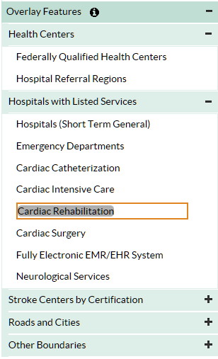
Expand “Overlay Features” and select the type of information to display.
- Health Centers include Federally Qualified Health Center locations and Hospital Referral Region boundaries.
- Hospital locations.
- Stroke Centers include hospitals that have been certified as providing stroke services.
- Under “Other Boundaries,” you can turn congressional district, state, county, ZIP code, and Census tract boundaries and labels on and off.
Step 2
Click on the symbol on the map to see facility name.
Recommended Citation for Maps
This map was created using the Interactive Atlas of Heart Disease and Stroke, a website developed by the Centers for Disease Control and Prevention, Division for Heart Disease and Stroke Prevention. http://nccd.cdc.gov/DHDSPAtlas.
- Page last reviewed: July 19, 2017
- Page last updated: July 19, 2017
- Content source: