

About the Project
 ShareCompartir
In 2015, The Robert Wood Johnson Foundation and CDC Foundation launched the 500 Cities Project in partnership with the Centers for Disease Control and Prevention (CDC).
Project Purpose:
- This project reports city and census tract-level data, obtained using small area estimation methods, for 27 chronic disease measures for the 500 largest American cities.
- The data are published through a public, interactive “500 Cities” website that allows users to view, explore, and download city- and tract-level data.
- Although limited data are available at the county and metropolitan levels, this project represents a first-of-its kind data analysis to release information on a large scale for cities and for small areas within cities. This system complements existing surveillance data necessary to more fully understand the health issues affecting the residents of that city or census tract.
- These high-quality, small-area epidemiologic data can be used both by individual cities and groups of cities as well as other stakeholders to help develop and implement effective and targeted prevention activities; identify emerging health problems; and establish and monitor key health objectives. For example, city planners and elected officials may want to use this data to target neighborhoods with high rates of smoking or other health risk behaviors for effective interventions.
Cities:
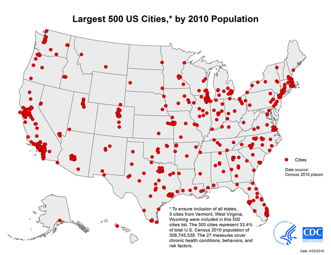
- The project will deliver data for the 497 largest American cities and will include data from the largest cities in Vermont (Burlington – population: 42,417), West Virginia (Charleston – population: 51,400) and Wyoming (Cheyenne – population: 59,466) to ensure inclusion of cities from all the states; bringing the total to 500 cities.
- The number of cities per state ranges from 1 to 121.
- The cities range in population from 42,417 in Burlington, Vermont to 8,175,133 in New York City, New York.
- Among these 500 cities, there are approximately 28,000 census tracts, for which data will be provided. The tracts range in population from less than 50 to 28,960, and in size from less than 1 square mile to more than 642 square miles. The number of tracts per city ranges from 8 to 2,140.
- The project includes a total population of 103,020,808, which represents 33.4% of the total United States population of 308,745,538.
- List of 500 Cities [PDF-314KB]
Unique Value of the 500 Cities Project
- The 500 Cities Project reflects innovations in generating valid small-area estimates for population health.
- It provides data for cities, many of which cover multiple counties or do not follow county boundaries, and for census tracts for the first time. These data will be filterable (by city and/or tracts; as well as by measure) and downloadable for use in separate analyses by the end-users.
- The project will enable retrieval, visualization, and exploration of a uniformly- defined selected city and tract-level data for the largest 500 US cities for conditions, behaviors, and risk factors that have a substantial effect on population health.
For More Information
The Robert Wood Johnson Foundation hosted an informational webinar on the 500 Cities Project on June 30, 2016. The 500 Cities Project webinar recording is now available.
Local Data Widget
A widget is an interactive web tool that displays the featured content directly on your web page. You can embed content in personalized home pages, blogs, and other sites. Once you’ve added the widget, there’s no technical maintenance. CDC.gov will update the content automatically.
- Page last reviewed: August 28, 2017
- Page last updated: August 28, 2017
- Content source: