مسوری کی کاؤنٹیوں کی فہرست
امریکی ریاست مسوری کی 114 کاؤنٹیاں اور ایک آزاد شہر ہے۔
| مسوری کی کاؤنٹیاں اور آزاد شہر Independent city and Counties of Missouri | |
|---|---|
 GA
DG
ST
OZ
| |
| مقام | ریاست مسوری |
| تعداد |
114 کاؤنٹیاں 1 آزاد شہر |
| آبادی | (کاؤنٹیاں صرف):2,171 (ورتھ) – 916,829 (سینٹ لوئس) |
| رقبہ | (کاؤنٹیاں صرف):266 مربع میل (690 کلومیٹر2) (ورتھ) – 1,179 مربع میل (3,050 کلومیٹر2) (ٹیکساس) |
| حکومت | کاؤنٹی حکومت |
| ذیلی تقسیمات | cities, towns, unincorporated communities, مردم شماری نامزد مقام |
کاؤنٹیاں
| کاؤنٹی |
ایف آئی پی ایس رموز [1] |
County seat [2] |
Established [2] |
Formed from [3] |
Etymology [3][4][5] |
آبادی [6] |
رقبہ [2] |
نقشہ |
|---|---|---|---|---|---|---|---|---|
| Adair County | 001 | Kirksville | 1841 | Macon County | John Adair (1757–1840), pioneer, soldier, and seventh Governor of Kentucky | 25,607 | 568 sq mi (1,471 km2) |  |
| Andrew County | 003 | Savannah | 1841 | Part of the Platte Purchase | Andrew Jackson Davis (1826–1910), spiritualist and missionary who settled in سینٹ لوئس | 17,291 | 435 sq mi (1,127 km2) |  |
| Atchison County | 005 | Rock Port | 1843 | Holt County, part of the Platte Purchase | ریاستہائے متحدہ سینٹ David Rice Atchison (1807–1886), a Democrat from Missouri | 5,685 | 545 sq mi (1,412 km2) |  |
| Audrain County | 007 | Mexico | 1831 | Callaway, Monroe and Ralls counties | James H. Audrain, a War of 1812 colonel Missouri State Legislator | 25,529 | 693 sq mi (1,795 km2) |  |
| Barry County | 009 | Cassville | 1835 | Greene County | William Taylor Barry (1784–1835), jurist and United States Postmaster General | 35,597 | 779 sq mi (2,018 km2) |  |
| Barton County | 011 | Lamar | 1855 | Jasper County | ریاستہائے متحدہ سینٹ David Barton (1783–1837), one of the first senators from Missouri | 12,402 | 594 sq mi (1,538 km2) |  |
| Bates County | 013 | Butler | 1841 | Van Buren (now Cass) County | Frederick Bates (1777–1825), the second governor of Missouri | 17,049 | 848 sq mi (2,196 km2) |  |
| Benton County | 015 | Warsaw | 1835 | Pettis and Greene counties | Thomas Hart Benton (1782–1858), ریاستہائے متحدہ سینٹ from Missouri | 19,056 | 706 sq mi (1,829 km2) |  |
| Bollinger County | 017 | Marble Hill | 1851 | Cape Girardeau, Madison, Stoddard and Wayne counties | George Frederick Bollinger (1770–1842), early settler of Missouri | 12,363 | 621 sq mi (1,608 km2) | 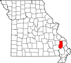 |
| Boone County | 019 | Columbia | 1821 | Howard County | Daniel Boone (1734–1820), American pioneer and شکار | 162,642 | 685 sq mi (1,774 km2) | 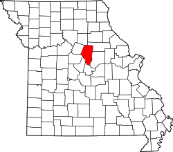 |
| Buchanan County | 021 | Saint Joseph | 1838 | Part of the Platte Purchase | جیمز بکانن (1791–1868), 15th صدر ریاستہائے متحدہ امریکہ | 89,201 | 410 sq mi (1,062 km2) | 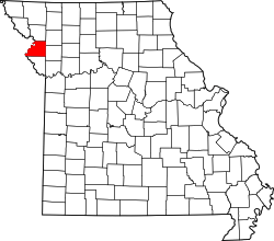 |
| Butler County | 023 | Poplar Bluff | 1849 | Wayne County | William O. Butler (1791–1880), ریاستہائے متحدہ ایوان نمائندگان from Kentucky and vice-presidential nominee under لوئیس کاس | 42,794 | 698 sq mi (1,808 km2) | 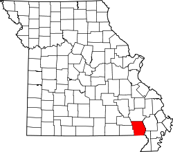 |
| Caldwell County | 025 | Kingston | 1836 | Ray County | Disputed; either John Caldwell, an Indian scout and friend of respected Colonel Alexander William Doniphan; John Caldwell, Lieutenant Governor of کینٹکی; or Mathew Caldwell, a signer of the Texas Declaration of Independence | 9,424 | 429 sq mi (1,111 km2) |  |
| Callaway County | 027 | Fulton | 1821 | Boone, Howard and Montgomery counties | James Callaway (1783–1815), soldier during the War of 1812 and grandson of Daniel Boone | 44,332 | 839 sq mi (2,173 km2) |  |
| Camden County | 029 | Camdenton | 1841 | Benton, Morgan and Pulaski counties | Charles Pratt, 1st Earl Camden (1714–1794), an English قانون دان, قاضی, Whig سیاست دان, and proponent of civil liberties | 44,002 | 655 sq mi (1,696 km2) |  |
| Cape Girardeau County | 031 | Jackson | 1812 | One of the five original counties | Sieur de Girardot, a French officer and early explorer of the region | 75,674 | 579 sq mi (1,500 km2) |  |
| Carroll County | 033 | Carrollton | 1833 | Ray County | Charles Carroll (1737–1832), delegate to the Continental Congress and ریاستہائے متحدہ سینٹ for میری لینڈ | 9,295 | 695 sq mi (1,800 km2) |  |
| Carter County | 035 | Van Buren | 1859 | Oregon, Reynolds, Ripley and Shannon counties | Zimri Carter, pioneering settler | 6,265 | 508 sq mi (1,316 km2) |  |
| Cass County | 037 | Harrisonville | 1833 | Jackson County | لوئیس کاس (1782–1866), senator from مشی گن | 99,478 | 699 sq mi (1,810 km2) |  |
| Cedar County | 039 | Stockton | 1845 | Dade and St. Clair counties | Named for the abundance of Eastern Red Cedar trees | 13,982 | 476 sq mi (1,233 km2) |  |
| Chariton County | 041 | Keytesville | 1821 | Howard County | Chariton River, a tributary of the دریائے مسوری, whose naming origin is disputed | 7,831 | 756 sq mi (1,958 km2) |  |
| Christian County | 043 | Ozark | 1859 | Greene, Taney and Webster counties | William Christian (1743–1786), colonel in the American Revolution | 77,422 | 563 sq mi (1,458 km2) |  |
| Clark County | 045 | Kahoka | 1836 | Lewis County | William Clark (1770–1838), American explorer, soldier, Indian agent, and territorial governor | 7,139 | 507 sq mi (1,313 km2) |  |
| Clay County | 047 | Liberty | 1822 | Ray County | ہینری کلے (1777–1852), American Senator and orator from کینٹکی | 221,939 | 396 sq mi (1,026 km2) |  |
| Clinton County | 049 | Plattsburg | 1833 | Clay County | George Clinton (1739–1812), soldier and Governor of New York, considered one of the Founding Fathers of the United States | 20,743 | 419 sq mi (1,085 km2) |  |
| Cole County | 051 | Jefferson City | 1820 | Cooper County | Stephen Cole, pioneering settler | 75,990 | 392 sq mi (1,015 km2) |  |
| Cooper County | 053 | Boonville | 1818 | Howard County | Sarshel Benjamin Cooper, pioneering settler | 17,601 | 565 sq mi (1,463 km2) |  |
| Crawford County | 055 | Steelville | 1829 | Gasconade County | William H. Crawford (1772–1834), U.S. Senator from Georgia, U.S. Secretary of Treasury, and قاضی | 24,696 | 743 sq mi (1,924 km2) |  |
| Dade County | 057 | Greenfield | 1841 | Barry and Polk counties | Major Francis L. Dade (1793?–1835), Major in the U.S. 4th Infantry Regiment, امریکی فوج, during the Second Seminole War | 7,883 | 490 sq mi (1,269 km2) |  |
| Dallas County | 059 | Buffalo | 1841 | Polk County | George M. Dallas (1792–1864), نائب صدر ریاستہائے متحدہ امریکہ under جیمز کے پوک | 16,777 | 542 sq mi (1,404 km2) |  |
| Daviess County | 061 | Gallatin | 1836 | Ray County | Joseph Hamilton Daveiss (1774–1811), commanded the Dragoons of the انڈیانا Militia at the Battle of Tippecanoe | 8,433 | 567 sq mi (1,469 km2) |  |
| DeKalb County | 063 | Maysville | 1843 | Clinton County | Johann de Kalb (1721–1780), a German soldier who served as a میجر جنرل in the Continental Army during the امریکی جنگ انقلاب | 12,892 | 424 sq mi (1,098 km2) |  |
| Dent County | 065 | Salem | 1851 | Crawford and Shannon counties | James Dent, pioneering settler | 15,657 | 754 sq mi (1,953 km2) |  |
| Douglas County | 067 | Ava | 1857 | Ozark County | Stephen A. Douglas (1813–1861), American Senator from الینوائے, and the Democratic nominee for President in 1860 | 13,684 | 815 sq mi (2,111 km2) |  |
| Dunklin County | 069 | Kennett | 1843 | Stoddard County | Daniel Dunklin (1790–1844), fifth governor of Missouri | 31,953 | 546 sq mi (1,414 km2) | 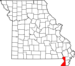 |
| Franklin County | 071 | Union | 1818 | St. Louis County | بن یمین فرینکلن (1706–1790), writer, publisher, orator, and one of the Founding Fathers of the ریاستہائے متحدہ امریکا | 101,492 | 922 sq mi (2,388 km2) |  |
| Gasconade County | 073 | Hermann | 1821 | Franklin County | Gasconade River, a tributary of the دریائے مسوری; the river probably derives its name from the French word "gascon" which means braggart, and could be an old satirical name describing those who boast about their adventures upon return to St. Louis | 15,222 | 520 sq mi (1,347 km2) |  |
| Gentry County | 075 | Albany | 1841 | Clinton County | Richard Gentry (1788–1837), a distinguished American military colonel in the Seminole Wars | 6,738 | 492 sq mi (1,274 km2) | 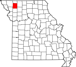 |
| Greene County | 077 | Springfield | 1833 | Crawford and Wayne counties | Nathanael Greene (1742–1786), a میجر جنرل of the Continental Army in the امریکی جنگ انقلاب | 275,174 | 675 sq mi (1,748 km2) |  |
| Grundy County | 079 | Trenton | 1839 | Livingston County | Felix Grundy (1777–1840), ریاستہائے متحدہ ایوان نمائندگان and ریاستہائے متحدہ سینٹ from ٹینیسی who also served as the 13th Attorney General of the United States | 10,261 | 436 sq mi (1,129 km2) |  |
| Harrison County | 081 | Bethany | 1843 | Daviess County | Albert G. Harrison (1800–1839), ریاستہائے متحدہ ایوان نمائندگان from مسوری | 8,957 | 725 sq mi (1,878 km2) |  |
| Henry County | 083 | Clinton | 1834 | Lillard (now Lafayette) County | Patrick Henry (1736–1799), first post-colonial Governor of Virginia and prominent figure in the American Revolution | 22,272 | 702 sq mi (1,818 km2) |  |
| Hickory County | 085 | Hermitage | 1845 | Benton and Polk counties | اینڈریو جیکسن (1767–1845), seventh U.S. President, who was nicknamed "Old Hickory" during his military service | 9,627 | 399 sq mi (1,033 km2) |  |
| Holt County | 087 | Oregon | 1841 | Part of the Platte Purchase | David Rice Holt, Missouri State Representative | 4,912 | 462 sq mi (1,197 km2) |  |
| Howard County | 089 | Fayette | 1816 | St. Charles and St. Louis counties | Benjamin Howard (1760–1814), a Congressman from کینٹکی, governor of Missouri Territory and a brigadier general in the War of 1812 | 10,144 | 466 sq mi (1,207 km2) |  |
| Howell County | 091 | West Plains | 1857 | Oregon County | Disputed - Josiah Howell, pioneering settler | 40,400 | 928 sq mi (2,404 km2) |  |
| Iron County | 093 | Ironton | 1857 | Madison, Reynolds, St. Francois, Washington and Wayne counties | The abundance of لوہا ore in the area | 10,630 | 551 sq mi (1,427 km2) |  |
| Jackson County | 095 | Kansas City, Independence | 1826 | Lillard (now Lafayette) County | اینڈریو جیکسن (1767–1845), ریاستہائے متحدہ سینٹ from ٹینیسی and later صدر ریاستہائے متحدہ امریکہ | 674,158 | 605 sq mi (1,567 km2) |  |
| Jasper County | 097 | Carthage | 1841 | Barry County | William Jasper (c. 1750–1779), a noted American soldier in the Revolutionary War | 117,404 | 640 sq mi (1,658 km2) |  |
| Jefferson County | 099 | Hillsboro | 1818 | St. Louis and Sainte Genevieve counties | ٹامس جیفرسن (1743–1826), third صدر ریاستہائے متحدہ امریکہ, principal author of the Declaration of Independence, and one of the most influential Founding Fathers | 218,733 | 657 sq mi (1,702 km2) |  |
| Johnson County | 101 | Warrensburg | 1834 | Lillard (now Lafayette) County | Richard M. Johnson (1780–1850), ریاستہائے متحدہ کے نائب صدور کی فہرست نائب صدر ریاستہائے متحدہ امریکہ, serving in the administration of مارٹن وان بورن | 52,595 | 831 sq mi (2,152 km2) |  |
| Knox County | 103 | Edina | 1843 | Scotland County | Henry Knox (1750–1806) an American bookseller from بوسٹن, میساچوسٹس who became the chief artillery officer of the Continental Army and later the nation's first Secretary of War | 4,131 | 506 sq mi (1,311 km2) | 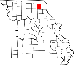 |
| Laclede County | 105 | Lebanon | 1849 | Camden, Pulaski and Wright counties | Pierre Laclede (1729–1778), founder of سینٹ لوئس | 35,571 | 766 sq mi (1,984 km2) | 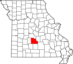 |
| Lafayette County | 107 | Lexington | 1821 | Cooper County | Gilbert du Motier, the Marquis de Lafayette (1757–1834), French military officer and general in the امریکی جنگ انقلاب | 33,381 | 629 sq mi (1,629 km2) | 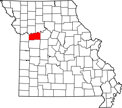 |
| Lawrence County | 109 | Mount Vernon | 1843 | Barry and Dade counties | James Lawrence (1781–1813), an American naval officer best known for his last words "Don't give up the ship!" | 38,634 | 613 sq mi (1,588 km2) | 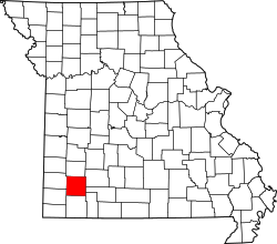 |
| Lewis County | 111 | Monticello | 1833 | Marion County | Meriwether Lewis (1774–1809), explorer and governor of the Louisiana Territory | 10,211 | 505 sq mi (1,308 km2) |  |
| Lincoln County | 113 | Troy | 1818 | St. Charles County | Disputed; either لنکن کاؤنٹی، کینٹکی (birthplace of Christopher Clark, a Missouri legislator who advocated for the county's creation),[7] or for Benjamin Lincoln (1733–1810), an American revolutionary war general | 52,566 | 630 sq mi (1,632 km2) |  |
| Linn County | 115 | Linneus | 1837 | Chariton County | Lewis F. Linn (1796–1843), a جیکسونین ڈیموکریسی Democratic ریاستہائے متحدہ سینٹ for مسوری | 12,761 | 620 sq mi (1,606 km2) |  |
| Livingston County | 117 | Chillicothe | 1837 | Carroll County | Edward Livingston (1764–1836), a prominent American jurist and statesman, influential in the drafting of the Louisiana Civil Code of 1825, a civil code based largely on the Napoleonic Code | 15,195 | 535 sq mi (1,386 km2) |  |
| Macon County | 121 | Macon | 1837 | Chariton and Randolph counties | Nathaniel Macon (1758–1837), member of the ریاستہائے متحدہ ایوان نمائندگان from 1791 to 1815 who briefly served in the امریکی جنگ انقلاب | 15,566 | 804 sq mi (2,082 km2) |  |
| Madison County | 123 | Fredericktown | 1818 | Cape Girardeau and Sainte Genevieve counties | جیمز میڈیسن (1751–1836), سیاست دان and political philosopher who served as the fourth صدر ریاستہائے متحدہ امریکہ, and one of the Founding Fathers of the United States | 12,226 | 497 sq mi (1,287 km2) |  |
| Maries County | 125 | Vienna | 1855 | Osage and Pulaski counties | Maries River, possibly a corruption of the French word marais meaning "marsh" or "swamp" | 9,176 | 528 sq mi (1,368 km2) |  |
| Marion County | 127 | Palmyra | 1826 | Ralls County | Francis Marion (1732–1795), a military officer who served in the امریکی جنگ انقلاب | 28,781 | 438 sq mi (1,134 km2) |  |
| McDonald County | 119 | Pineville | 1847 | Newton County | Alexander McDonald, امریکی جنگ انقلاب sergeant | 23,083 | 540 sq mi (1,399 km2) |  |
| Mercer County | 129 | Princeton | 1845 | Grundy County | John F. Mercer (1759–1821), an American lawyer, planter, and Governor of Maryland | 3,785 | 454 sq mi (1,176 km2) |  |
| Miller County | 131 | Tuscumbia | 1837 | Cole and Pulaski counties | John Miller (1781–1846), an American publisher and سیاست دان from سینٹ لوئس. He was the fourth Governor of Missouri and represented مسوری in the ریاستہائے متحدہ ایوان نمائندگان | 24,748 | 592 sq mi (1,533 km2) |  |
| Mississippi County | 133 | Charleston | 1842 | Scott County | دریائے مسیسپی, the second-longest دریا in the ریاستہائے متحدہ امریکا which forms مسوری's eastern border | 14,358 | 413 sq mi (1,070 km2) |  |
| Moniteau County | 135 | California | 1845 | Cole and Morgan counties | Moniteau Creek; "moniteau" is a French spelling of manitou, the Algonquian Great Spirit | 15,607 | 417 sq mi (1,080 km2) |  |
| Monroe County | 137 | Paris | 1831 | Ralls County | جیمز مونرو (1758–1831), fifth صدر ریاستہائے متحدہ امریکہ who crafted the Missouri Compromise | 8,840 | 646 sq mi (1,673 km2) |  |
| Montgomery County | 139 | Montgomery City | 1818 | St. Charles County | Richard Montgomery (1738–1775), an جزیرہ آئرلینڈ-born soldier who first served in the برطانوی فوج and later became a brigadier-general in the Continental Army during the Revolutionary War | 12,236 | 539 sq mi (1,396 km2) |  |
| Morgan County | 141 | Versailles | 1833 | Cooper County | Daniel Morgan (c. 1736–1802), American pioneer, soldier, and ریاستہائے متحدہ ایوان نمائندگان from ورجینیا | 20,565 | 598 sq mi (1,549 km2) |  |
| New Madrid County | 143 | New Madrid | 1812 | One of the five original counties | میدرد, ہسپانیہ | 18,956 | 678 sq mi (1,756 km2) |  |
| Newton County | 145 | Neosho | 1838 | Barry County | John Newton (1755–1780), legendary soldier of the American Revolution | 58,114 | 626 sq mi (1,621 km2) |  |
| Nodaway County | 147 | Maryville | 1843 | Andrew County, the Platte Purchase | Nodaway River, a 120-میل (190 کلومیٹر) long river in southwest Iowa and northwest Missouri | 23,370 | 877 sq mi (2,271 km2) |  |
| Oregon County | 149 | Alton | 1841 | Ripley County | Oregon Territory | 10,881 | 792 sq mi (2,051 km2) |  |
| Osage County | 151 | Linn | 1841 | Gasconade County | Osage River, a 360 میل (580 کلومیٹر) long tributary of the دریائے مسوری in central مسوری; the name of the river is probably derived from a French corruption of "Washazhe" – the name of the Osage Native Americans | 13,878 | 606 sq mi (1,570 km2) |  |
| Ozark County | 153 | Gainesville | 1841 | Taney County | سلسلہ کوہ اوزارک – Ozark is the anglicized form of the French "aux arcs", an abbreviation of "Aux Arkansas", which means in the county of Arkansas | 9,723 | 747 sq mi (1,935 km2) |  |
| Pemiscot County | 155 | Caruthersville | 1851 | New Madrid County | An American Indian word meaning "liquid mud" | 18,296 | 493 sq mi (1,277 km2) |  |
| Perry County | 157 | Perryville | 1821 | Sainte Geneviere County | Oliver Hazard Perry (1785–1819), naval officer in the War of 1812 against Britain, earned the title "Hero of جھیل ایری" for leading American forces in a decisive naval victory at the Battle of Lake Erie | 18,971 | 475 sq mi (1,230 km2) |  |
| Pettis County | 159 | Sedalia | 1833 | Cooper and Saline counties | Spencer Darwin Pettis (1802–1831), U.S. Representative from مسوری | 42,201 | 685 sq mi (1,774 km2) |  |
| Phelps County | 161 | Rolla | 1857 | Crawford County | John S. Phelps (1814–1886), a سیاست دان, soldier during the امریکی خانہ جنگی, and twenty-third گورنر of مسوری | 45,156 | 673 sq mi (1,743 km2) |  |
| Pike County | 163 | Bowling Green | 1818 | St. Charles County | Zebulon Pike (1778–1813), American soldier and explorer for whom پائکس پیک in کولوراڈو is also named | 18,516 | 673 sq mi (1,743 km2) |  |
| Platte County | 165 | Platte City | 1838 | Part of the Platte Purchase | دریائے پلیٹ, a tributary of the دریائے مسوری, which is in turn named for the French word "platte" meaning flat or shallow | 89,322 | 420 sq mi (1,088 km2) |  |
| Polk County | 167 | Bolivar | 1835 | Greene County | جیمز کے پوک (1795–1849), 11th صدر ریاستہائے متحدہ امریکہ | 31,137 | 637 sq mi (1,650 km2) |  |
| Pulaski County | 169 | Waynesville | 1833 | Crawford County | Kazimierz Pulaski (1745–1779), Polish soldier of fortune in the American Revolutionary War, he saved the life of جارج واشنگٹن and became a general in the Continental Army | 52,274 | 547 sq mi (1,417 km2) |  |
| Putnam County | 171 | Unionville | 1843 | Adair and Sullivan counties | Israel Putnam (1718–1790), an American army منصبِ جامع who fought with distinction at the Battle of Bunker Hill during the امریکی جنگ انقلاب | 4,979 | 518 sq mi (1,342 km2) |  |
| Ralls County | 173 | New London | 1821 | Pike County | Daniel Ralls, a Missouri State Representative | 10,167 | 471 sq mi (1,220 km2) |  |
| Randolph County | 175 | Huntsville | 1829 | Chariton and Ralls counties | John Randolph of Roanoke (1773–1833), a leader in Congress from ورجینیا and spokesman for the "Old Republican" | 25,414 | 482 sq mi (1,248 km2) |  |
| Ray County | 177 | Richmond | 1820 | Howard County | John Ray, Missouri State Representative | 23,494 | 570 sq mi (1,476 km2) |  |
| Reynolds County | 179 | Centerville | 1845 | Shannon County | Thomas Reynolds (1796–1844), governor of مسوری from 1840 to 1844 | 6,696 | 811 sq mi (2,100 km2) |  |
| Ripley County | 181 | Doniphan | 1831 | Wayne County | Eleazer Wheelock Ripley (1782–1839), Brigadier General in the War of 1812 | 14,100 | 630 sq mi (1,632 km2) |  |
| Saint Charles County | 183 | Saint Charles | 1812 | One of the five original counties | St. Charles Borromeo (1538–1584), an Italian بزرگ and کارڈینل of the رومن کیتھولک | 360,485 | 561 sq mi (1,453 km2) |  |
| Saint Clair County | 185 | Osceola | 1841 | Rives (now Henry) County | Arthur St. Clair (1737–1818), an American soldier and Governor of the Northwest Territory | 9,805 | 677 sq mi (1,753 km2) |  |
| Saint Francois County | 187 | Farmington | 1821 | Jefferson, Ste. Genevieve and Washington counties | فرانسس آسیزی (c. 1182–1226), a کاتھولک کلیسیا شماس and the founder of the Order of Friars Minor, more commonly known as the Franciscans | 65,359 | 450 sq mi (1,165 km2) |  |
| Saint Louis County | 189 | Clayton | 1812 | One of the five original counties | King Louis IX (1214–1270), فرانس کے شاہی حکمرانوں کی فہرست from 1226 until his death | 1,000,438 | 508 sq mi (1,316 km2) |  |
| Saint Louis City | 510 | St. Louis | 1876 | Created in 1876 when city residents voted to secede from St. Louis County | King Louis IX (1214–1270), فرانس کے شاہی حکمرانوں کی فہرست from 1226 until his death | 319,294 | 61.9 sq mi (160 km2) |  |
| Ste. Genevieve County | 186 | Ste. Genevieve | 1812 | One of the five original counties | St. Genevieve (c. 420 – c. 510), the patron saint of پیرس in رومن کیتھولک and راسخ الاعتقاد کلیسیا tradition | 18,145 | 502 sq mi (1,300 km2) |  |
| Saline County | 195 | Marshall | 1820 | Cooper County | Local hot springs | 23,370 | 756 sq mi (1,958 km2) |  |
| Schuyler County | 197 | Lancaster | 1843 | Adair County | Philip Schuyler (1733–1804), a general in the American Revolution and a ریاستہائے متحدہ سینٹ from نیویارک | 4,431 | 308 sq mi (798 km2) |  |
| Scotland County | 199 | Memphis | 1841 | Clark, Lewis, and Shelby counties | اسکاٹ لینڈ (country) | 4,843 | 438 sq mi (1,134 km2) |  |
| Scott County | 201 | Benton | 1822 | New Madrid County | John Guier Scott (1819–1892), a ریاستہائے متحدہ ایوان نمائندگان from مسوری | 39,191 | 421 sq mi (1,090 km2) |  |
| Shannon County | 203 | Eminence | 1837 | Ripley County | George Shannon (1785–1836), member of the Lewis and Clark Expedition | 8,441 | 1,004 sq mi (2,600 km2) |  |
| Shelby County | 205 | Shelbyville | 1835 | Marion County | Isaac Shelby (1750–1826), the first and fifth Governor of the ریاست of کینٹکی | 6,373 | 501 sq mi (1,298 km2) |  |
| Stoddard County | 207 | Bloomfield | 1835 | New Madrid County | Amos Stoddard (1762–1813), the only commandant of Upper Louisiana for the French Republic and the only commandant for the District of Louisiana for the United States in 1804 during the handover of the لوزیانا کی خرید و فروخت | 29,968 | 827 sq mi (2,142 km2) |  |
| Stone County | 209 | Galena | 1851 | Taney County | William Stone, first elected judge of Taney County | 32,202 | 463 sq mi (1,199 km2) |  |
| Sullivan County | 211 | Milan | 1843 | Linn County | John Sullivan (1740–1795), امریکی جنگ انقلاب general | 6,714 | 651 sq mi (1,686 km2) |  |
| Taney County | 213 | Forsyth | 1837 | Greene County | Roger Brooke Taney (1777–1864), eleventh United States Attorney General and fifth Chief Justice of the United States | 51,675 | 632 sq mi (1,637 km2) |  |
| Texas County | 215 | Houston | 1843 | Shannon and Wright counties | جمہویہ ٹیکساس | 26,008 | 1,179 sq mi (3,054 km2) |  |
| Vernon County | 217 | Nevada | 1851 | Bates County | Miles Vernon, Missouri State Senator – the county was originally defined as having the same boundaries as Bates county, but was later declared unconstitutional and changed | 21,159 | 834 sq mi (2,160 km2) |  |
| Warren County | 219 | Warrenton | 1833 | Montgomery County | Joseph Warren (1741–1775), Revolutionary War doctor and general | 32,513 | 432 sq mi (1,119 km2) |  |
| Washington County | 221 | Potosi | 1813 | Sainte Genevieve County | جارج واشنگٹن (1732–1799), commander of the Continental Army in the امریکی جنگ انقلاب and first President of the ریاستہائے متحدہ امریکا | 25,195 | 760 sq mi (1,968 km2) |  |
| Wayne County | 223 | Greenville | 1818 | Cape Girardeau and Lawrence counties | Anthony Wayne (1745–1796), امریکی فوج general and statesman | 13,521 | 761 sq mi (1,971 km2) |  |
| Webster County | 225 | Marshfield | 1855 | Greene County | Daniel Webster (1782–1852), U.S. Secretary of State and Senator from Massachusetts | 36,202 | 593 sq mi (1,536 km2) |  |
| Worth County | 227 | Grant City | 1861 | Gentry County | William J. Worth (1794–1849), a ریاستہائے متحدہ امریکا general during the Mexican-American War | 2,171 | 266 sq mi (689 km2) |  |
| Wright County | 229 | Hartville | 1841 | Pulaski County | Silas Wright (1795–1847), an American Democratic politician and Governor of New York | 18,815 | 682 sq mi (1,766 km2) |  |
حوالہ جات
- "NACo - Find a county"۔ National Association of Counties۔ مورخہ اگست 28, 2009 کو اصل سے آرکائیو شدہ۔ اخذ شدہ بتاریخ ستمبر 17, 2009۔
- Michael Beatty۔ County Name Origins of the United States۔ McFarland Press۔ آئی ایس بی این 0-7864-1025-6۔
- René Coulet du Gard؛ Dominique Coulet Western۔ The Handbook of American Counties, Parishes and Independent Cities۔ Editions des Deux Mondes۔ آئی ایس بی این 0-939586-00-2۔
- Howard Louis Conard۔ Encyclopedia of the history of Missouri۔ صفحہ 68۔
بیرونی روابط
- Missouri Association of Counties
- Digitized 1930 Plat Books of Missouri Counties from یونیورسٹی آف مسوری Division of Special Collections, Archives, and Rare Books
This article is issued from
Wikipedia.
The text is licensed under Creative
Commons - Attribution - Sharealike.
Additional terms may apply for the media files.