Building GIS Capacity for Chronic Disease Surveillance


This project builds GIS capacity within state and local health departments for the surveillance and prevention of heart disease, stroke and other chronic diseases.
Collaborating Organizations include:
- The Centers for Disease Control and Prevention (CDC)
- The National Association of Chronic Disease Directors (NACDD)
- Rice University
The main objectives of the project are to enhance the capacity for using GIS techniques to:
- Document geographic disparities in chronic diseases
- Strengthen community partnerships
- Inform chronic disease policies and program development
- Facilitate collaboration among chronic disease units within a health department
Examples of How Health Departments are Using GIS
Highlights Reports
 Highlights Reports showcase the work of each health department that has participated in the GIS Capacity Building project. You can view the reports of each year’s cohort to see maps that document burden, inform policy, and enhance partnerships.
Chronic Disease GIS Exchange
 An online community forum for public health professionals and community leaders to learn and share techniques for using GIS to enhance chronic disease prevention and treatment.
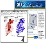
GIS Snapshots
 Maps from many participants have been published as GIS Snapshots in CDC’s Preventing Chronic Disease Journal. Several one page fact sheets were also disseminated.
Publications and Presentations
 Follow the links on this page to see recent GIS-related accomplishments of our program alumni, such as Map Books, scientific posters, conference presentations, and more.
- Page last reviewed: August 18, 2015
- Page last updated: August 18, 2015
- Content source:


 ShareCompartir
