

Map Details - Stroke Death Rates by County and Year, New York State
 ShareCompartir
Impact Statement
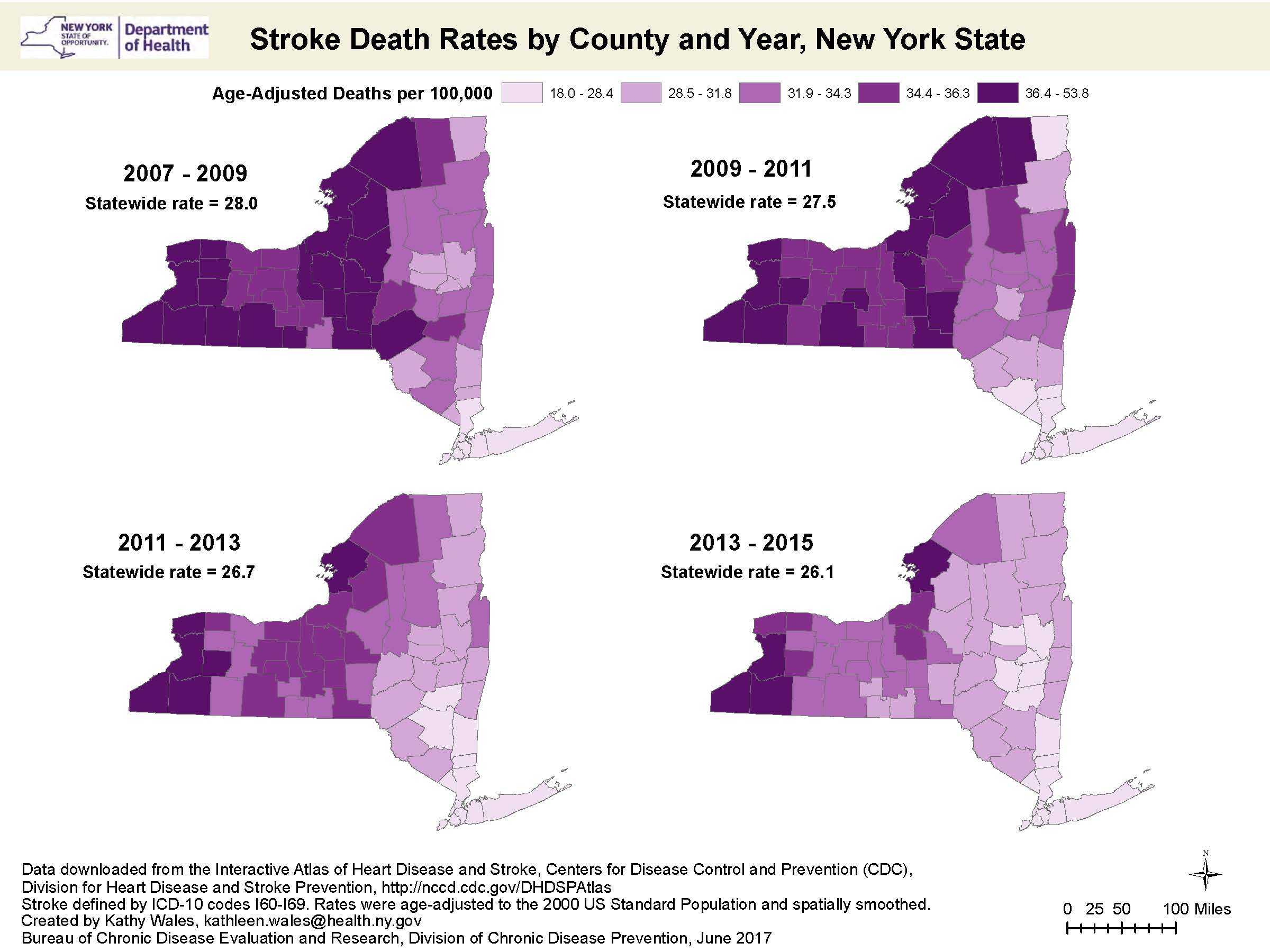
The maps can be used to monitor progress of stroke mortality over time among counties in New York state.
Findings
The progression of maps display the age-adjusted stroke death rates by county per 100,000 residents in New York State (NYS) and are presented by 3 year combined increments. The maps show the concentrations of counties with the highest stroke death rates are located primarily in the northern, central, and western counties of the state, while the lowest concentration of stroke deaths are predominantly in the counties closer to New York City and the eastern half of the state. The statewide stroke death rate decreased from 28.0 in 2007-2009 to 26.1 in 2013-1015. In 2014, stroke was the 4th leading cause of death in NYS. Comparatively, the stroke death rate in 2014 was 36.5 and the 5th leading cause of death in the United States.
Software Used
ArcGIS 10.1
Data Used
Deaths National Vital Statistics System, Bridged-Race Post-censal Population Estimates from National Center for Health Statistics 2007- 2015; Downloaded from the Interactive Atlas of Heart Disease and Stroke, Centers for Disease Control and Prevention , Division for Heart Disease and Stroke Prevention.
Methods Used
Stroke death rates were calculated based on all stroke ICD-10 codes I60-I69, and are presented by quintile of counties. The rates are age-standardized to the 2000 US standard population, allowing for comparison of rates between counties with different age distributions. Rates were spatially smoothed to enhance the stability of rates in counties with small populations by using a spatial moving average.
Contact the Submitter of this Map
Kathy Wales, Program Research Specialist, New York State Department of Health
518-473-0673
kathleen.wales@health.ny.gov
How to Cite this Map
Wales, K., “Stroke Death Rates by County and Year, New York State” [map]. August, 2017. New York Department of Health. Accessed from the Centers for Disease Control and Prevention’s Chronic Disease GIS Exchange https://www.cdc.gov/dhdsp/maps/gisx/mapgallery/ny-stroke-deaths.html
- Page last reviewed: August 31, 2017
- Page last updated: August 31, 2017
- Content source: