

Map Details - Michigan Deaths for Cardiovascular Disease by County
 ShareCompartir
Impact Statement
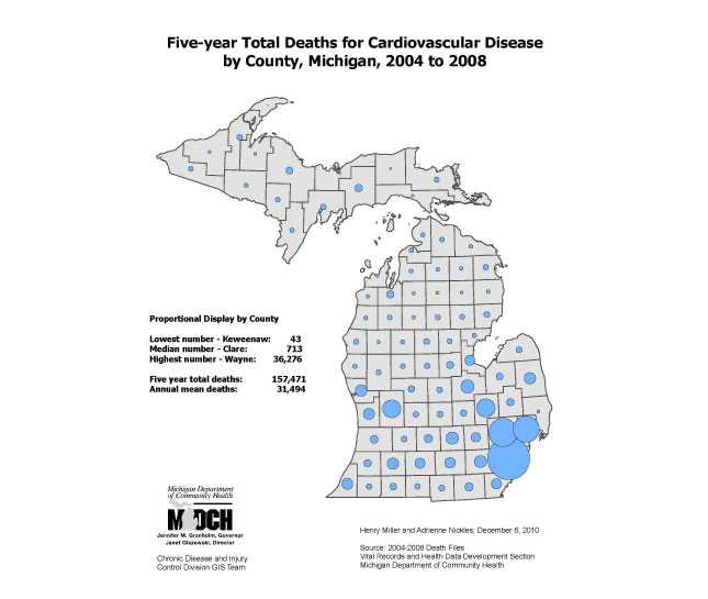
This map of Michigan, by county, displays the total number of cardiovascular disease deaths, over a five-year period, by county.
Purpose
The purpose is to display data a different way. Rate maps do not identify where the most cases are, just where the higher rates are. Thus, number maps can be added to rate maps to give a more balanced view of the disease burden. The purpose is also to document the disease burden by total numbers, thus suggesting where more people can be reached in potential public health interventions.
Software Used
ArcGIS 9.3 and SAS 9.1
Data Used
2004 to 2008 Death Files, Vital Records and Health Data Section, MDCH.
Methods Used
SAS used to develop county level table with death numbers. ArcGIS used to create proportional disc symbols to overlay map with Michigan counties.
Contact the Submitter of this Map
Henry L Miller, Departmental Specialist, Michigan Department of Community Health
(517) 335-8779
millerhenry@michigan.gov
How to Cite this Map
Five-year Total Deaths for Cardiovascular Disease by County, Michigan, 2004 to 2008 Miller, Henry; Nickles, Adrienne; Michigan Department of Community Health, [TODAY’S DATE].
- Page last reviewed: July 7, 2017
- Page last updated: July 7, 2017
- Content source: