

Map Details - PCI Capability in Idaho
 ShareCompartir
Impact Statement
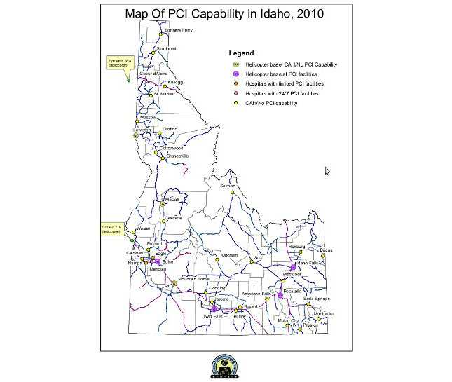
This map depicts the availability of percutaneous coronary intervention (PCI) capability at Idaho hospitals (as of September 2010). The map also depicts transportation elements such as highways and hospitals with helicopter bases.
Purpose
This map has been used by EMS providers to know the end goal for transportation of ST-Segment Elevation Myocardial Infarction (STEMI) patients. Also, EMS directors will use the map in the development of their local STEMI plans.
Software Used
Arc GIS 9.3
Data Used
Data on cities with hospitals was gathered from Idaho Hospital Association, data on availability of PCI services and helicopter facilities was collected by HDSP and the Cardiac EMS subcommittee.
Methods Used
This is the 5th iteration of this map. Changes have been made due to new information on PCI capability as well as input from the Cardiac EMS subcommittee. Based on their recommendations, the map has evolved into an outline of the state and counties (with no color fill) and a minimal legend.
Contact the Submitter of this Map
Robert Graff, chronic disease epidemiologist, Idaho Dept. of Health and Welfare
(208) 334-6521
graffr@dhw.idaho.gov
How to Cite this Map
Map of PCI Capability in Idaho, 2010 Robert Graff, Idaho Dept. of Health and Welfare; members of the Cardiac EMS subcommittee (of the Idaho Heart Disease and Stroke Prevention Advisory Committee), [TODAY’S DATE].
- Page last reviewed: July 13, 2017
- Page last updated: December 19, 2014
- Content source: