

Map Details - Where are the 2016 Food Deserts in Lawrence, KS?
 ShareCompartir
Impact Statement
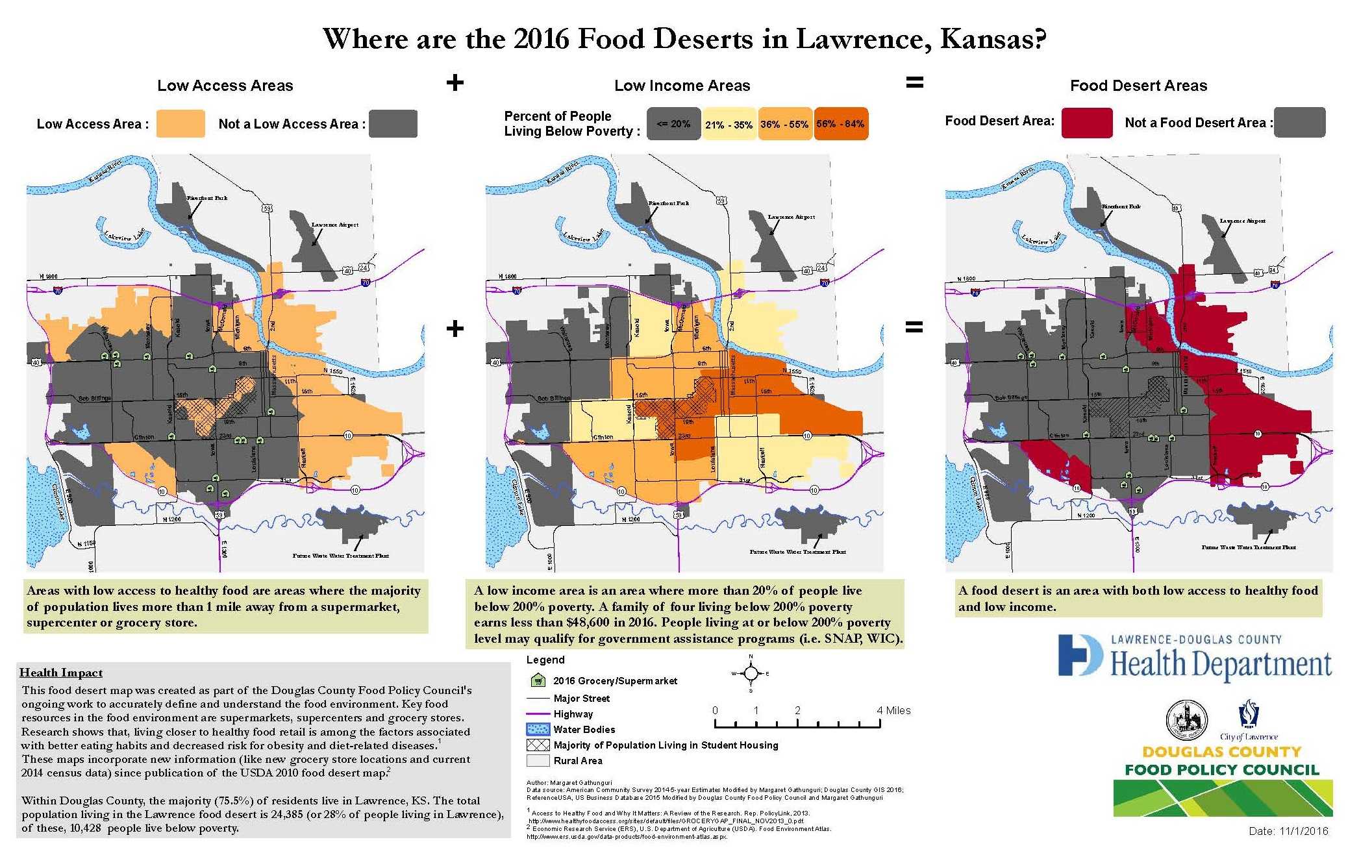
The map series shows the factors that contribute to a food desert: low access to healthy foods and low income.
Findings
Using 2014 Census data, 28% of people living in Lawrence, KS live within a food desert. Many in Lawrence who experience low income and/or low access are concentrated in East Lawrence, although southwest Lawrence also qualifies as a food desert.
Software Used
ArcGIS10.3 RESRI, SAS
Data Used
American Community Survey 2014 5-year Census Tract Weighted population estimate centroid, American Community Survey 2014 5-year Census Tract Population Living Below Poverty, RefrenceUSA, US Business Database 2015.
Methods Used
The areas with low access are tracts where the weighted population centroid of the tract is located more than 1 mile from a grocery store. The one-mile distance is calculated by the drive distance from the store. Low-access areas are masked using the incorporated city limits to visualize where the majority of people live. The low-income areas are any tracts that are higher than 20% poverty. Low-income areas are also masked to show only incorporated limit. Low-access and low-income areas in the incorporated city limits were overlaid to see which areas had both. The areas that had both low access and low income are classified as food deserts.
Contact the Submitter of this Map
Margaret Gathunguri, GIS Analyst/Environmental Health, Lawrence-Douglas County Health Department
785-766-2093
margaret@mgshiftdesign.com
How to Cite this Map
Gathunguri, M., Schones, H., Bryan, C., Romero, V., Vernberg, D. “ Where are the 2016 Food Deserts in Lawrence, KS?” [map]. November 2016. Lawrence-Douglas County Health Department.
Accessed from the Centers for Disease Control and Prevention’s Chronic Disease GIS Exchange http://www.cdc.gov/dhdsp/maps/gisx/mapgallery/KS_FoodDesert.html
- Page last reviewed: July 7, 2017
- Page last updated: July 7, 2017
- Content source: