

Map Details - Arkansas EMS Agency Personnel Types
 ShareCompartir
Impact Statement
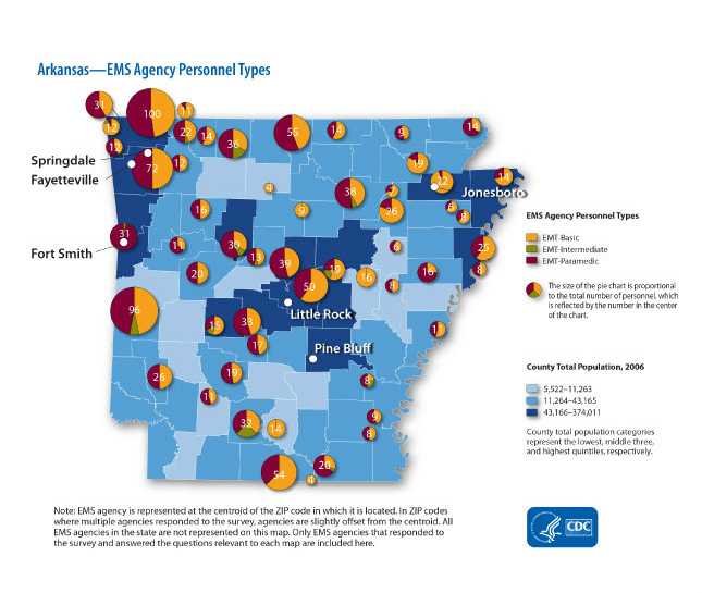
The map uses pie charts to represent EMT personnel by type and placed at centroid of ZIP code. They were overlayed on choropleth map of county-level population size. In general, the spatial distribution of the agencies shows a random pattern, but the total number of personnel by agency appears to vary slightly by location and county population size.
Purpose
The purpose of this map was to display approximate locations of Emergency Medical Services (EMS) agencies and total number of personnel employed at each agency in order to show EMS capacity by location. This map was provided to state EMS directors and other EMS partners to help inform them on EMS capacity to respond to acute cardiovascular events.
Software Used
ArcGIS 9.2
Data Used
Data are from EMS Survey conducted in 2008.
Methods Used
Choropleth map with pie charts placed at zip code centroid.
Contact the Submitter of this Map
Sophia Greer, Epidemiologist, CDC
(770) 488-5467
fgz3@cdc.gov
How to Cite this Map
Arkansas EMS Agency Personnel Types Sophia Greer CDC, Ishmael Williams CDC, [TODAY’S DATE].
- Page last reviewed: July 10, 2017
- Page last updated: July 10, 2017
- Content source: