رومانیہ کی کاؤنٹیاں
رومانیہ کی 41 کاؤنٹیاں (رومانیانی: județe) اور ایک بلدیہ بخارسٹ ہے۔
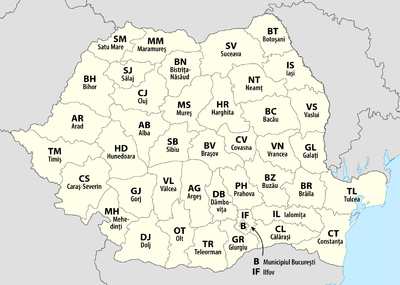
رومانیہ کی 41 کاؤنٹیاں اور بلدیہ بخارسٹ (تصویر نقشہ)
موجودہ فہرست
| کاؤنٹی |
کاؤنٹی نشست |
وجہ تسمیہ [note 1][1] |
ترقیاتی علاقہ |
آیزو رمز [note 2] |
ڈاک رمز [note 3][2] |
علاقہ رمز [note 4][3] |
این یو ٹی ایس رمز [note 5][4] |
آبادی (2011)[5] |
رقبہ [6] |
نقشہ |
|---|---|---|---|---|---|---|---|---|---|---|
| البا |
البا یولیا |
دریائے البا | وسطی | AB | 51 | 58 | RO121 | 342,376 | 6,242 کلومیٹر2 (6.719×10¹⁰ فٹ مربع) |  |
| آراد |
آراد |
کاؤنٹی سیٹ | مغربی | AR | 31 | 57 | RO421 | 430,629 | 7,754 کلومیٹر2 (8.346×10¹⁰ فٹ مربع) |  |
| آرجش |
پیتیشتی |
دریائے آرجش | جنوبی | AG | 11 | 48 | RO311 | 612,431 | 6,862 کلومیٹر2 (7.386×10¹⁰ فٹ مربع) |  |
| باکئو |
باکئو |
کاؤنٹی سیٹ | شمالی-مشرقی | BC | 60 | 34 | RO211 | 616,168 | 6,621 کلومیٹر2 (7.127×10¹⁰ فٹ مربع) | 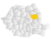 |
| بیہور |
اورادیا |
بیہاریا کمیون | شمالی-مغربی | BH | 41 | 59 | RO111 | 575,398 | 7,544 کلومیٹر2 (8.120×10¹⁰ فٹ مربع) | 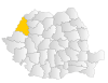 |
| بیستریتسا-ناسائود |
بیستریتسا |
دریائے بیستریتسا اور ناسائود شہر | شمالی-مغربی | BN | 42 | 63 | RO112 | 286,225 | 5,355 کلومیٹر2 (5.764×10¹⁰ فٹ مربع) | 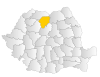 |
| بوتوشانی |
بوتوشانی |
کاؤنٹی سیٹ | شمالی-مشرقی | BT | 71 | 31 | RO212 | 412,626 | 4,986 کلومیٹر2 (5.367×10¹⁰ فٹ مربع) | 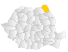 |
| براشوو |
براشوو |
کاؤنٹی سیٹ | وسطی | BV | 50 | 68 | RO122 | 549,217 | 5,363 کلومیٹر2 (5.773×10¹⁰ فٹ مربع) | 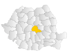 |
| برئیلا |
برئیلا |
کاؤنٹی سیٹ | جنوبی-مشرقی | BR | 81 | 39 | RO221 | 321,212 | 4,766 کلومیٹر2 (5.130×10¹⁰ فٹ مربع) | 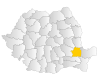 |
| بخارسٹ |
(بلدیہ بخارسٹ) [note 6] |
گزشتی نام بوجار[7] | بخارسٹ-الیفوف | B | 01–06 [note 7] |
1x [note 8] |
RO321 | 1,883,425 | 228 کلومیٹر2 (2.45×10⁹ فٹ مربع) | 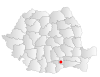 |
| بوزاو |
بوزاو |
دریائے بوزاو | جنوبی-مشرقی | BZ | 12 | 38 | RO222 | 451,069 | 6,103 کلومیٹر2 (6.569×10¹⁰ فٹ مربع) | 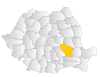 |
| کاراش-سیویرین |
ریشیتسا |
کالعدم کاراش اور سیویرین کاؤنٹیاں | مغربی | CS | 32 | 55 | RO422 | 295,579 | 8,514 کلومیٹر2 (9.164×10¹⁰ فٹ مربع) | 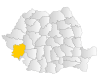 |
| کالاراشی |
کالاراشی |
کاؤنٹی سیٹ | جنوبی | CL | 91 | 42 | RO312 | 306,691 | 5,088 کلومیٹر2 (5.477×10¹⁰ فٹ مربع) | 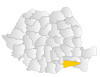 |
| کلوژ |
کلوژ-ناپوکا |
کاؤنٹی سیٹ | شمالی-مغربی | CJ | 40 | 64 | RO113 | 691,106 | 6,674 کلومیٹر2 (7.184×10¹⁰ فٹ مربع) | 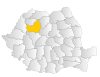 |
| کونستانتسا |
کونستانتسا |
کاؤنٹی سیٹ | جنوبی-مشرقی | CT | 90 | 41 | RO223 | 684,082 | 7,071 کلومیٹر2 (7.611×10¹⁰ فٹ مربع) | 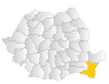 |
| کوواسنا |
سفینتو گیورگے |
دریائے کوواسنا | وسطی | CV | 52 | 67 | RO123 | 210,177 | 3,710 کلومیٹر2 (3.99×10¹⁰ فٹ مربع) | 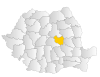 |
| دیمبوویتسا |
تیرگوویشتے |
دریائے دیمبوویتسا | جنوبی | DB | 13 | 45 | RO313 | 518,745 | 4,054 کلومیٹر2 (4.364×10¹⁰ فٹ مربع) | 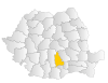 |
| دولژ |
کرایووا |
دریائے ژیو[note 9] | جنوبی-مغربی ترقیاتی علاقہ | DJ | 20 | 51 | RO411 | 660,544 | 7,414 کلومیٹر2 (7.980×10¹⁰ فٹ مربع) | 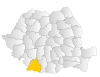 |
| گالاتسی |
گالاتسی |
کاؤنٹی سیٹ | جنوبی-مشرقی | GL | 80 | 36 | RO224 | 536,167 | 4,466 کلومیٹر2 (4.807×10¹⁰ فٹ مربع) | 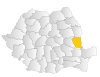 |
| جیورجو |
جیورجو |
کاؤنٹی سیٹ | جنوبی | GR | 08 | 46 | RO314 | 281,422 | 3,526 کلومیٹر2 (3.795×10¹⁰ فٹ مربع) |  |
| گورژ |
تیرگو ژیو |
دریائے ژیو[note 10] | جنوبی-مغربی ترقیاتی علاقہ | GJ | 21 | 53 | RO412 | 341,594 | 5,602 کلومیٹر2 (6.030×10¹⁰ فٹ مربع) |  |
| ہارگیتا |
میرکوریا چوک |
سلسلہ کوہ ہارگیتا | وسطی | HR | 53 | 66 | RO124 | 310,867 | 6,639 کلومیٹر2 (7.146×10¹⁰ فٹ مربع) |  |
| ہونےدوارا |
دیوا |
ہونےدوارا شہر | مغربی | HD | 33 | 54 | RO423 | 418,565 | 7,063 کلومیٹر2 (7.603×10¹⁰ فٹ مربع) |  |
| یالومیتسا |
سلوبوزیا |
دریائے یالومیتسا | جنوبی | IL | 92 | 43 | RO315 | 274,148 | 4,453 کلومیٹر2 (4.793×10¹⁰ فٹ مربع) |  |
| یاشی |
یاشی |
کاؤنٹی سیٹ | شمالی-مشرقی | IS | 70 | 32 | RO213 | 772,348 | 5,476 کلومیٹر2 (5.894×10¹⁰ فٹ مربع) |  |
| الیفوف |
بوفتیا |
دریائے الیفوف | بخارسٹ-الیفوف | IF | 07 | 1x [note 8] |
RO322 | 388,738 | 1,583 کلومیٹر2 (1.704×10¹⁰ فٹ مربع) |  |
| ماراموریش |
بایا مارے |
ماراموریش تاریخی علاقہ | شمالی-مغربی | MM | 43 | 62 | RO114 | 478,659 | 6,304 کلومیٹر2 (6.786×10¹⁰ فٹ مربع) |  |
| میہیدینتسی |
دروبیتا-تورنو سیویرین |
میہیدیا کمیون | جنوبی-مغربی ترقیاتی علاقہ | MH | 22 | 52 | RO413 | 265,390 | 4,933 کلومیٹر2 (5.310×10¹⁰ فٹ مربع) |  |
| موریش |
تیرگو موریش |
دریائے موریش | وسطی | MS | 54 | 65 | RO125 | 550,846 | 6,714 کلومیٹر2 (7.227×10¹⁰ فٹ مربع) |  |
| نامتس |
پیاترا نامتس |
دریائے نامتس | شمالی-مشرقی | NT | 61 | 33 | RO214 | 470,766 | 5,896 کلومیٹر2 (6.346×10¹⁰ فٹ مربع) |  |
| اولت |
سلاتینا |
دریائے اولت | جنوبی-مغربی ترقیاتی علاقہ | OT | 23 | 49 | RO414 | 436,400 | 5,498 کلومیٹر2 (5.918×10¹⁰ فٹ مربع) |  |
| پراہوا |
پلویشتی |
دریائے پراہوا | جنوبی | PH | 10 | 44 | RO316 | 762,886 | 4,716 کلومیٹر2 (5.076×10¹⁰ فٹ مربع) |  |
| ساتو مارے |
ساتو مارے |
کاؤنٹی سیٹ | شمالی-مغربی | SM | 44 | 61 | RO115 | 344,360 | 4,418 کلومیٹر2 (4.755×10¹⁰ فٹ مربع) | 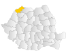 |
| سالاژ |
زالیو |
دریائے سالاژ | شمالی-مغربی | SJ | 45 | 60 | RO116 | 224,384 | 3,864 کلومیٹر2 (4.159×10¹⁰ فٹ مربع) | 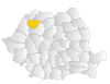 |
| سیبیو |
سیبیو |
کاؤنٹی سیٹ | وسطی | SB | 55 | 69 | RO126 | 397,322 | 5,432 کلومیٹر2 (5.847×10¹⁰ فٹ مربع) | 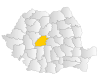 |
| سوچاوا |
سوچاوا |
دریائے سوچاوا | شمالی-مشرقی | SV | 72 | 30 | RO215 | 634,810 | 8,553 کلومیٹر2 (9.206×10¹⁰ فٹ مربع) | 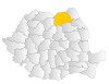 |
| تیلیاورمان |
الیکساندریا |
دریائے تیلیاورمان | جنوبی | TR | 14 | 47 | RO317 | 380,123 | 5,790 کلومیٹر2 (6.23×10¹⁰ فٹ مربع) |  |
| تیمیش |
تیمیشاوارا |
دریائے تیمیش | مغربی | TM | 30 | 56 | RO424 | 683,540 | 8,697 کلومیٹر2 (9.361×10¹⁰ فٹ مربع) |  |
| تولچا |
تولچا |
کاؤنٹی سیٹ | جنوبی-مشرقی | TL | 82 | 40 | RO225 | 213,083 | 8,499 کلومیٹر2 (9.148×10¹⁰ فٹ مربع) |  |
| واسلوی |
واسلوی |
دریائے واسلوی | شمالی-مشرقی | VS | 73 | 35 | RO216 | 395,499 | 5,318 کلومیٹر2 (5.724×10¹⁰ فٹ مربع) |  |
| ویلچا |
ریمنیکو ویلچا |
قرون وسطی کاؤنٹی ویلچا[8][note 11] | جنوبی-مغربی ترقیاتی علاقہ | VL | 24 | 50 | RO415 | 371,714 | 5,765 کلومیٹر2 (6.205×10¹⁰ فٹ مربع) |  |
| ورانچا |
فوکشانی |
قرون وسطی کاؤنٹی ورانچا[9][note 12] | جنوبی-مشرقی | VN | 62 | 37 | RO226 | 340,310 | 4,857 کلومیٹر2 (5.228×10¹⁰ فٹ مربع) | 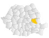 |
حوالہ جات
- "Istoria numelor județelor din România. De unde provine denumirea regiunii în care locuiți" (Romanian زبان میں)۔ مورخہ 25 دسمبر 2018 کو اصل سے آرکائیو شدہ۔ اخذ شدہ بتاریخ 2013-01-30۔
- "Postal code search" (Romanian زبان میں)۔ Compania Nationala Posta Romania SA۔ مورخہ 25 دسمبر 2018 کو اصل سے آرکائیو شدہ۔ اخذ شدہ بتاریخ 2010-08-22۔
- "List of the county prefixes in Romania" (Romanian زبان میں)۔ National Regulatory Authority for Communications and Information Technology (Romania)۔ 2005-04-26۔ مورخہ 25 دسمبر 2018 کو اصل سے آرکائیو شدہ۔ اخذ شدہ بتاریخ 2010-08-22۔
- "Publications Office, European Union, EU"۔ Simap – Information about European public procurement۔ مورخہ 25 دسمبر 2018 کو اصل سے آرکائیو شدہ۔ اخذ شدہ بتاریخ 2010-08-29۔
-
(Romanian میں) (XLS) Population at the Censuses of 1948, 1956, 1966, 1977, 1992, 2002 and 2011 – By Localities and Counties. National Institute of Statistics (Romania). 2013-07-04. pp. 1–2. http://www.recensamantromania.ro/wp-content/uploads/2013/07/sR_TAB_1.xls۔ اخذ کردہ بتاریخ 2013-07-06. - (Romanian میں) (PDF) Romanian Statistical Yearbook 2008 – Geography, Meteorology, and Environment. National Institute of Statistics (Romania). 2007-07-01. p. 18. http://www.insse.ro/cms/files/pdf/ro/cap1.pdf۔ اخذ کردہ بتاریخ 2010-08-29.
- "DEX online – Search: "bucura""۔ Romanian Etymological Dictionary 1958–1966 (Romanian زبان میں)۔ Dexonline.ro۔ مورخہ 25 دسمبر 2018 کو اصل سے آرکائیو شدہ۔ اخذ شدہ بتاریخ 2010-08-23۔
- "Județul Vrancea (Vrancea County)" (Romanian زبان میں)۔ National Institute of Statistics (Romania)۔ مورخہ 25 دسمبر 2018 کو اصل سے آرکائیو شدہ۔ اخذ شدہ بتاریخ 2010-08-23۔
ملاحظات
- Most of the names of the present counties originate from one of the larger rivers that flow through the county. In a number of cases, the name of the county seat or another large city in the county is the same as that river.
- These are the آیزو 3166-2:RO codes which coincide with the license plate ones; they are also used as usual abbreviations, such as in mailing addresses.
- The postal code format is of the type xxyzw, with xx being the numbers associated with the county; the digits y, z, and w indicate the city, the street, part of the street, or even the building of the address.
- Landline phone numbers are of the type +40-abb-xxx-xxx, where 40 is the country code, bb is the area code, and a is a digit indicating the operator: 2 for the former national operator, Romtelecom, and 3 for the other ground telephone networks. Mobile phone numbers, however, only start with the digit 7 (for a) and do not follow county borders.
- The development region code follows the format ROxyz, where x is the macroregion number, y represents the development region and is either 1 or 2, and z is the county number within the region.
- Bucharest is not a county, but a municipality that has an identical administrative status to all the other 41 counties.
- Due to Bucharest's significantly larger population, it has a different postal code for each of its six sectors.
- Bucharest and Ilfov county have the same code. Due to their large population, phone numbers have only the suffix "1" (unlike two-digit suffixes for counties) followed by seven digits (only six digits for anywhere else).
- Dolj is a shortened form of Dolu (Slavic for "valley") Jiu, in reference to the county's location in the lower part of Jiu river.
- Gorj is a shortened form of Gora (Slavic for "mountain") Jiu, in reference to the county's location in the upper part of Jiu river.
- Vâlcea is the Romanian word for a narrow valley.
- Vran is a Dacian word believed to mean "forest" or "mountain".
This article is issued from
Wikipedia.
The text is licensed under Creative
Commons - Attribution - Sharealike.
Additional terms may apply for the media files.