

Atlas of United States Mortality
 ShareCompartir
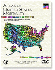 Released to the public on April 14, 1997, this atlas is the first to show all leading causes of death by race and sex for small U.S. geographic areas referred to as Health Service Areas (HSA's). The 18 causes of death included in this atlas account for 83 percent of all deaths in the United States during 1988-92. In addition to maps with age-adjusted death rates for each HSA, the atlas includes maps that compare each HSA rate to the national rate, smoothed maps for each cause that show the broad geographic patterns at selected ages, and a chart with regional rates for each cause of death.
Copies of this printed publication and a CD-ROM containing atlas text, maps, additional tables, and the mortality data used to create the maps are available from the National Technical Information Service (NTIS) and Government Printing Office (GPO). Check NTIS or GPO for stock numbers and price.
Atlas of United States Mortality selected causes of death
- Heart disease (white male)
- Lung cancer (white female)
- Lung cancer (white male)
- Stroke (black female)
- Motor vehicle deaths (black male)
- All cancer
- Colorectal cancer
- Prostate cancer
- Breast cancer
- Unintentional injuries
- Chronic obstructive pulmonary diseases
- Pneumonia & influenza
- Diabetes
- Suicide
- Firearm suicide
- Liver disease
- Immunodeficiency virus infection
- Homicide
- Firearm homicide
- All causes
Atlas of United States Mortality
 209 pp. (PHS) 97-1015
- Cover, Title page, Acknowledgments, Contents, List of tables, List of figures, Introduction, and Methods (cover to page 11) [PDF - 907 KB]
- Results (pages 13-27) [PDF - 6.6 MB]
- Maps for Heart Disease (pages 32-39)[PDF - 3.1 MB]
- Maps for All Cancer (pages 40-47) [PDF - 1.7 MB]
- Maps for Lung Cancer (pages 48-55) [PDF - 3.3 MB]
- Maps for Colorectal Cancer (pages 56-63) [PDF - 1.8 MB]
- Maps for Prostate Cancer (pages 64-67) [PDF - 1.6 MB]
- Maps for Breast Cancer (pages 68-71) [PDF - 985,279 KB]
- Maps for Stroke (pages 72-79) [PDF - 3.2MB]
- Maps for Unintentional Injuries (pages 80-87) [PDF - 3.5 MB]
- Maps for Motor Vehicle Injuries (pages 88-95) [PDF - 3.7 MB]
- Maps for COPD (pages 96-103) [PDF - 1.7 MB]
- Maps for Pneumonia & Influenza (pages 104-111)[PDF - 3.6 MB]
- Maps for Diabetes (pages 112-119) [PDF - 3.5 MB]
- Maps for Suicide (pages 120-127) [PDF - 3.8 MB]
- Maps for Firearm Suicide (pages 128-135) [PDF - 3.9 MB]
- Maps for Liver Disease (pages 136-143) [PDF - 3.8 MB]
- Maps for HIV (pages 144-151) [PDF - 4.0 MB]
- Maps for Homicide (pages 152-159) [PDF - 4.0 MB]
- Maps for Firearm Homicide (pages 160-167) [PDF - 4.1 MB]
- Maps for All Causes (pages 168-175) [PDF - 1.6 MB]
- References, Appendix I, HSA Boundary Map, and Appendix II (pages 179-201) [PDF - 140 KB]
- Appendix III (pages 203-209) [PDF - 5.7 MB]
- Page last reviewed: November 6, 2015
- Page last updated: June 10, 2010
- Content source: