

Geographic distribution of ticks that bite humans
 ShareCompartir
Of the many different tick species found throughout the world, only a select few bite and transmit disease to humans. These maps provide general insight into the expected distribution these human-biting ticks in the contiguous United States. Populations of ticks may be found outside noted areas. Naturally occurring populations of the ticks described below do not occur in Alaska; however, the brown dog tick is endemic in Hawaii.
Note that adult ticks are the easiest to identify and male and female ticks of the same species may look different. Nymphal and larval ticks are very small and may be difficult to identify.
American dog tick (Dermacentor variabilis)
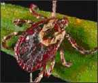
Where found: Widely distributed east of the Rocky Mountains. Also occurs in limited areas on the Pacific Coast.
Transmits: Tularemia and Rocky Mountain spotted fever.
Comments: The highest risk of being bitten occurs during spring and summer. Dog ticks are sometimes called wood ticks. Adult females are most likely to bite humans.
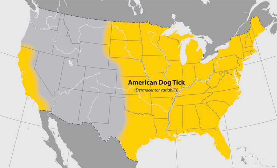
About This Map
This map is not meant to represent risks for a specific tick-borne disease, because disease transmission is influenced by multiple factors beyond mere tick presence. This map has been designed to answer the question “What ticks should I be concerned about at a regional scale?” Please consult a local public health authority or USDA Agricultural Extension Office to determine more specific information at the state, county, or municipal level. Background data for this map is from the US National Atlas.
Blacklegged tick (Ixodes scapularis)
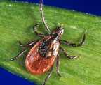
Where found: Widely distributed in the northeastern and upper midwestern United States.
Transmits: Lyme disease, anaplasmosis, ehrlichiosis (Ehrlichia muris eauclairensis), babesiosis, Borrelia miyamotoi, and Powassan disease.
Comments: The greatest risk of being bitten exists in the spring, summer, and fall. However, adults may be out searching for a host any time winter temperatures are above freezing. Stages most likely to bite humans are nymphs and adult females.
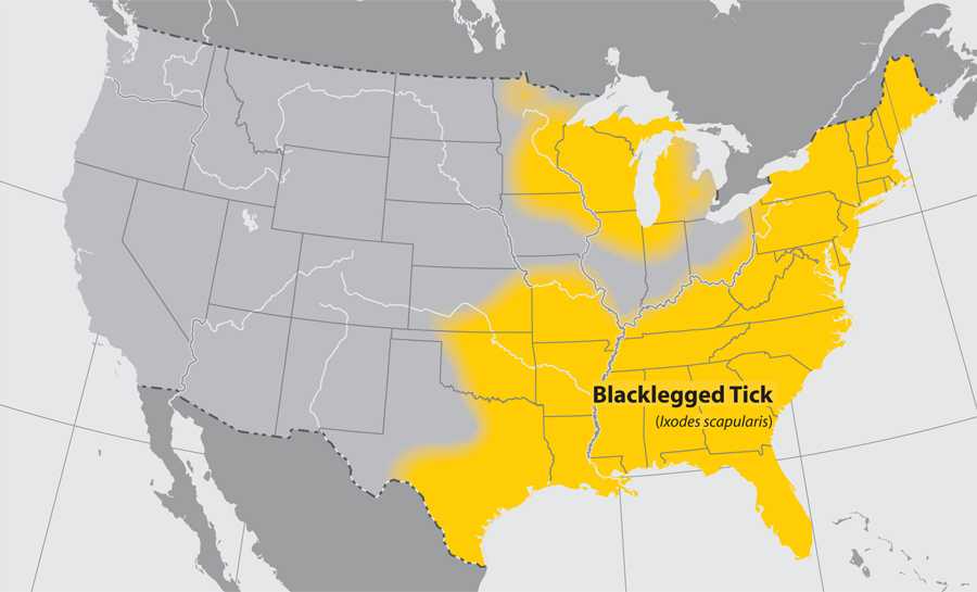
About This Map
This map is not meant to represent risks for a specific tick-borne disease, because disease transmission is influenced by multiple factors beyond mere tick presence. This map has been designed to answer the question “What ticks should I be concerned about at a regional scale?” Please consult a local public health authority or USDA Agricultural Extension Office to determine more specific information at the state, county, or municipal level. Background data for this map is from the US National Atlas.
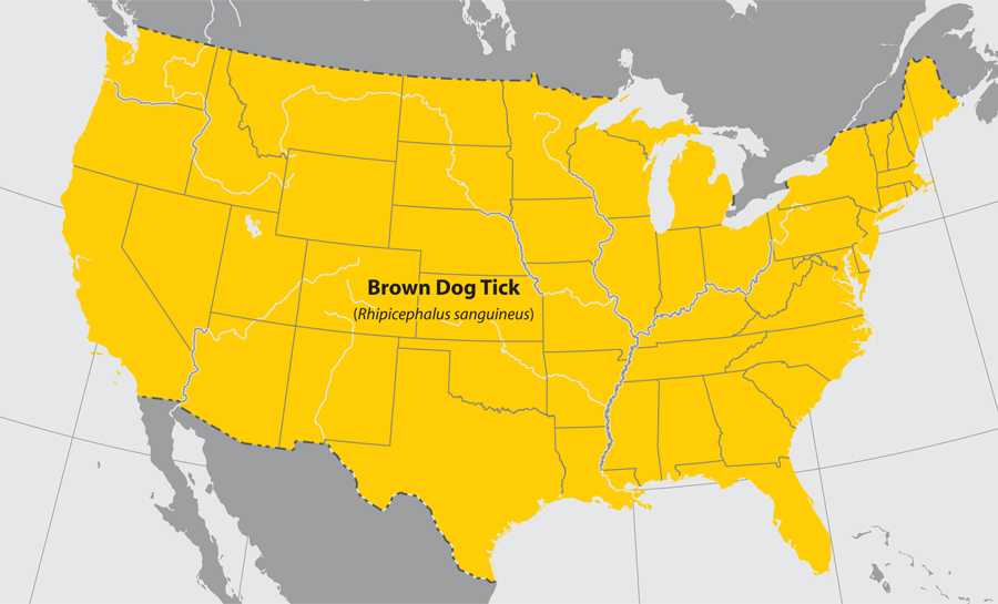
Brown dog tick (Rhipicephalus sanguineus)
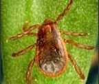 Where found: Worldwide.
Transmits: Rocky Mountain spotted fever (in the southwestern U.S. and along the U.S.-Mexico border).
Comments: Dogs are the primary host for the brown dog tick in each of its life stages, but the tick may also bite humans or other mammals.
About This Map
This map is not meant to represent risks for a specific tick-borne disease, because disease transmission is influenced by multiple factors beyond mere tick presence. This map has been designed to answer the question "What ticks should I be concerned about at a regional scale?" Please consult a local public health authority or USDA Agricultural Extension Office to determine more specific information at the state, county, or municipal level. Background data for this map is from the US National Atlas.
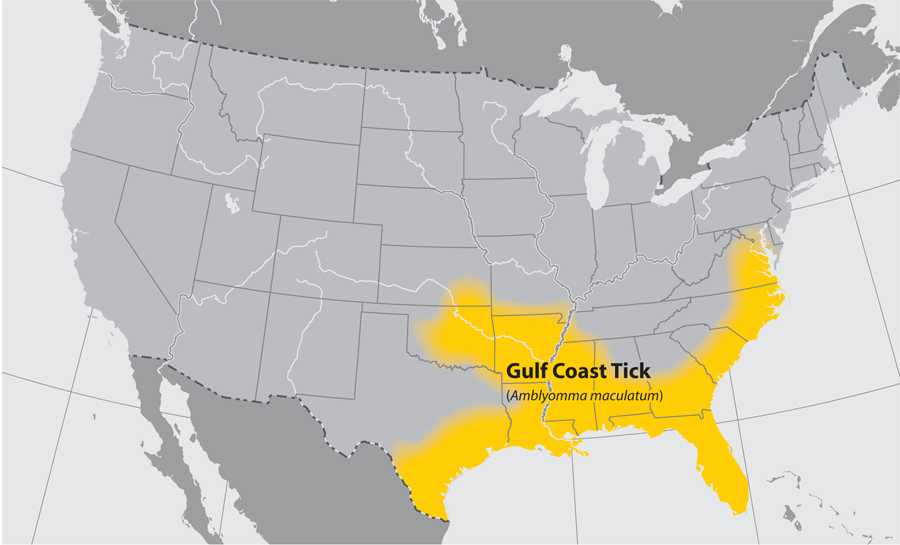
Gulf Coast tick (Amblyomma maculatum)
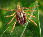
Where found: Coastal areas of the U.S. along the Atlantic coast and the Gulf of Mexico.
Transmits: Rickettsia parkeri rickettsiosis, a form of spotted fever.
Comments: Larvae and nymphs feed on birds and small rodents, while adult ticks feed on deer and other wildlife. Adult ticks have been associated with transmission of R. parkeri to humans.
About This Map
This map is not meant to represent risks for a specific tick-borne disease, because disease transmission is influenced by multiple factors beyond mere tick presence. This map has been designed to answer the question “What ticks should I be concerned about at a regional scale?” Please consult a local public health authority or USDA Agricultural Extension Office to determine more specific information at the state, county, or municipal level. Background data for this map is from the US National Atlas.
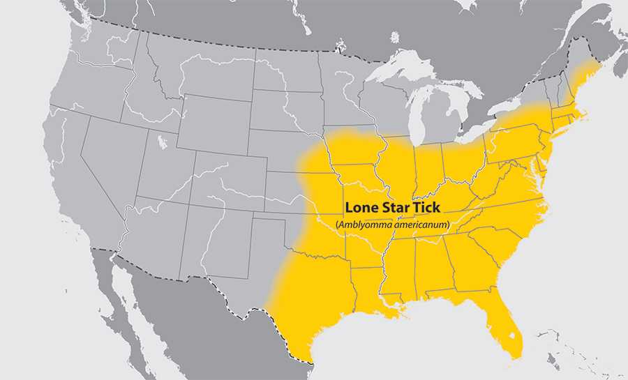
Lone star tick (Amblyomma americanum)
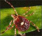
Where found: Widely distributed in the southeastern and eastern United States.
Transmits: Ehrlichia chaffeensis and Ehrlichia ewingii (which cause human ehrlichiosis), Heartland virus, tularemia, and STARI.
Comments: A very aggressive tick that bites humans. The adult female is distinguished by a white dot or “lone star” on her back. Lone star tick saliva can be irritating; redness and discomfort at a bite site does not necessarily indicate an infection. The nymph and adult females most frequently bite humans and transmit disease.
About This Map
This map is not meant to represent risks for a specific tick-borne disease, because disease transmission is influenced by multiple factors beyond mere tick presence. This map has been designed to answer the question “What ticks should I be concerned about at a regional scale?” Please consult a local public health authority or USDA Agricultural Extension Office to determine more specific information at the state, county, or municipal level. Background data for this map is from the US National Atlas.
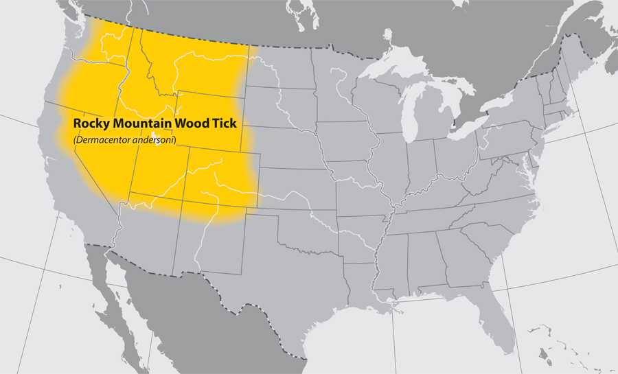
Rocky Mountain wood tick (Dermacentor andersoni)
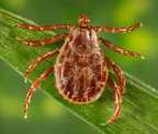 Where found: Rocky Mountain states and southwestern Canada from elevations of 4,000 to 10,500 feet.
Transmits: Rocky Mountain spotted fever, Colorado tick fever, and tularemia.
Comments: Adult ticks feed primarily on large mammals. Larvae and nymphs feed on small rodents. Adult ticks are primarily associated with pathogen transmission to humans.
About This Map
This map is not meant to represent risks for a specific tick-borne disease, because disease transmission is influenced by multiple factors beyond mere tick presence. This map has been designed to answer the question "What ticks should I be concerned about at a regional scale?" Please consult a local public health authority or USDA Agricultural Extension Office to determine more specific information at the state, county, or municipal level. Background data for this map is from the US National Atlas.
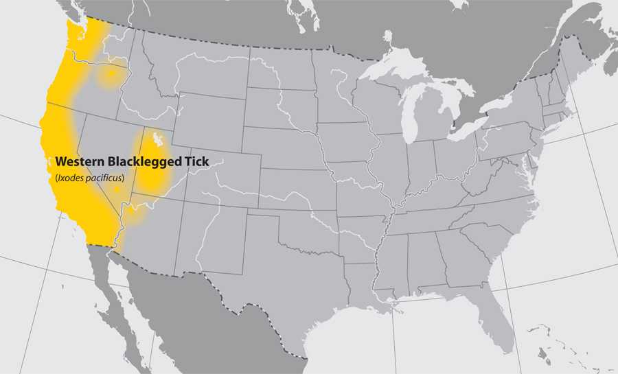
Western blacklegged tick (Ixodes pacificus)
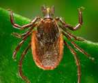 Where found: Along the Pacific coast of the U.S., particularly northern California.
Transmits: Anaplasmosis and Lyme disease.
Comments: Nymphs often feed on lizards, as well as other small animals. As a result, rates of infection are usually low (~1%) in adults. Stages most likely to bite humans are nymphs and adult females.
About This Map
This map is not meant to represent risks for a specific tick-borne disease, because disease transmission is influenced by multiple factors beyond mere tick presence. This map has been designed to answer the question "What ticks should I be concerned about at a regional scale?" Please consult a local public health authority or USDA Agricultural Extension Office to determine more specific information at the state, county, or municipal level. Background data for this map is from the US National Atlas.
- Page last reviewed: June 1, 2015
- Page last updated: August 11, 2017
- Content source: