ಆಕ್ರಾ
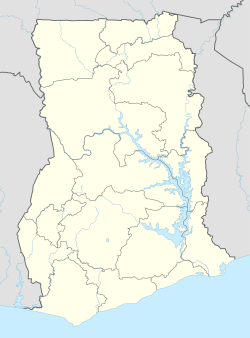
ಆಕ್ರಾ ಆಫ್ರಿಕದ ಪಶ್ಚಿಮ ಭಾಗದಲ್ಲಿ ಕಾಮನ್ವೆಲ್ತ್ ಗಣರಾಜ್ಯವೆನಿಸಿಕೊಂಡಿರುವ ಘಾನದ ರಾಜಧಾನಿ, ರೇವು. ಅತಿ ದೊಡ್ಡ ಪಟ್ಟಣ. ಜನಸಂಖ್ಯೆ ಸು.೨೨.೭ ಲಕ್ಷas of 2012.[6] . ಹಿಂದೆ ಇದು ಬ್ರಿಟಿಷರ ವಸಾಹತಾಗಿದ್ದ ಗೋಲ್ಡ್ ಕೋಸ್ಟ್ಗೆ ಸೇರಿತ್ತು. ಬ್ರಿಟಿಷರ, ಫ್ರೆಂಚರ ಮತ್ತು ಡಚ್ಚರ ಕೋಟೆಗಳು ಇವೆ.
| ಆಕ್ರಾ | ||
|---|---|---|
| ನಗರ | ||
 Counter-clockwise from top: Black Star Square; The Black Star Monument; The Planetarium of Accra; terraced houses of Accra. | ||
| ||
 ಆಕ್ರಾ | ||
| Coordinates: 5°33′N 0°12′W | ||
| Sovereign state | ||
| Country | ||
| Administrative division | ||
| Metropolis | ||
| Settled | 15th century | |
| Incorporated (city) | 1961 | |
| ಸರ್ಕಾರ | ||
| • ಶೈಲಿ | Mayor–council | |
| • Mayor | Alfred Vanderpuije | |
| ವಿಸ್ತೀರ್ಣ[1][2] | ||
| • ನಗರ | ೧೭೩ | |
| • ಮೆಟ್ರೋ | ೮೯೪.೧೮ | |
| ಎತ್ತರ | ೬೧ | |
| ಜನ ಸಂಖ್ಯೆ (2013)[3][4][5] | ||
| • ನಗರ | ೨ | |
| • ಜನಸಾಂದ್ರತೆ | ೯,೫೮೯.೨ | |
| Demonym(s) | Accran | |
| ಸಮಯ ವಲಯ | UTC | |
| ಏರಿಯಾ ಕೋಡ್(sಗಳು) | 030 | |
| ಜಾಲತಾಣ | http://www.ama.gov.gh | |
ಸಾರಿಗೆ
ಇತ್ತೀಚೆಗೆ ರಸ್ತೆ ಮತ್ತು ರೈಲು ಮಾರ್ಗಗಳು ಉತ್ತಮ ಸ್ಥಿತಿಯಲ್ಲಿ ಬೆಳೆದಿರುವುದರಿಂದ ಸಾರಿಗೆ ಅನುಕೂಲತೆ ಈ ಪಟ್ಟಣಕ್ಕೆ ಚೆನ್ನಾಗಿ ದೊರೆತಿದೆ.
ವಾಣಿಜ್ಯ
ಸಾಬೂನು ಮತ್ತು ಕೀಟನಾಶಕ ರಾಸಾಯನಿಕ ವಸ್ತುಗಳ ತಯಾರಿಕೆ ಹೆಚ್ಚಾಗಿ ಬೆಳೆದಿದೆ. ಬಹುವಾಗಿ ಕೊಕೊ ರಫ್ತಾಗುತ್ತದೆ. ಒಂದು ವಿಶ್ವವಿದ್ಯಾನಿಲಯವಿದೆ.
ಉಲ್ಲೇಖಗಳು
- "Physical And Natural Environment Boundary/ Administrative Area". ama.gov.gh.
- "Boundary and Administrative Area". Ghanadistricts.com. Retrieved 2010-07-22.
- "World Gazetteer online". World-gazetteer.com. Retrieved 1 January 2012.
- "Population of Accra, Ghana". GeoNames. Retrieved 22 July 2010.
- "Ghana". Thomas Brinkhoff. Archived from the original on 14 July 2010. Retrieved 22 July 2010. Cite uses deprecated parameter
|deadurl=(help) - "Ghana". The World Factbook. Central Intelligence Agency. Retrieved 2013-11-23.
ಬಾಹ್ಯ ಸಂಪರ್ಕಗಳು

This article is issued from
Wikipedia.
The text is licensed under Creative
Commons - Attribution - Sharealike.
Additional terms may apply for the media files.