Simple methods of preventing soil erosion
Arid Land Information Network
to do some "straightening" out of the line after it is first marked, but this needs careful thought. It
is not good enough to line up bunds "by eye" as this can often lead to worse problems.
Where bunds are constructed independently on small adjoining farms, the bunds on the farm
boundaries need to be turned up so that surplus water does not run down the boundary and cause
erosion.
Marking the contour
A contour is an imaginary line, which joins up places of the same height. There are three simple
ways of accurately marking out a contour line on the ground, which can be done by farmers
themselves after a short training session at little cost.
These are:
1. Using the water level technique with a length of clear plastic tube attached to two poles
2. Using a small line level suspended on a string between two poles
3. Using a simply constructed "a" frame and plumb bob or weight on a string.
For making level contours, the water level technique is probably the easiest and quickest method.
The line level, however, can have many other uses such as laying out a gradient or for measuring
the vertical distance or interval between two points. The ‘A’frame is not so accurate and has more
limited uses.
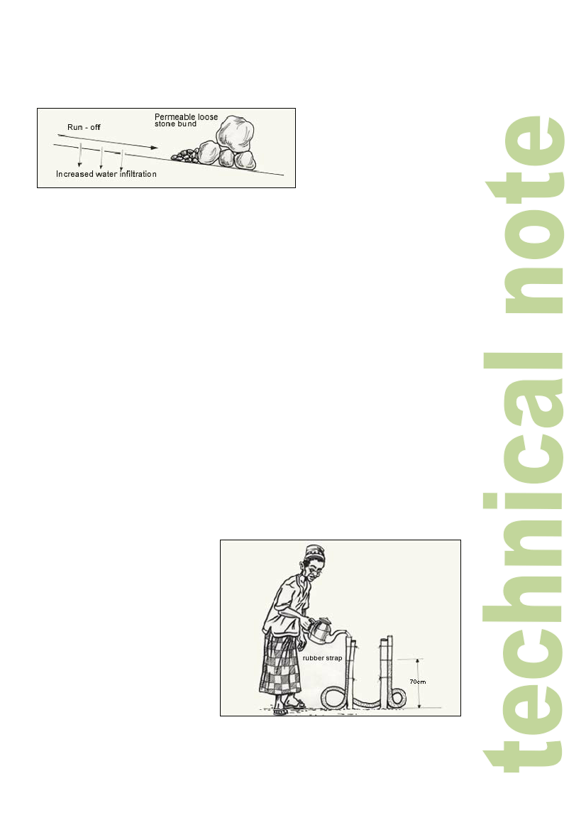
Water level
(Peter Wright for Burkina Faso)
Components
1. One length of clear plastic tube, 6-10 mm inside diameter and about 12 metres long.
2. Two poles about 1.5 m long (which can be given a "foot" as in line level).
3. Two rubber straps to mark the water level in the tube.
4. One or two litres of water.
Construction
1. Uncoil the tube and lay it on
the ground
2. Fill the tube with water.
3. Remove any air bubbles.
4. Tie each end of the tube to
one of the poles. Then place
both poles together on a hard
smooth surface. Add or
remove water as necessary to
ensure that the water levels
are about 0.5m below the
tube ends.
5. Attach a rubber strap to each
tube so that it marks the
position of the water level.
2