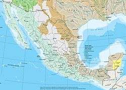
Water resources management in Mexico
Water resources management is a significant challenge for Mexico. Furthermore, water management is imposing a heavy cost to the economy. The arid northwest and central regions contain 77% of Mexico's population and generate 87% of the gross domestic product (GDP).[1] By contrast, the poorer southern regions have abundant water resources ;however, surface and groundwater are overexploited and polluted thus leading to an insufficient water availability to support economic development and environmental sustainability. The country has in place a system of water resources management that includes both central (federal) and decentralized (basin and local) institutions.
| Water resources management in Mexico | |
|---|---|
| Withdrawals by sector 2008 |
|
| Surface water produced internally | 361 km3 (87 cu mi) |
| Groundwater recharge | 139 km3 (33 cu mi) |
| Overlap shared by surface water and groundwater | 91 km3 (22 cu mi) |
| External renewable water resources | 48.22 10^9 m3 per capita |
| Renewable water resources per capita | 3,606 m3 (127,300 cu ft) |
| Wetland designated as Ramsar sites | 53,178.57 km2 (13,140,710 acres) |
| Hydropower generation | 22% |
Water management history and recent developments
Mexico has a long and well-established tradition on water resources management (WRM) which started approximately in the 1930s when the country began investing heavily in water storage facilities and groundwater development to expand irrigation and supply water to the rapidly increasing population.
The 1934 Código Agrario, promulgated during the Cárdenas administration (1934–1940), granted the federal government powers to define the “public interest” to which water could be harnessed. By virtue of such legislation, between the 1930s and 1970s, the rural community and ejido sector were subject to direct federal control over water.[2] Private landowners, on the other hand, enjoyed the benefits of federally subsidized irrigation infrastructure and guaranteed market prices. Over time, large landowners became highly capitalized, while small land owners, by the 1970s, were suffering from the effects of water monopolies.[3]
In the 1970s, the Mexican government entered into a tripartite agreement with the World Bank and the United Nations Development Program to prepare the 1975 National Water Plan (NWP), which identified the need to enact a New Water Law (NWL) and a National Water Authority (ANA) as well as decentralize responsibilities and promote water user participation in operational and maintenance (O&M). The NWP spurred a significant institutional development and infrastructural achievements: (i) the federal government transfer responsibilities for water supply and sanitation to municipalities and states in 1983, (ii) the Mexican Institute of Water Technology was established in 1986, (iii) the National Commission on Water (CONAGUA) was established in 1988, and (iv) in 1989, the first Basin Council was created in Lerma Chapala, incorporating water users from multiple sectors.
During the 1990s, there was a rapid groundwater development and aquifer pumping for combined agricultural, urban, and industrial demand. Also the federal government decentralized responsibility for large irrigation infrastructure to autonomous agencies (irrigation districts).
In 1992, Mexico adopted the Ley de Aguas Nacionales (LAN), which contained specific provisions for the role of the CONAGUA, the structure and functioning of river basin councils, public participation in water management, etc. In 1993 the Cutzamala system, one of the largest pumping schemes in the world, was completed. The Cutzamala system pumps 19 cubic meters per second (670 cu ft/s) of water into the Mexico City metropolitan area.
In 1997 the first technical groundwater committee was created to manage an overexploited aquifer in the state of Guanajuato.
With the 2004 Revision of the National Water Law, the thirteen decentralized CNA regions would become basin organizations serving as the technical arm of more broad-based basin councils that incorporate civil society interests including the private sector and citizens’ groups.[3]
Water resource base
Surface and ground water resources
Mexico's internal renewable water resources per capita is 4,016 cubic metres (141,800 cu ft), which is below the average in the Central American and the Caribbean region, 6,645 cubic metres (234,700 cu ft).
A volume of 396 cubic kilometres (95 cu mi) of water per year flows through Mexico's rivers, including imports from other countries and excluding exports. A total of 65% of this surface runoff occurs in seven rivers: Grijalva, Usumacinta, Papaloapan, Coatzacoalcos, Balsas, Panuco, Santiago and Tonala, whose total watershed area represents 22% of the country's total land area. The Balsas and Santiago rivers empty on the Pacific Ocean, while the other five empty into the Gulf of Mexico.[4]
The historical mean annual precipitation (1941–2004) is 773 mm (30.4 in), with 77% of all precipitation accruing between June and October.[5] A little over 70% of rainwater in Mexico is lost through evapotranspiration and returns to the atmosphere. The rest runs off rivers and streams or infiltrates into the subsoil and recharges groundwater.[6]
Mexico shares three watersheds (Colorado, Bravo and Tijuana) with the United States, four with Guatemala (Grijalva, Usumacintam Suchiate, Coatan, and Candelaria) and one with Belize and Guatemala (Rio Hondo). The waters are shared with the U.S. in accordance with the stipulations included in the Treaty on the Utilization of the Waters of the Colorado, Tijuana and Rio Grande Rivers, signed in 1944.
Groundwater accounts for 64% of the volume for public water supply, 33% of all water used for agriculture and livestock, and 24% of water utilized by self-supplied industry. There are 653 groundwater aquifers in Mexico. CONAGUA estimates the total amount of groundwater recharge to be around 77 cubic kilometres (18 cu mi) per year, 36.4% of which, (around 28 km3 or 6.7 cu mi per year) are actually used. This average rate does not fully represent the situation of the arid region, where a negative balance is threatening the sustainable use of groundwater resources.
Groundwater is a key water supplier for several users in the arid region or in some cities where groundwater is most of the time the sole water resource available. About 71% of the groundwater is used for agriculture, 20% for water urban supply and 3% for domestic and animal use.[7]
Storage capacity and infrastructure
Mexico counts with 4,000 dams and other hydraulic infrastructure with a storage capacity of 180 cubic kilometres (43 cu mi), which account for 44% of the annual flow. In the arid regions, dams are mostly used for irrigation. In the humid areas, dams are mostly used for electricity generation. Dams are also considered a means for flood protection in Mexico. Approximately 63 dams have a storage capacity of over 100,000,000 cubic metres (81,000 acre⋅ft), and account for 95% of Mexico's storage capacity.[6] The largest reservoirs are La Angostura (20,217 km2), Nezahualcóyotl (14,0298 km2), Chicoasén (11,883 km2), and Infiernillo (11,860 km2).[8]
Mexico has approximately 70 lakes with a storage capacity of 14 km3 (3.4 cu mi). The largest lake, the Chapala Lake, has a storage capacity of 8,126 cubic hectometres (1.950 cu mi).
| Main lakes and storage capacity | |||||
|---|---|---|---|---|---|
| Lake | River basin area | Storage capacity | Federal Entity | ||
| km² | sq mi | hm³ | acre feet | ||
| Chapala | 1,116 | 431 | 8,126 | 6,588,000 | Jalisco and Michoacan |
| Cuitzeo | 306 | 118 | 920 | 750,000 | Michoacan |
| Patzcuaro | 97 | 37 | 550 | 450,000 | Michoacan |
| Yuriria | 80 | 31 | 188 | 152,000 | Guanajuato |
| Catemaco | 75 | 29 | 454 | 368,000 | Veracruz |
| Tequesquitengo | 8 | 3.1 | 16 | 13,000 | Morelos |
| Nabor Carrillo | 10 | 3.9 | 12 | 9,700 | Mexico |
Source: CONAGUA
Water quality
According to the Water Quality Index, 96% of Mexico's surface water bodies have different levels of pollution. OECD estimates the economic cost of water pollution in Mexico at US$6 billion per year. The problem is most serious in the Valle de Mexico region where 100% of the water bodies have different levels of contamination, 18% of which are highly polluted. Low water quality is due to untreated discharge of industrial effluents and municipal wastewater into rivers and lakes, solid waste deposits along river banks, uncontrolled seepage from unsanitary landfills, and non-point pollution mainly from agricultural production.[9]
CONAGUA has also detected infiltration of untreated municipal wastewater in 8 aquifers, iron and manganese in 2, arsenic in 1 aquifer of the Lagunera region. In overexploited aquifers, contamination tends to worsen over time as the groundwater reservoir is depleted. This is the case of the Lagunera region, where concentration of 0.09 to 0.59 mg/L of arsenic found in the drinking water, are above of the permissible level of 0.05 mg/L. In addition, information regarding water quality, available by the Public Water Rights and Registry, is scarce and often unreliable.[9]
Water resources management by sector
| Water withdrawal per sector in 2005 | ||||||||
|---|---|---|---|---|---|---|---|---|
| Withdrawal | Freshwater | Groundwater | Total | % | ||||
| hm³ | acre feet | hm³ | acre feet | hm³ | acre feet | |||
| Agriculture (a) | 39,545.0 | 32,059,700 | 19,176.0 | 15,546,200 | 58,721.3 | 47,606,100 | 76.8 | |
| Domestic | 3,879.0 | 3,144,800 | 6,824.5 | 5,532,700 | 10,703.5 | 8,677,500 | 14.0 | |
| Industrial (b) | 5,347.2 | 4,335,000 | 1,736.4 | 1,407,700 | 7,083.6 | 5,742,800 | 9.3 | |
| Total | 48,771.5 | 39,539,700 | 27,736.9 | 22,486,700 | 76,508.4 | 62,026,400 | 100 | |
| Source: CONAGUA
(a) Including livestock and aquaculture (b) Including hydropower | ||||||||
Drinking water and sanitation
In 1998, domestic consumption accounted for 17% of surface water withdrawals in Mexico. During the past decade, the Mexican water supply and sanitation sector made major strides in service coverage. In urban areas almost 100% of the population is estimated to have access to improved water supply and 91% to adequate sanitation. In rural areas, the respective shares are 87% for water and 41% for sanitation.[10] Coverage levels are particularly low in the southern regions. (See also Water supply and sanitation in Mexico)
Irrigation and drainage
In 1998, agriculture accounted for 78% of surface water withdrawals in Mexico. A total of 62,000 km² (15.3 million acre) count with irrigation infrastructure (22.9% of the total cultivated area), 55,000 km² (13.6 million acres) of which are actually irrigated. In 1997, 58,000 km² (14.3 million acres) use surface irrigation, 3,000 km² use sprinkler irrigation and 1,000 km² localized irrigation. Ineffective irrigation has generated salinization and drainage problems in 3,841.63 square kilometers (949,290 acres) of a total irrigated area of 62,560 square kilometers (15,460,000 acres).[6] (See also Irrigation in Mexico)
Hydropower
The electricity sector in Mexico relies heavily on thermal sources (74% of total installed capacity), followed by hydropower generation (22%). The largest hydro plant in Mexico is the 2,300 MW Manuel Moreno Torres in Chicoasén, Chiapas. This is the world’s fourth most productive hydroelectric plant.[11] (See also Electricity sector in Mexico)
Aquatic ecosystems
.jpg)
There are approximately 70 lakes in Mexico, covering a total area of 3,700 square kilometers (910,000 acres). Some of these lakes, especially in the Eastern side, have a volcanic origin and count with numerous endemic species. Lake Chapala, the largest Mexican lake, is considered a hydrological priority region for biodiversity conservation due to its 39 local species, 19 of which are endemic. The Lake Catemaco, located in Veracruz, has 12 native species 9 of which are endemic.[12]
Wetlands in Mexico are dynamic, complex and productive ecosystems. Six major wetland are registered in the RAMSAR Convention on Wetlands: Lagartos River (Yucatan Peninsula), Cuatrocienagas (Coahuila), La Encrucijada (Chiapas), Marsh Nayarit and Sinaloa, Centla Swamp (Tabasco), and the Colorado River (Baja California).
Cenotes, sinkholes on the Yucatan peninsula that are filled with groundwater, host a number of unique species from bacteria, algae and protozoa (i.e. copepoda, cladocera and rotifera) to vertebrates (i.e.lepisosteus).[12] Cenotes are the main water source for many ancient and contemporary Maya people, as there are no rivers and very few lakes on the peninsula.
Legal and institutional framework
Legal framework
The main law governing water resources management in Mexico is the National Water Law of 1992 (Ley de Aguas Nacionales -LAN), revised on April 29, 2004.[13]
According to the LAN key functions in the sector are the responsibility of the federal government, through the National Water Commission (CNA or CONAGUA). The LAN made possible to implement a regulatory framework that seeks to encourage greater efficiency and a more accurate perception of the social, economic, and environmental value of water resources. Therefore, waters users operate within a framework of rights and obligations that are clearly defined in three basic instruments:
- Titles of concession or allocation, which establish the right to withdraw, use or enjoy in usufruct a specific volume of water
- Permits for wastewater discharges. This instrument establishes the concession under which permittees must dispose of resulting wastewater
- Enrollment in the Public Registry of the Water Rights (Registro Público de Derechos de Agua – REDPA) of both titles of concession or allocation and permits for discharging wastewater, which affords the rights granted to water users greater certainty and assistance form a legal standpoint.
The 2004 amended National Water Law (NWL) aims to restructure CONAGUA key functions through the transfer of responsibilities from the central level to subnational entities: the basin agencies (Organismos de Cuenca – BA) and Basin Councils (Consejos de Cuenca – BC). BA and BCs are expected to play an increasing role in the sector limiting CONAGUA’s role to the administration of the NWL, the conduct of national water policy, and planning, supervision, support and regulatory activities.
The NWL also introduced a Water Financing System (Sistema Finaciero del Agua – SFA). CONAGUA will create together with the Ministry of Finance appropriate instruments to determine funding sources, spending guidelines, cost recovery, settling of accounts and management indicators.
Institutional framework
Three groups of institutions have been assigned with the main responsibilities for WRM: (i) the National Water Commission (Comisión Nacional del Agua –CONAGUA), at the federal level; (ii) Water Commissions (Comisiones Estatales del Agua – CEAs), at the State level; and (iii) basin authorities and basin councils.
CONAGUA is the highest institution for water resource management in Mexico, including water policy, water rights, planning, irrigation and drainage development, water supply and sanitation, and emergency and disaster management (with an emphasis on flooding). CONAGUA’s mission is to manage and preserve national water resources, with the participation of the society, to reach a sustainable use of the resource.
CONAGUA is formally under the authority of the Ministry of Environment and Natural Resources (Secretaria del Medio Ambiente y Recursos Naturales – SEMARNAT) but it enjoys considerable de facto autonomy. It employs 17,000 professionals, has 13 regional offices and 32 state offices and had an annual budget of US$1.2 billion in 2005. It also directly manages certain key hydraulic facilities such as the Cutzamala Pipeline that supplies a large share of the water used in the Metropolitan Area of Mexico City. CONAGUA also owns and operates most dams in Mexico and operates the country’s water monitoring network.[9]
The CEAs are autonomous entities that usually are under the authority of the State Ministry of Public Works. Their attributions are different among states and can include water resources management, irrigation and the provision of water supply and sanitation services.
The recently created Basin Authorities (BAs) will develop from the 13 existing Regional Offices of CONAGUA and are expected to be responsible for formulating regional policy, designing programs to implement such policies, conducting studies to estimate the value of the financial resources generated within their boundaries (water user fees and service fees), recommending specific rates for water user fees and collecting them. Basin Councils (BCs) are expected to guide, together with CONAGUA, BAs work. There are a total of 25 BCs that have been established with the same basin boundaries as the BAs.[9]
Government strategy
The National Water Plan 2007-2012, linked to the National Development Plan, aims at ensuring water quality and quantity, recognizing the strategic value of water and promoting sustainable water use and water resources conservation. The Plan has eight objectives, namely: (i) increasing agricultural productivity, (ii) increasing access and quality of water supply and sanitation services, (iii) promoting integrated water resources management at the river basin level, (iv) improving technical, administrative and financial development of the water sector, (v) increase participation of water users and society in general in the management of water resources, (vi) reduce water risks, (vii) evaluate climate change impacts on water resources, and (viii) promote compliance with the National Water Law, especially on administrative matters.
Each objective has a strategy and a set of goals associated. The NWP has a total budget of 227,130 million pesos (about US$21.9 billion), which does not include operational and maintenance costs of hydraulic infrastructure.
Water pricing, cost recovery and subsidies
Mexico lacks a coherent national policy framework for setting and linking water and sanitation tariffs, subsidies and cost-recovery goals. The absence of overarching policies produces a wide variation in the degree of cost recovery and subsidies across regions. Tariffs are set below costs – the most common form of user subsidy in water supply and sanitation.
Water service providers charge industrial and commercial user tariffs that are close to full recovery cost, and cross subsidize residential users. The average tariff across users, US$0.32 per cubic meter ($0.24/cu yd), is half the Latin American and the Caribbean average, US$0.65/m³ ($0.50/cu yd).
The level of collection efficiency in Mexico has been estimated at 72%, far below the levels achieved in developed countries (OECD 95%). Water tariff collections in water supply and sanitation have been estimated at US$1.54 billion in 2002. Billed revenues were estimated at between US$2.14 billion and US$2.9 billion.
Approximately 31% of water customers are not metered and are charged a flat rate, independent of consumption, differentiated by neighborhood.[14]
Water-related risks
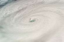
Mexico is prone to several weather events including hurricanes on both Pacific and Caribbean coasts. Hurricanes contribute to recharge surface and groundwater reservoirs with increases water supply for cities, irrigation and electricity generation. Hurricanes pose also a threat to service delivery, infrastructure and ultimately to ecosystems and human life. This situation is aggravated by deforestation upstream as well as human settlements located in flood prone areas.[15]
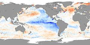
With more than 85% of the Mexican land area defined as arid or semi-arid and a highly variable interannual rainfall Mexico is also prone to droughts, especially in the northern areas. The most severe droughts in Mexico in recent decades coincide with the variations in Pacific sea-surface temperatures associated with El Niño. The economic and social and environmental impacts of droughts in Mexico are notable. In 1996, four years of below normal rainfall produced farms losses estimated at US$1 billion and interstate political between Sonora and Sinaloa.[16]
Potential climate change impacts
In parts of Mexico climate change is projected to produce a decrease in water flow. Furthermore, an increase on water demand is expected due to increasing temperature and extreme weather conditions such as droughts and floods due to El Niño Southern Oscillation and La Niña are expected to become more frequent.
The IPCC considers various scenarios with increases in temperatures ranging between 1 and 6 degrees Celsius. By 2050, the Mexican Institute of Water Technology expects a 7-12% decrease in precipitation in the southern basins, 3% in the Mexican Gulf basin, and 11% in the central basin. Precipitation is estimated to continue to decrease over the next 50 years. An increase in category 5 hurricanes is also expected.[17]
During some El Niño/La Niña years, winter precipitation may be so great that stream flow and water levels in dams may exceed those observed during summer. In contrast, summer droughts during these events can lead to serious deficits in reservoir levels and in rain-fed maize production. In Mexico during 1997, the estimated costs of climate anomalies associated with El Niño were 900 million US dollars, particularly in agricultural activities, when 20,000 km² (5 million acres) were affected by a severe drought.[18]
In 2007, SEMARNAT together with the Instituto Mexicano de Tecnología del Agua published a study “Climate Change Effects on Water Resources in Mexico.” The main findings are summarized below.
Qualitative vulnerability to climate change by hydrologic-administrative region
| Hydrological Region | Change in demand | Change in availability | Scarcity | Hurricane, storms | Droughts | Change in sea level | Observations |
|---|---|---|---|---|---|---|---|
| Baja California | Major | Decrease | Very vulnerable | Not very vulnerable | Vulnerable | Not very vulnerable | The basin depends on water flowing from the US, which is expected to reduce |
| Northeast | Major, agriculture biggest water use | Decrease | Very vulnerable | Not very vulnerable | Vulnerable | Sea intrusion on coastal aquifers | One of the most vulnerable regions in Mexico |
| North Pacific | Major, agriculture biggest water use | Unknown | Vulnerable | Vulnerable | Unknown | Sea intrusion on coastal aquifers | Need further studies |
| Balsas | Major | Probable decrease | Vulnerable | Very vulnerable in the coastal region Guerrero and Michoacan | Vulnerable | Sea intrusion on Rio Balsas | Severe effects on agriculture in Tlaxcala and highlands |
| South Pacific | Major | Unknown. Some models expect increased precipitation | Specially on high mountain | Very vulnerable, coastal region | Not very vulnerable | Not very vulnerable | One of the most vulnerable to storms |
| Rio Bravo | High due to increased population and temperature | Expected decrease on flows and aquifer recharge | Very vulnerable | Not very vulnerable | Very vulnerable | N/A | One of the most important basins and most vulnerable to scarcity and droughts |
| Central north basins | High, due to increased temperature | Expected decrease on flows and aquifer recharge | Very vulnerable | N/A | Very vulnerable | N/A | One of the most vulnerable basins to scarcity and droughts |
| Lerma-Santiago-Pacifico | Medium | Unknown, models predict few changes | Very vulnerable due to high use | Not very vulnerable | Vulnerable, high natural variability | Not very vulnerable | Need further research due to high vulnerability and uncertain models |
| North Gulf | High, due to increased temperature | High probability of increasing, according to most of the models | Not very vulnerable | Vulnerable | Not very vulnerable | High vulnerability on several rivers’ mouths | Probable need to revise design of hydraulic infrastructure, dams, and flooding control. |
| Center Gulf | High, due to increased temperature | High probability of increasing, according to most of the models | Not very vulnerable | Vulnerable | Not very vulnerable | High vulnerability on several rivers’ mouths | Probable need to revise design of hydraulic infrastructure, dams, flooding control, and landslide |
| South frontier | High, due to increased temperature | Few changes due to high availability | Not very vulnerable | Very vulnerable, especially on coastal Chiapas | Not very vulnerable, but need for new regulation works | High vulnerability especially on Grivalda and Campoton estuaries | Probable need to revise design of hydraulic infrastructure, dams, flooding control, and landslide |
| Yucatán | High, due to increased temperature | Vulnerable due to lack of regulation | Vulnerable due to lack of regulation | Very vulnerable, especially on coastal area | Vulnerable due to seasonal droughts | Vulnerable, due to sea intrusion on aquifers | Need of detailed research due to unique geology |
| Valley of Mexico | Low | Low | Very vulnerable | Vulnerable | Not very vulnerable | N/A | Already on water deficit, in need of high coast adaptation measures |
Source: SERMANAT (2007)
External cooperation
The World Bank is currently contributing with US$28.5 million, to an Adaptation to Climate Change Project in the Gulf of Mexico (). This project aims at formulating and implementing adaptation policy actions and specific measures in representative systems of Gulf of Mexico wetlands in order to protect their environmental functions and their rich biodiversity from climate change related impacts, and improving the knowledge base to ascertain with a higher level of certainty the anticipated impacts from climate change on the country’s water resources, with a primary focus on coastal wetlands and associated inland basins. The https://en.wikipedia.org/wiki/Wikipedia:About In November 2007, the Inter-American Development Bank approved a US$200,000 project to support a program for flood emergency in Tabasco. In September 2007 it approved a US$200,000 project to support a program to relief damages caused by Hurricane Dean.
See also
- Comarca Lagunera
- Electricity sector in Mexico
- Water supply and sanitation in Mexico
- Index of Mexico-related articles
- Water resources in Mexico
Further reading
- Aboites, Luis. El agua de la nación: Una historia política de México (1888-1946). Mexico City: Centro de Investigaciones y Estudios Superiores en Antropología Social 1998.
- Aboites, Luis, ed. Fuentes para la historia de los usos del agua en México (1710-1951). Hidalgo: Centro de Investigaciones y Estudios Superiores de Antropología y Comisión Nacional del Agua 2000.
- Wolfe, Mikael D. Watering the Revolution: An Environmental and Technological History of Agrarian Reform in Mexico. Durham: Duke University Press 2017.
References
- CONAGUA. Estadísticas del Agua en México, Edición 2008
- Sanderson, S.E. (1981). Agrarian Populism and the Mexican State: The Struggle for Land in Sonora. University of California Press.
- Scott, Christopher A.; Banister, Jeff M. (2008). "The Dilemma of Water Management 'Regionalization' in Mexico under Centralized Resource Allocation" (PDF). International Journal of Water Resources Development. 24: 61–74. doi:10.1080/07900620701723083.
- Subdireccion General de Programación. "Water in Mexico". CONAGUA. Retrieved March 19, 2008.
- Earth Trends. "Country Profile: Mexico". World Resources Institute. Retrieved March 19, 2008.
- Aquastat. "Country Profiles:Mexico". Food and Agricultural Organization. Retrieved March 10, 2008.
- CONAGUA. "La Gestion del Agua en Mexico:Avances y Retos" (PDF). CONAGUA. Retrieved March 19, 2008.
- Centro Virtual de Información del Agua.
- Douglas Olson. "Mexico: Water Public Expenditure Review". World Bank. Retrieved March 10, 2008.
- WHO and UNICEF. "Joint Monitoring Program". Retrieved March 17, 2008.
- EIA. "Country analysis Brief: Mexico". EIA. Retrieved March 10, 2008.
- Arriaga Cabrera; et al. "Aguas continentals y diversidad biologica de Mexico". Comision Nacional para el Conocimiento y Uso dela Biodiversidad. Archived from the original on June 27, 2008. Retrieved March 10, 2008.
- Diario Oficial. "Reforma de la lay de aguas nacionales". Diario Oficial. Archived from the original on January 30, 2008. Retrieved March 14, 2008.
- Olson, Douglas & Saltiel, Gustavo. "Averting a water crisis in Mexico. Chapter 9: Water Resources" (PDF). World Bank. Retrieved March 13, 2008.
- CONAGUA. "National Water Program" (PDF). SEMARNAT. Retrieved March 13, 2008.
- Liverman, Diana M. "Adaptation to Drought in Mexico". Oxford University Centre for the Environment. Missing or empty
|url=(help) - Martinez Austria; Polioptro F. "Efectos del Cambio Climatico en los Recursos Hidricos de Mexico" (PDF). Instituto Mexicano de Tecnologia del Agua. Retrieved March 13, 2008.
- Conde, Patricia & Gay, Carlos. "Impact of climate change and climate variability in Mexico" (PDF). Acclimations. Retrieved March 13, 2008.
External links
Water resources management in Countries of Latin America and the Caribbean | ||
|---|---|---|
| Caribbean |
|  |
| North America | ||
| Central America |
| |
| South America | ||
Dependencies not included. 1 Defined as a semi-autonomous territory. | ||